July 1, 2020 Tropical Update
The weather has been extremely boring for weeks
Another quiet week+ ahead in tropics
Global tropics are very quiet and hopefully the active tropical cyclone basins stay that way. I scanned through the brand new ECMWF model data from the upgraded model cycle (47r1) and found a Day 8 Eastern Pacific Hurricane. Talk about scraping the bottom of the barrel. Last week, the NHC was watching the water off the SW coast of Mexico for tropical storm development and even had a 80% red hatching on the map. Then poof — nothing.

Week of July 11-16
If we look at upper-level velocity potential (200 hPa) as a proxy for favorable areas for ascent and tropical convection, then the Western and Central Pacific are no-go zones heading into mid-July. Neutral or favorable conditions will extend from the Eastern Pacific to the coast of Africa. With waters continuing to warm in the main development region (MDR) of the tropical Atlantic, I’d expect things to crank up by the 2nd week of July. The ensembles will flip a switch and we’ll have Cape Verde type storm tracks filling a bowl of spaghetti.

4th of July
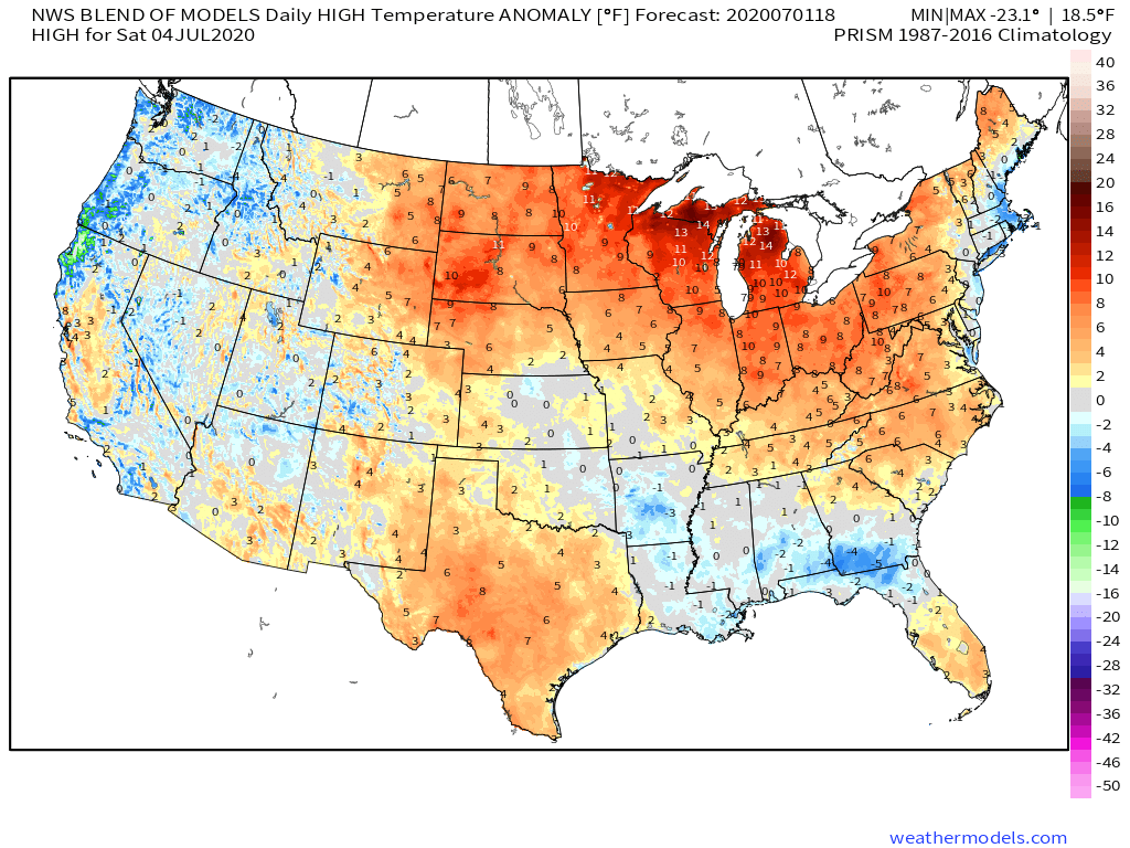
185-million + will see at least 90°F on the Fourth of July according to the latest Blend of Models forecast. Folks in the Great Lakes will be in the 90s and much above normal while clouds and rainfall will keep temperatures somewhat lower along the Gulf Coast.