


January 9, 2025 Thursday Extended Outlook
Much below normal temperatures into third week of January

Good Evening!
Please consider upgrading to a paid subscription so you receive all updates via app or email (your choice!), now averaging 8-10 posts per week …
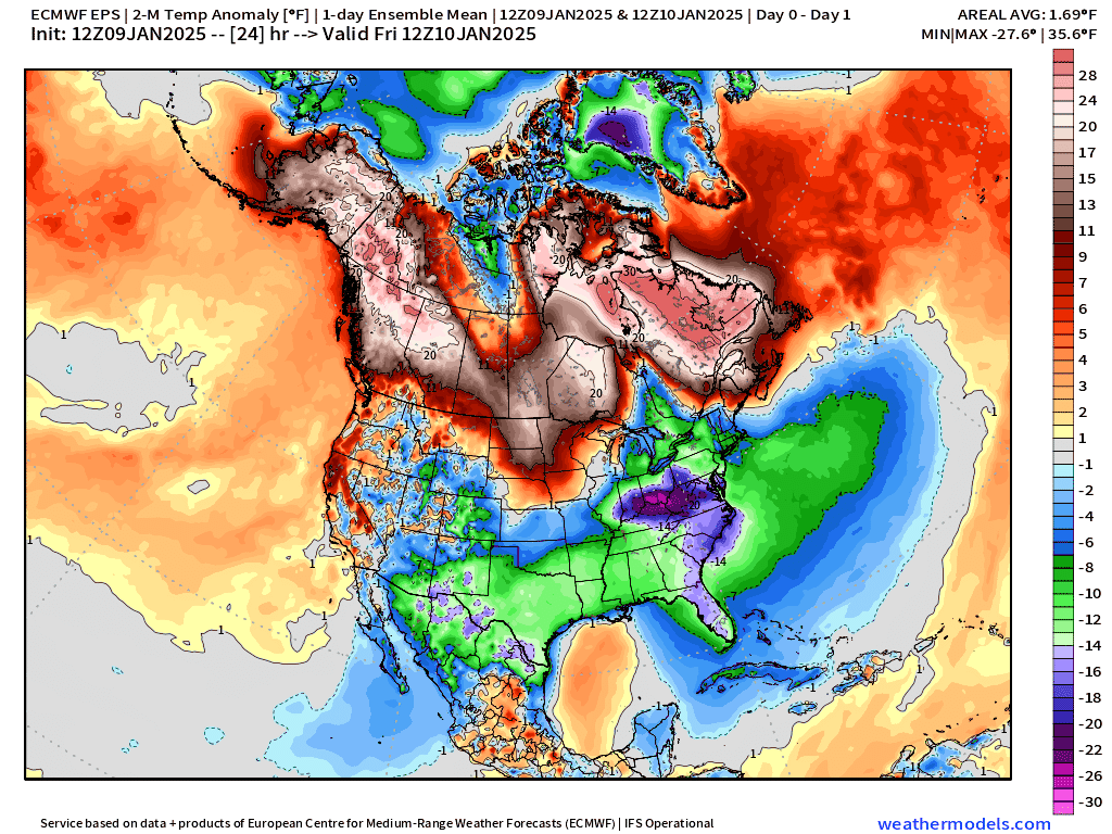
A quick update on the unfolding winter storm with the most recent HRRR radar simulations, and a look ahead into the extended range forecast = cold.
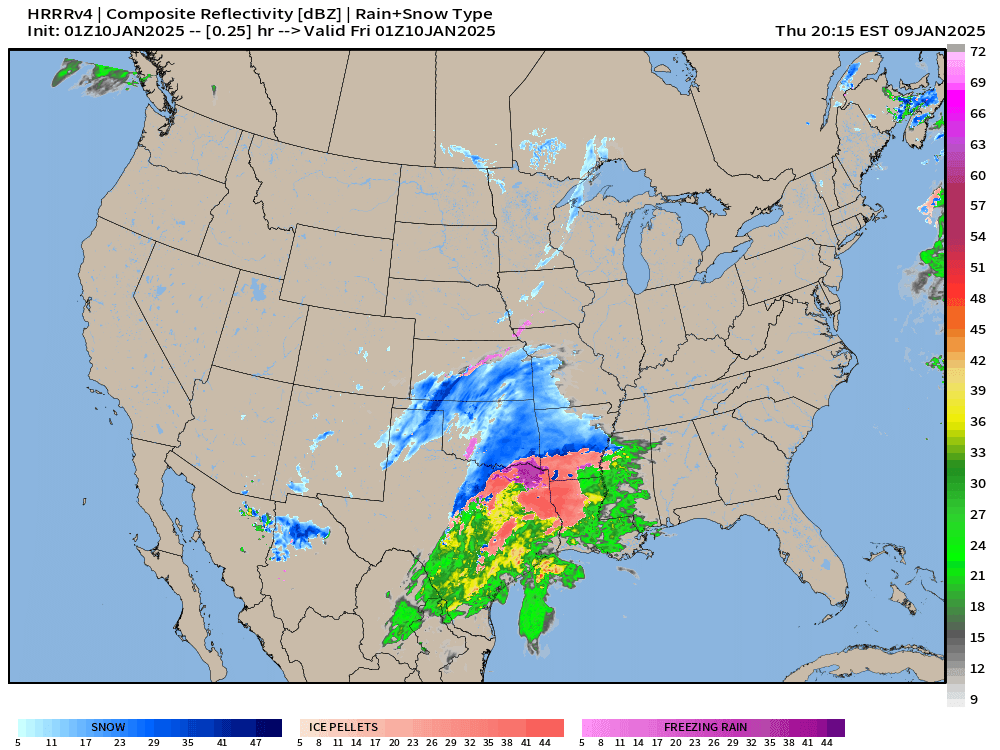
The party is almost over in Dallas with the back edge of a light rain / snowfall mix finishing in the next 2-3 hours.
But, the show is just beginning across the Southeast with Little Rock getting buried by heavy snowfall, then Nashville.
The Atlanta metro forecast has been in flux — to put it charitably — as the guidance has shifted much warmer = more freezing rain / ice or sleet rather than snow.
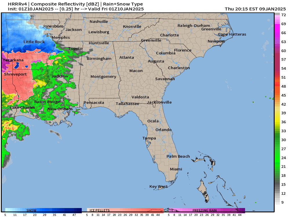
6”-8” in Little Rock of snowfall
Maybe 1-inch in Atlanta if lucky, but could be 0.2” of accumulated ice, which could be a bit tricky for a while until the rain takes over into the afternoon.

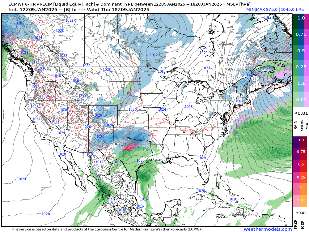
Precipitation Type and MSLP Next 10-days
A Clipper system with Pacific NW moisture will cross through the Midwest, Great Lakes, and Northeast into early next week. That’s the only major winter weather system after the ongoing winter storm exits the East Coast by Sunday.
Then, we’ll have flow out of the Northeast with potential for Clippers.
It would be after 10-days for a weather pattern flip to activate the Southern stream, and perhaps repeat what we just experienced this week in the Jan 22-23 range.
So, not expecting any additional Nor’easters or major winter storms for the next 10-days.
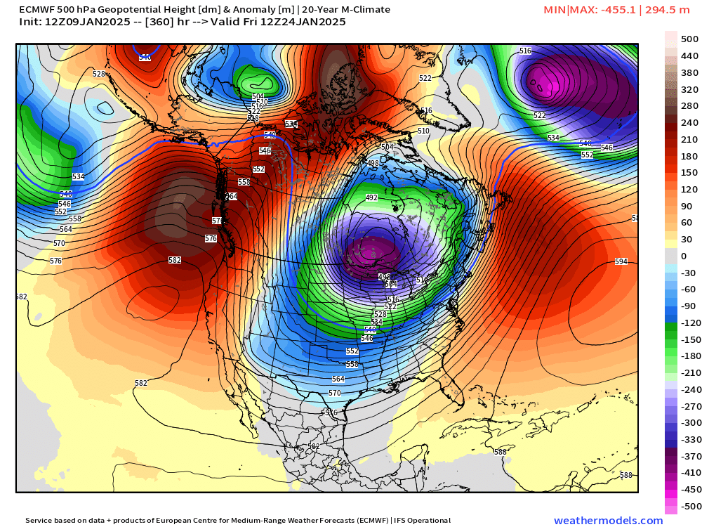
Upper Level Weather Pattern at Day 10: Cold


Easy to see the correlation between the Ensemble Means for 500 mb height anomaly at Day 10. I’d say that EPS is the most robust in terms of anomalies (right) while GEPS is close second (left). The GEFS (middle) is less amplified.
Looking at the deterministic runs from AIFS, GFS, and ECMWF show 2/3 matching, but the GFS out on its own again. Regardless, all are showing a cold signal!


EPS Temperature Anomaly Next 15-days
This animation is perfect to show the development of the cold pool over the northern Rockies and some bleeding eastward, but not much.
Note, there is a blast of cold into next Tuesday-Thursday centered on Ohio River Valley. Subzero actual temperatures for Indianapolis. More on that tomorrow.
Way down the road at Day 15 from HRES, remember I showed the insane run from 00z Wednesday. There is still a LOT of cold air in the extended range from HRES.
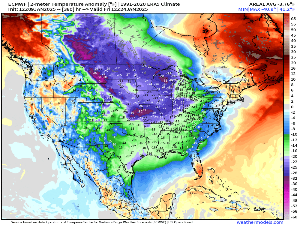
Seems it really wants to plop the main anchor of the polar vortex over the Great Lakes. This would be Jan 24, so 15-days from now, and outside any typical forecast model skill. Instead, we’ll watch trends and compare to the ensembles.
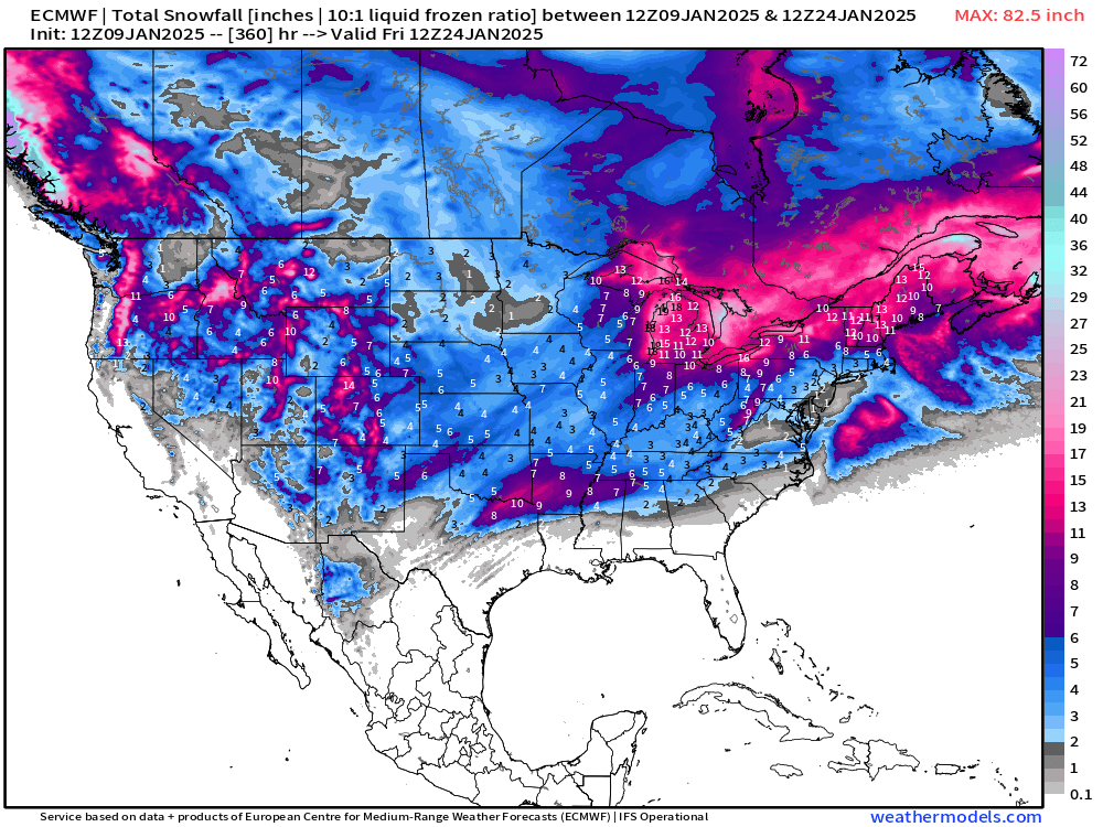
This weather pattern would mean a lot of snow for the Great Lakes and New England with the compounding accumulation of Lake Effect and Clippers. Sadly, no Nor’easters.
AIFS 18z Shows a Similar Story as its 12z run (above)
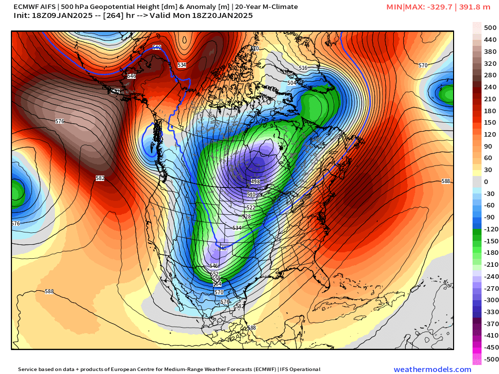
And the temperature anomalies are Barney colored cold! January 20th
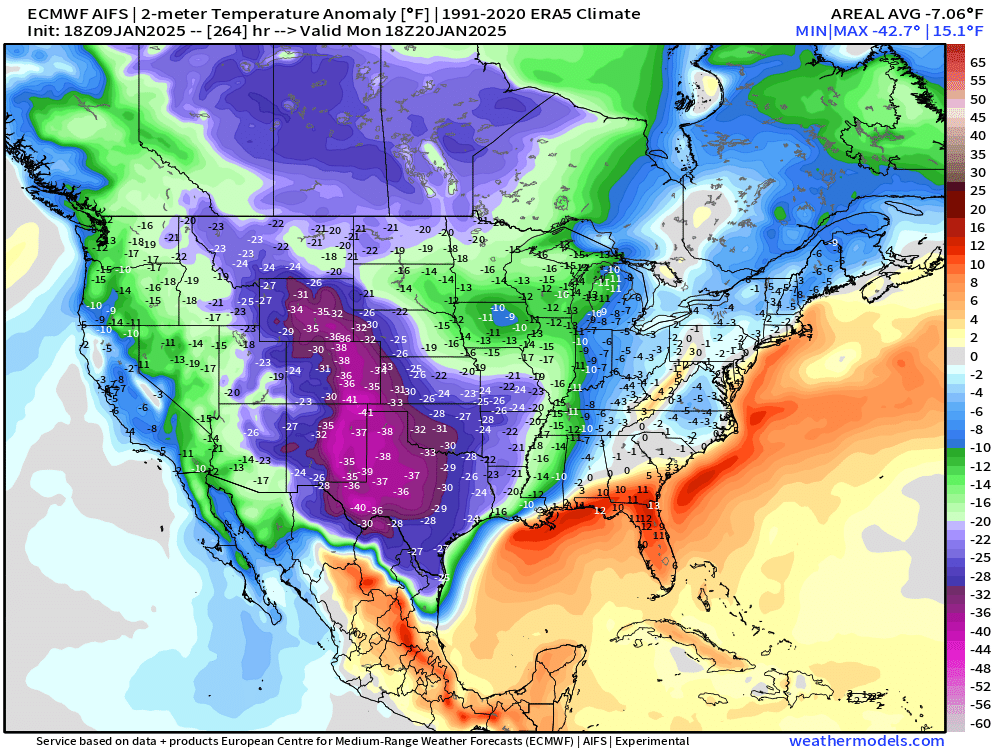
Seems the forecast problem over the next few days will be how cold will Week 2 get?
9:15 PM ET Temperatures across the Lower 48

Lower 48 temperatures are cold with average of about 28.2°F. 201 million freezing, but none subzero, so it could be a lot worse.
Temperature Anomaly | 9:15 PM ET
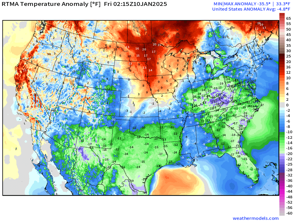
Overall the Lower 48 is -4.8°F (below normal) with broad swatch of green (at least 15°F below normal) and even 20°F below normal showing up in Ohio River Valley.
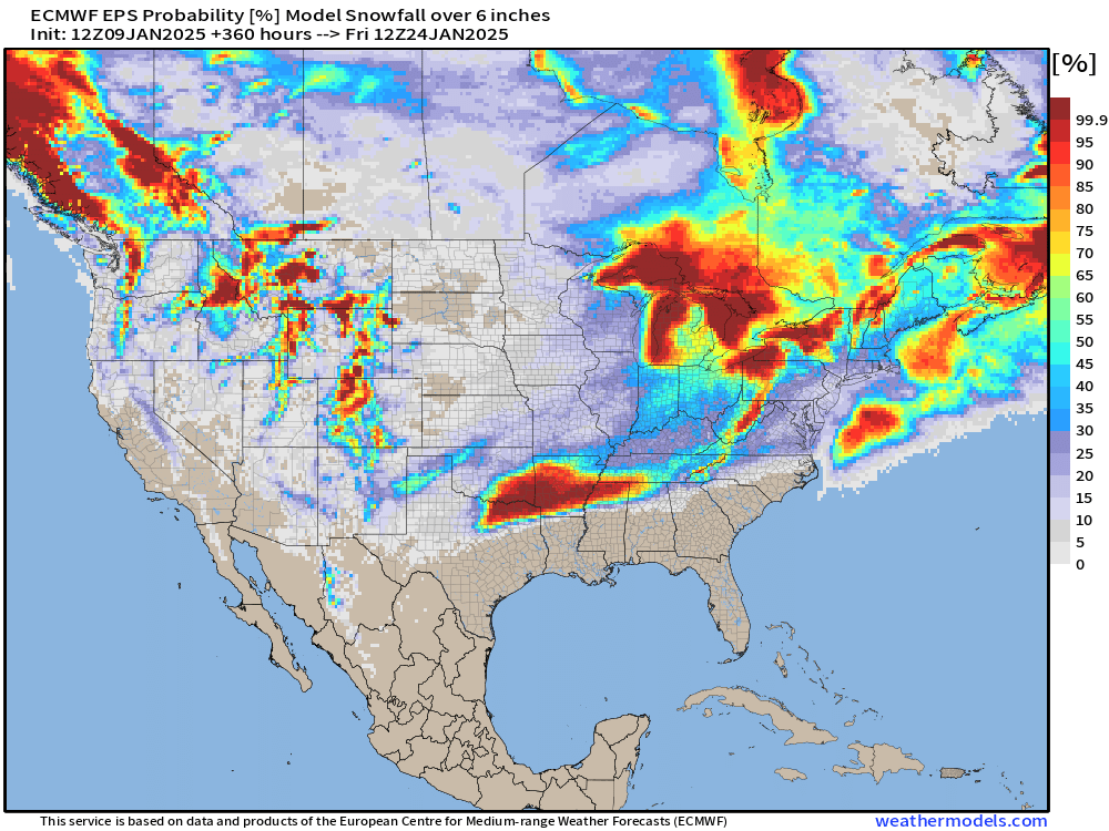
15-Days Ensemble Snowfall 50th Percentile Solution
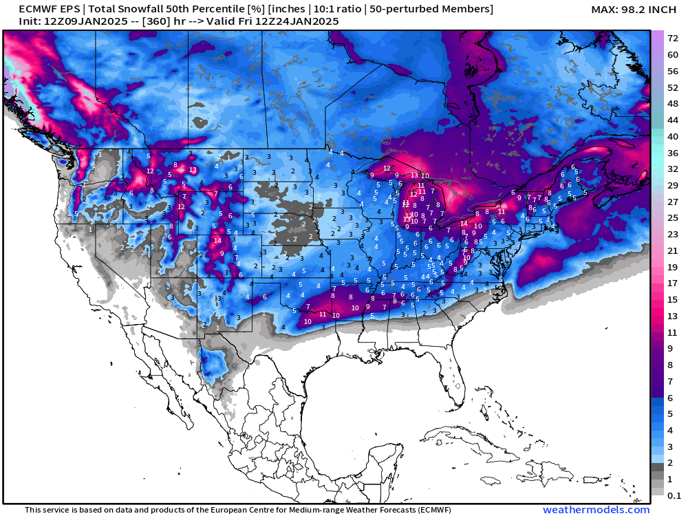
Probability in the next 15-days of at least 6-inches of snowfall
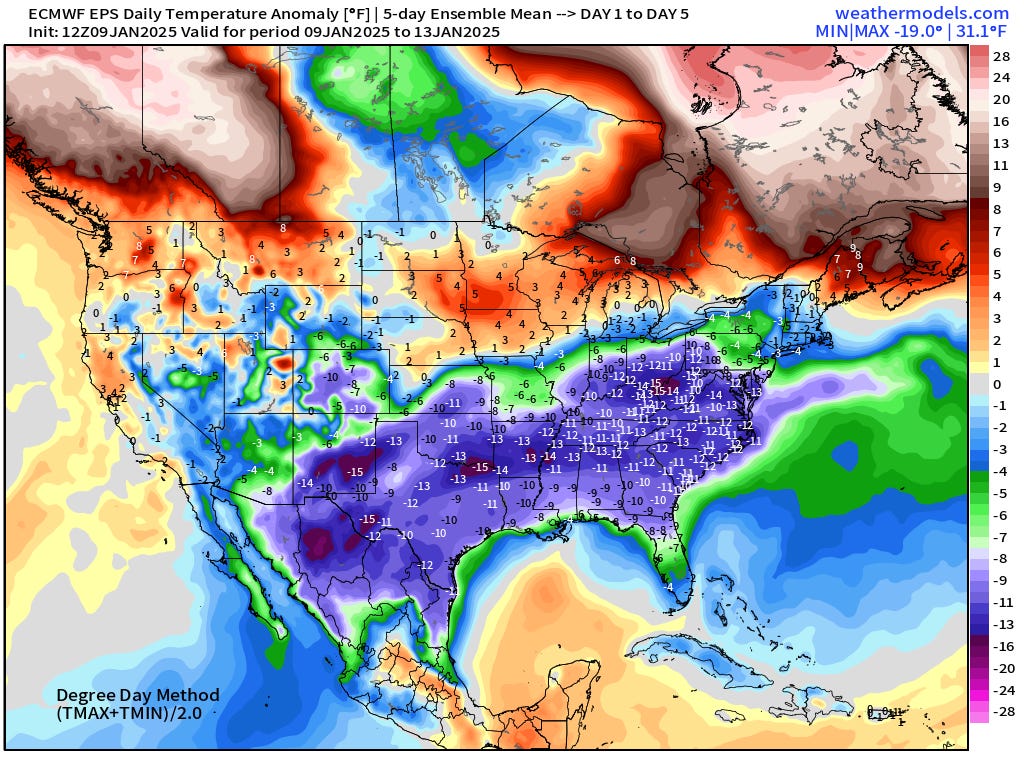
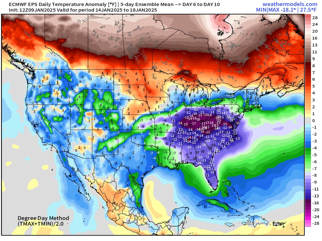
ECMWF EPS 12z | 5-Day Chunk Temperature Anomaly
Days 1-5: January 9 - January 13
Days 6-10: January 14 - January 18
Days 11-15: January 19 - January 23
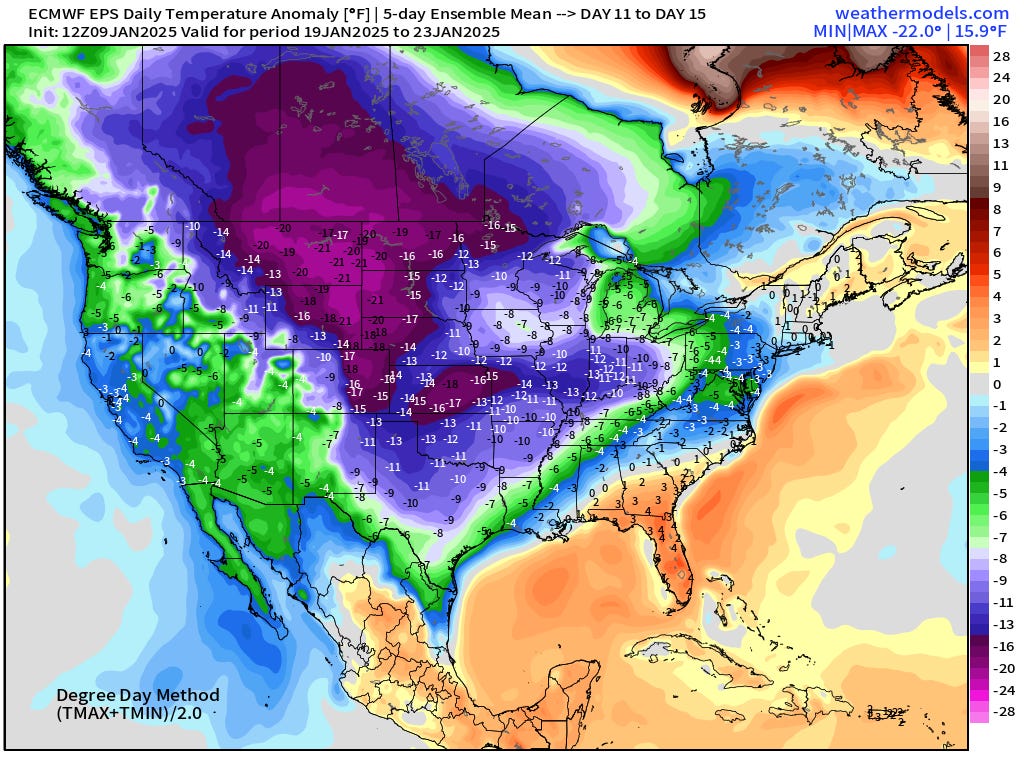
Whoa, quite the cold anomaly for Days 11-15!
For new followers coming from Substack, X, or friends, you’ll get daily updates of mainly Lower 48 weather including winter storms, heat waves, hurricanes, and now Arctic blast. The goal is to provide a “heads up” to impending extreme weather in the coming 1-2 weeks — medium range weather prediction. I use the best and most advanced Numerical Weather Prediction (NWP) systems including ECMWF ensembles, NOAA GFS, and the state-of-the-art A.I. systems.
Who writes and researchers this Newsletter? Dr. Ryan N. Maue [X https://x.com/ryanmaue] with 20-years experience of daily weather model production and analysis. You may have seen my weather maps! I live in Atlanta but was born and raised in Northern Michigan. I know snow, and southern heat and humidity.
Maps sourced from weathermodels.com designed and innovated by yours truly! Please subscribe there for real-time access to the newest maps, charts from all of the weather models including ECMWF.