


January 9, 2024 Blizzards and Arctic Blasts
Extreme cold to blanket the Lower 48 over fresh snowfall
Update on Texas tomorrow morning + potential significant Nor’easter early next week.
Severe weather blew through the Southeast earlier on Tuesday ahead of a strong cold front. Now, the low pressure will deepen to about 970 mb over Ontario with extreme winds continuing out of the E & SE nearing hurricane force gusts. This storm will decay and make way for the next one along a similar track Fri-Sat. The next storm will be a blizzard + bomb cyclone with central pressure of 968 mb over Michigan on Saturday morning.


Quick update of Western U.S. snowfall over the next 48-hours from HRRR. Excellent news for skiers and building snow pack. It’s also a pretty map.

The next “bomb cyclone” will bust barometers into the 960s by Saturday with severe weather in the Southeast again on Fri-Sat along with another foot of snowfall in Michigan. That’s fine — they want it!


GraphCast 12z — next 10-days precipitation
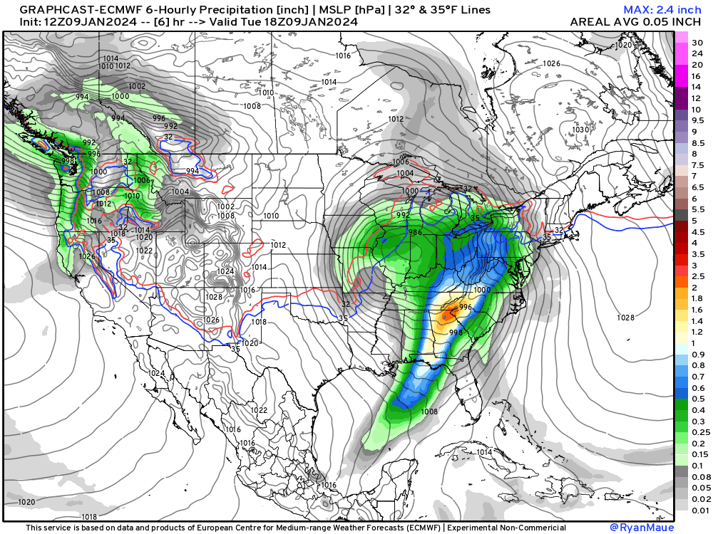
The A.I. powered GraphCast model from Google has done very well with the sequence of winter storms and Arctic blast. Overall, predictability is high — meaning the conventional NWP and A.I. models have a good handle on the upper-level weather patterns. This is a very cold period ahead peaking next Mon-Tues.
Keep reading with a 7-day free trial
Subscribe to Weather Trader to keep reading this post and get 7 days of free access to the full post archives.