


January 7, 2025 Tuesday Winter Weather
Winter Storm will create a mess across North Texas

Tuesday Evening Weather
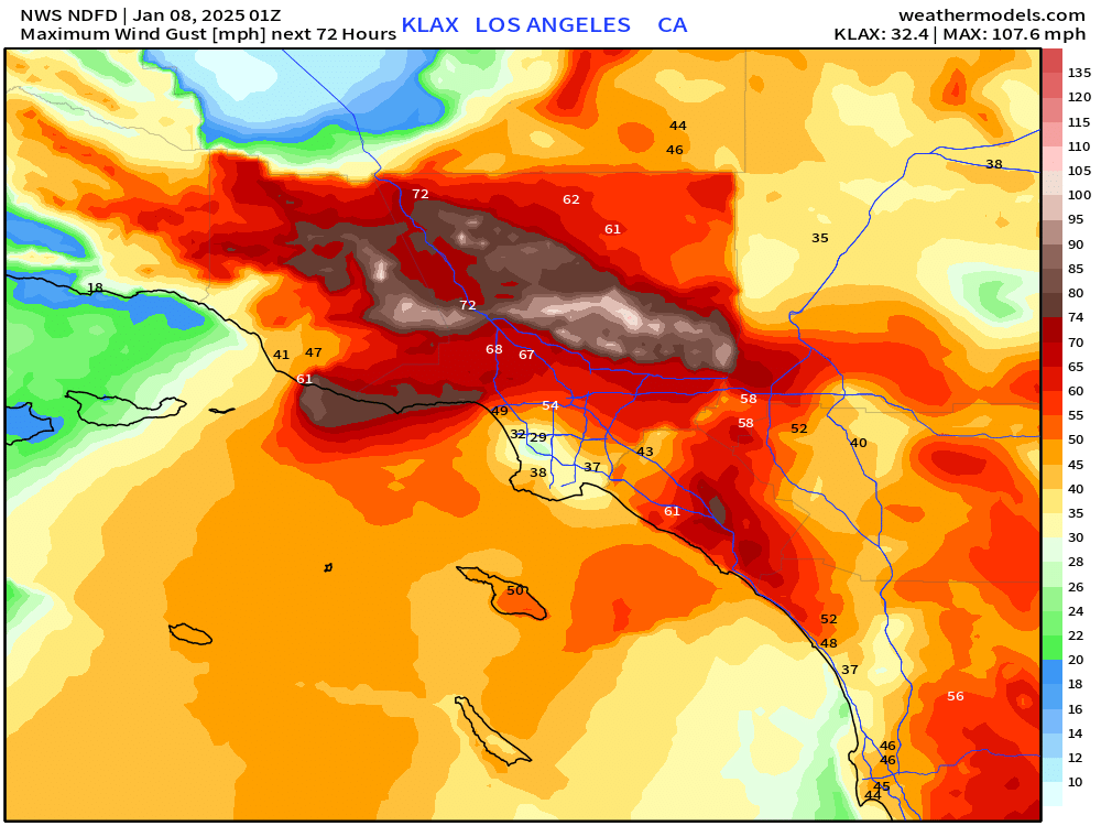
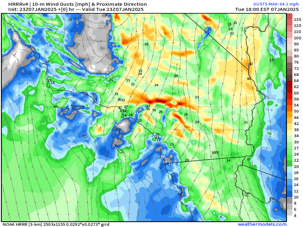
Catastrophic fire weather across Southern California with 80-100 mph+ gusts increasing into the overnight and early Wednesday morning.
HRRR wind gusts next 18-hours
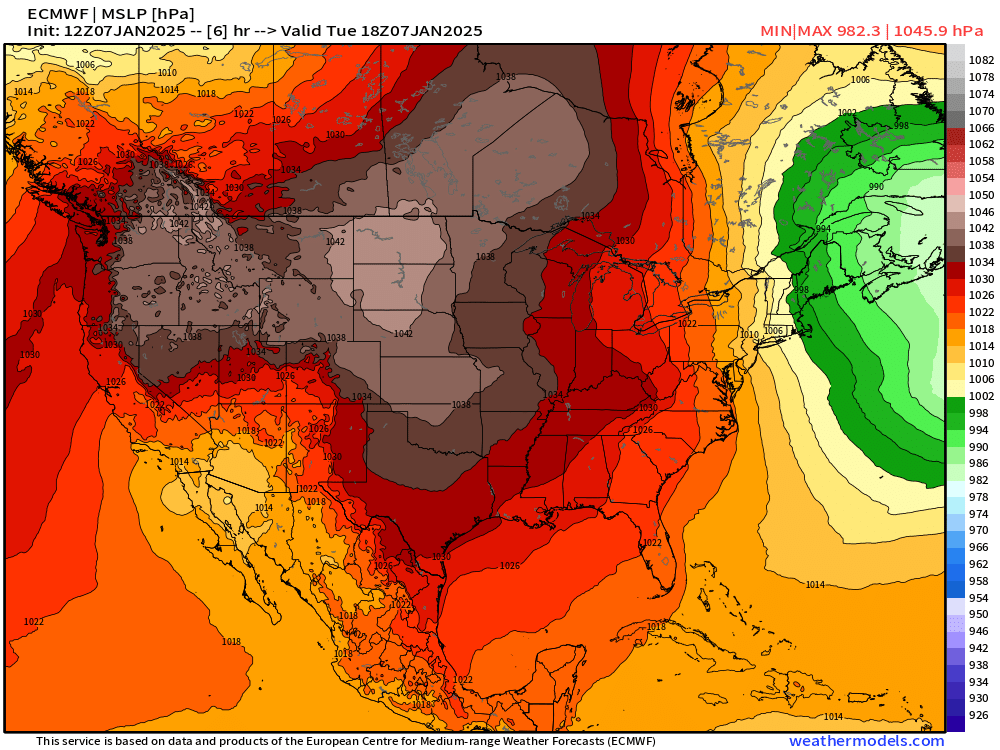
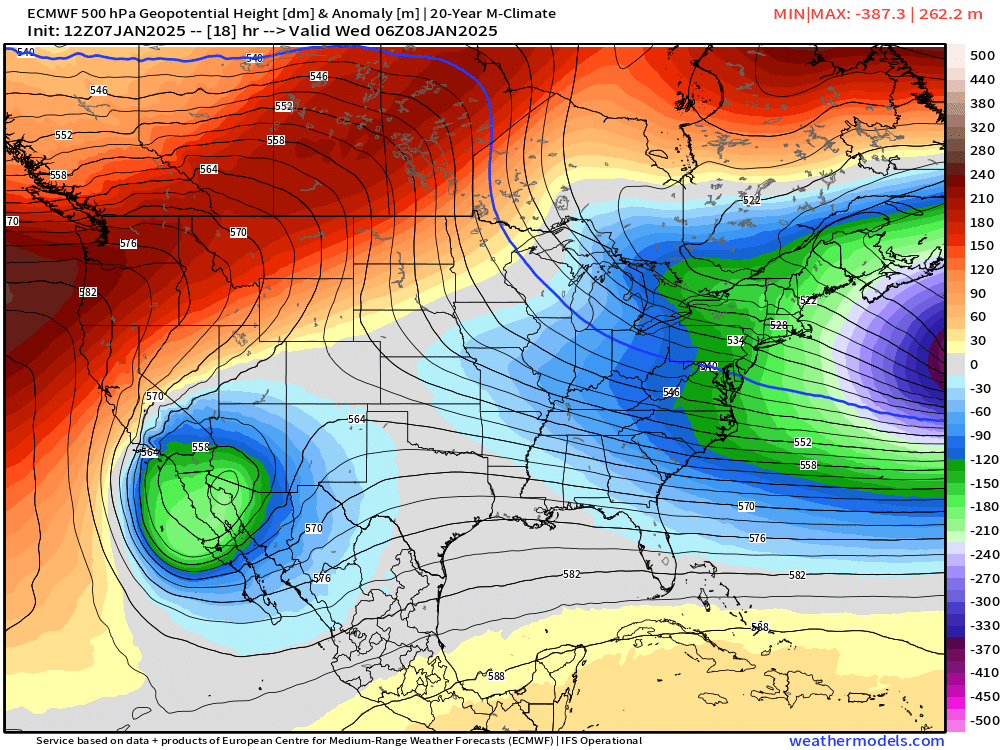
The surface pressure pattern favors strong offshore flow already, but the addition of a cut-off mid-level trough with counter-clockwise circulation is ramping up winds to a much higher level.
High Pressure > 1045 mb across Northern Plains
700 hPa Winds show strong low-level counterclockwise circulation centered over Yuma, Arizona.
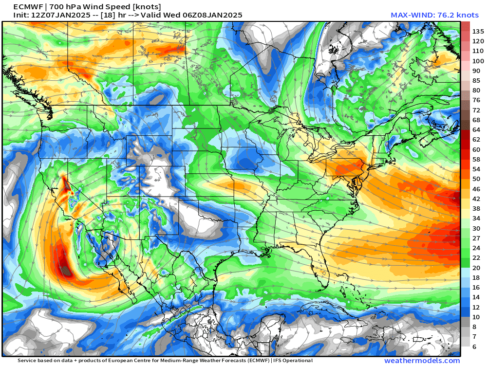
And, the 500 hPa upper-level trough anomaly is situated right there … all of these features are perfectly aligned to maximize wind gusts from the SoCal mountains/hills down to the beaches.
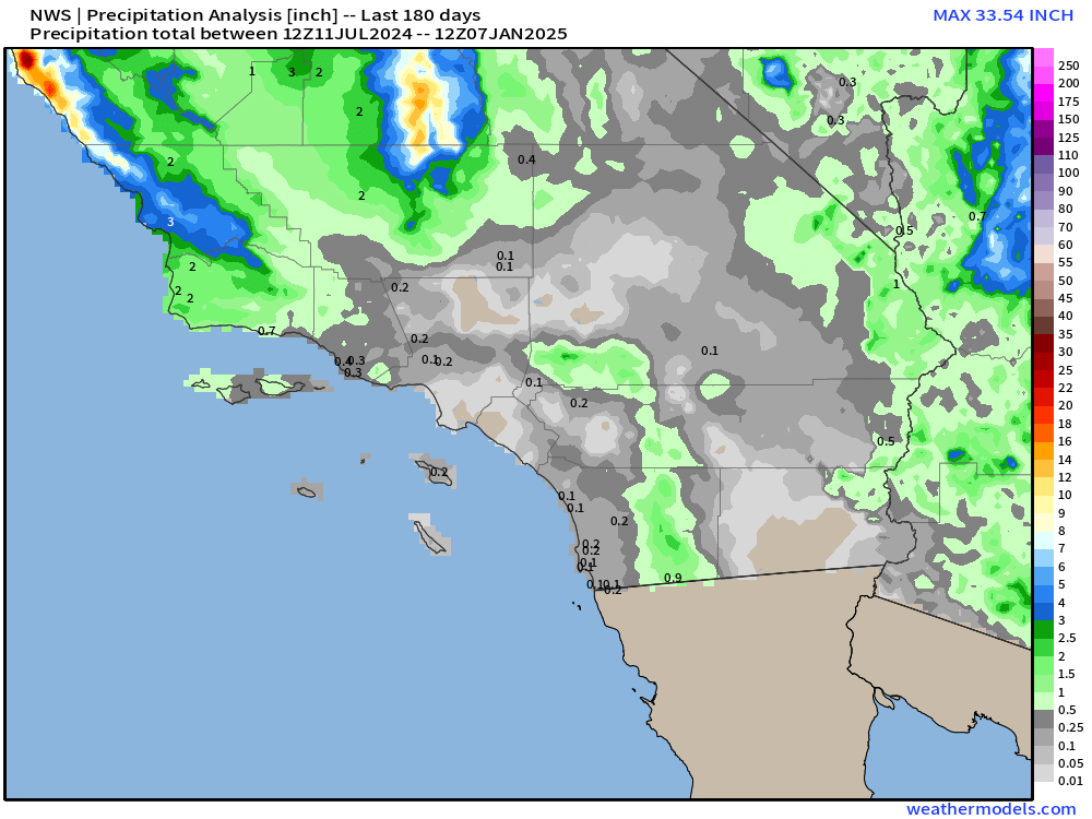
Rain during last 6-months
Not much … and probably little relief for the next 10-14 days at least.
North Texas Winter Weather Threat | Thursday
ECMWF HRES 18z and its ensembles have remained consistent with temperatures cold enough (33°F) in Dallas-Fort Worth for up to 6” of snowfall with 0.7” QPF.
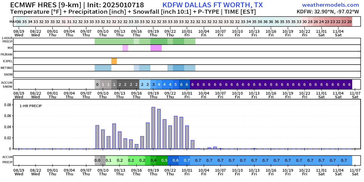
Much heavier QPF and rainfall is only 50-100 miles to the SSE of DFW, with > 2.4” around Houston.

Keep reading with a 7-day free trial
Subscribe to Weather Trader to keep reading this post and get 7 days of free access to the full post archives.