


January 5, 2024 Friday Update
On Polar Vortex watch
I don’t have enough space to discuss everything about the upcoming mega-Arctic blast coming in 7-10 days first to the Pacific Northwest and then down the lee of the Rockies into Oklahoma + maybe Texas and then east mainly into the Great Lakes. I think I’m safe here in the Southeast from sucked into the Polar Vortex. I’ll detail more about the extreme cold period ahead tomorrow.
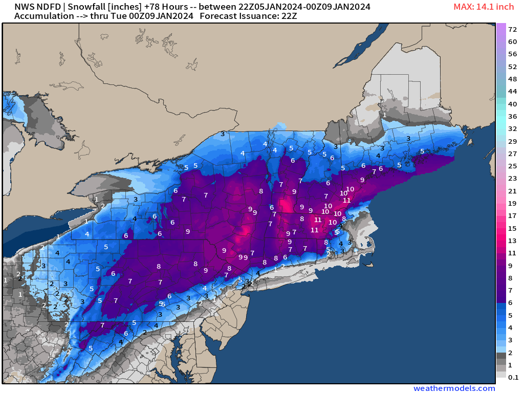
The main story is the Nor’easter, which we’ve talked about for several days. The cake is baked and snowfall forecasts 2-days out are mostly complete with only minor adjustments ahead. We could be surprised with extra accumulations further into Boston as NWS has oscillated between 2-4” over the past 24-hours of forecasts.
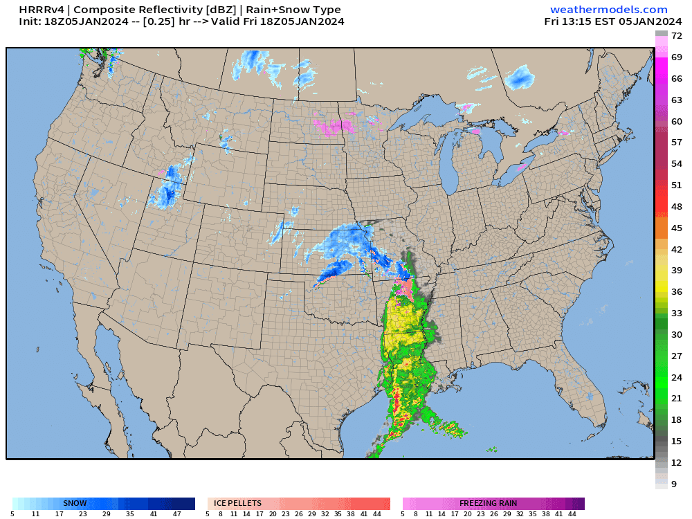
The HRRR 18z simulated radar actually has heavy snow over Boston and the Cape. I create a “dynamic SLR” snowfall map using the near-surface temperatures and precipitation types. I’d put the over/under at KBOS at 5” of measured but extremely wet snowfall. Nice area of 12-inches+.


The National Weather Service grids are slightly less than HRRR, but same general theme. Amazing to think that this rather innocuous storm tracking off the coast at meh central pressures is the best winter storm we’ve seen in 2-years.
Just posting NWS Boston to see how the humans fare with this dynamic event.

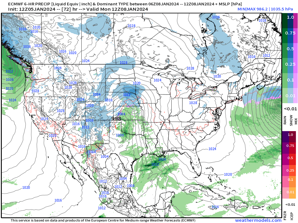
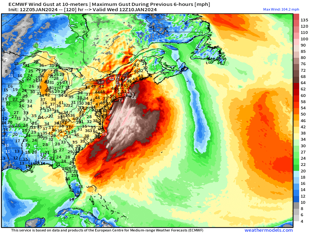
The next storm system will be significantly more intense with severe weather, blizzard conditions from St. Louis to Chicago and Detroit, and then extremely heavy rain + gusty winds along the East Coast. The winds in the Northeast will be extreme by Wednesday.
Maximum wind gusts Monday morning are > 100 mph offshore. I’d be concerned about New England w/potential for hurricane force wind gusts.
Saturday High Temperatures | January 6, 2024

The Southeast holds onto warm ahead of the cold front. 25 million at/above 70°F.
Sunday High Temperatures | January 7, 2024

Only 9 million at/above 70°F. The Western U.S. cools down, too. The Lower 48 average is only 39°F. We’ll think this is balmy compared to what’s coming over the next 2-weeks.
Temperature Outlook Next 2 Weeks
What are you going to do when the Polar Vortex runs wild on you? — Hulk Hogan.
I’m very concerned and watching with an eagle eye the evolution of the PV into the Pacific Northwest. The ensemble mean in Week 2 is just barely scratching the surface of the potential extremes.
Week 1: January 5 - January 12, 2024 [EPS Mean 12z]

Week 2: January 12 - January 19, 2024 [EPS Mean 12z]

7 Day Precipitation Outlook
NOAA WPC 7-day Total Precipitation including rain and snow together.

From 63 Trillion yesterday’s forecast to 64.5 Trillion gallons today of liquid equivalent precipitation spread very liberally across the Eastern U.S. but also Washington and Oregon, together with 7.5 Trillion. California gets about 3 Trillion gallons, too.
Snowfall Next 2 Weeks

The EPS 15-day median snowfall totals across the Lower 48 are astounding. However, I think there is high potential for extreme accumulations in the Cascades and Sierra.
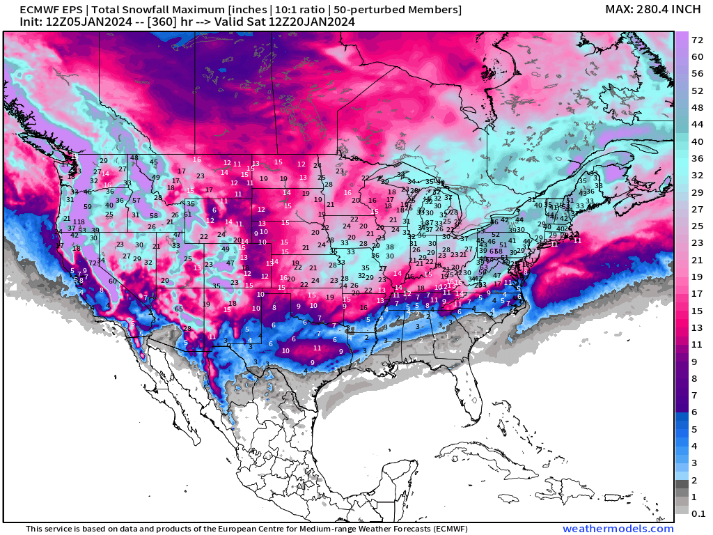
And, just for fun, here is the maximum or worst case scenario from all of the ensembles. Enjoy!
All maps are probably from weathermodels.com (please subscribe there for affordable, professional, and beautiful weather maps created by yours truly).
Thank you to my paying and freemium subscribers!
Your support pays for my Linux servers and product development. Also, it allows me to provide (usually) interesting and valuable commentary on scientific topics on X. Feel free to say hello and follow on X/Twitter (@RyanMaue)
Old News:
This newsletter will rebrand in 2024 as part of roll out of [WT] https://weathertrader.com