


January 31, 2025 Friday Weather Update
Goodbye January, a cold month with a lot of snow in usual locations

Good Evening!
Happy to be done with January and one month closer to Spring. Looking at the observed snowfall over the past 30-days is astounding with footprints of many storms at various latitudes including along the Gulf Coast.
Without knowing the date, I’d probably say this map was from 1899 to 1954.
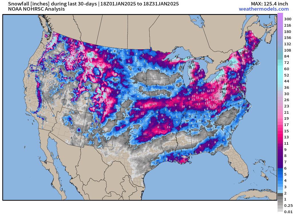
Overall, for the season-to-date from October 1st, extraordinary amounts of Lake Effect snowfall piled up in the Great Lakes. Colorado has also seen a LOT of snowfall. And, of course Louisiana around New Orleans and the Florida Panhandle into Southern Georgia has done very well for 20-winters let alone 1.

Weather Headlines
Models out to 2-weeks are showing the potential of a stratospheric polar vortex split. So far this winter season, the PV has been anomalous strong — more intense than usual.
NOAA has a nice blog on the PV —> Link
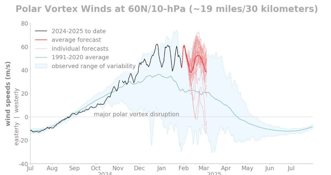
An intense stratospheric PV doesn’t have to mean anything for us down here in the lower troposphere unless the two layers can communicate, which has not been the case in the past months.
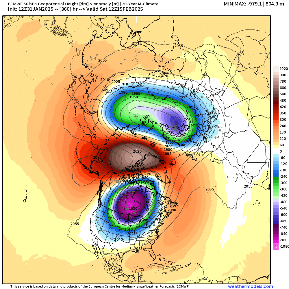
When looking at 50 hPa Height Anomaly in the Strat, we see much smoother features because the waves are not easily perturbed and remain much more stable than the ridges and troughs in the troposphere below the jet stream.
The stratosphere splits in ECMWF 12z HRES by mid-February.
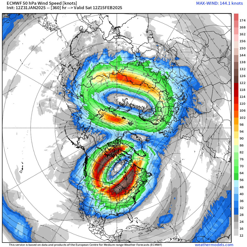
The split is confirmed with the 50 hPa wind streams. However, this does not necessarily phase or link to the circulation in the troposphere BUT IT CAN, and that would mean extreme cold when the thickness anomalies and a positive Arctic Oscillation align across North America. Is that going to happen this year? I’m currently leaning against it because of the dominant subtropical stream taking over in the coming days into mid-February. I’ll show that …
Frontal Systems Friday Evening

HRRR simulated radar next 48-hours
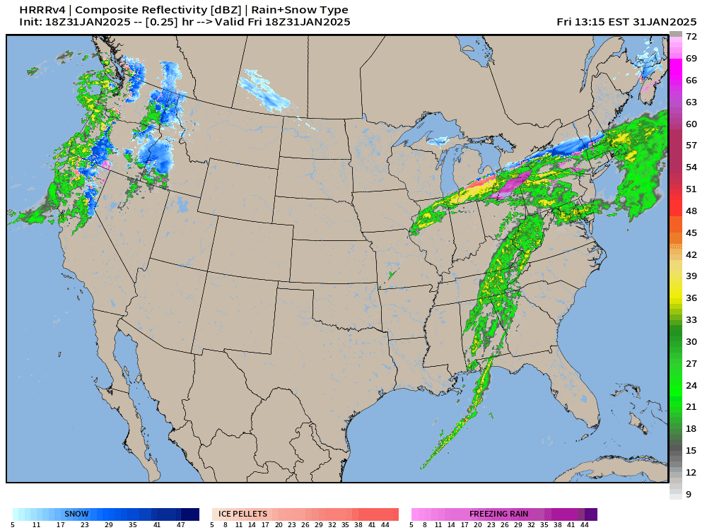
A storm system exits the Northeast by Saturday morning, and a Clipper System follows for Sunday into Monday. Boatloads of moisture begin flowing into the West Coast focused most on northern California.
Snowfall Next 72-hours
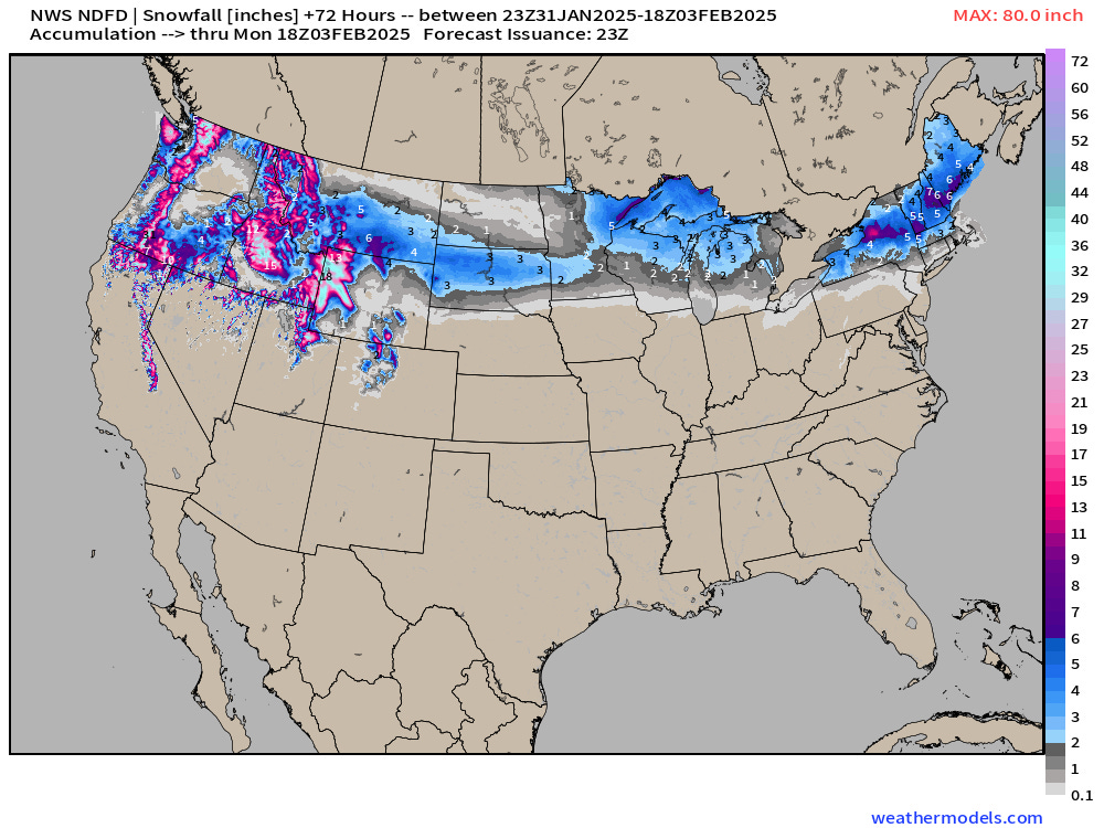
Maybe 2-3” in Boston, and dusting toward NYC, if anything.

Pineapple Express | Precipitable Water Next 6-days
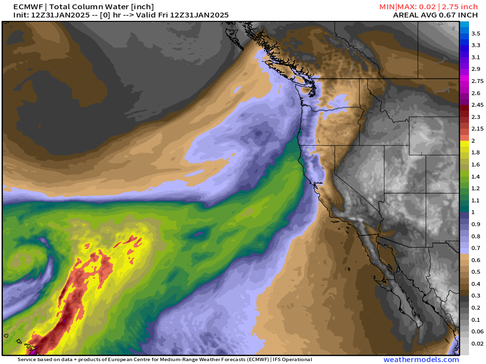
We can call this a Pineapple Express especially with the origin of the low pressure center [Kona Low] and atmospheric river out of the subtropics near Hawaii.
This is a very moisture laden system — we’ll see with the Integrated Vapor Transport. We can thank the deep trough associated with the polar vortex over Western Canada and the U.S. Pacific Northwest for rerouting the subtropical jet stream into the West Coast.
Precipitation Type and MSLP Next 7-days

Bunch of Clippers but perhaps a more substantial storm by end of next week.
NWS WPC Precipitation | Next 7-days
WPC has 26.2 inches maximum in the Sierra — not all of this will be snowfall as the subtropical moisture feed is quite warm even at highest elevation.


Total of 10.2 Trillion Gallons [liquid + melted snowfall] forecast to fall across California.
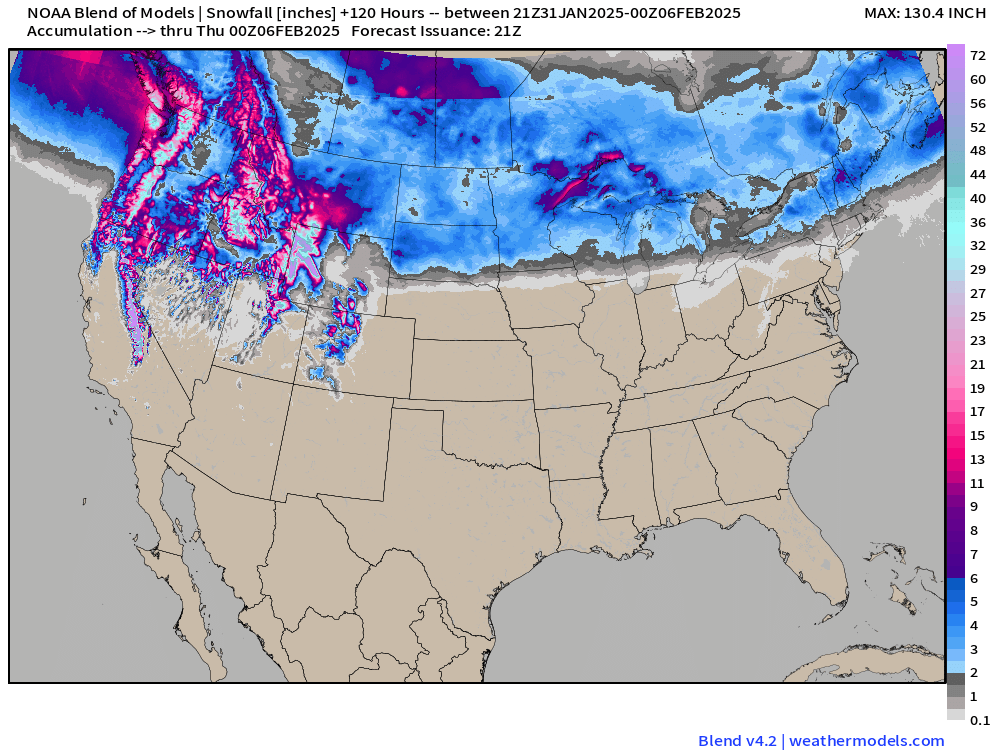
Blend of Models 10-day Snowfall

Enormous snowfall across the Western U.S. … could be 10-12 feet or more, who knows.
Why isn’t the Polar Vortex able to Plunge South Again?
Simplest explanation is the warmer subtropics winning out over the colder Arctic air bottled up in Canada. This sets up a battleground where the two air masses meet — and plenty of Pacific moisture streaming across the Western U.S. should keep the Lower 48 very stormy!
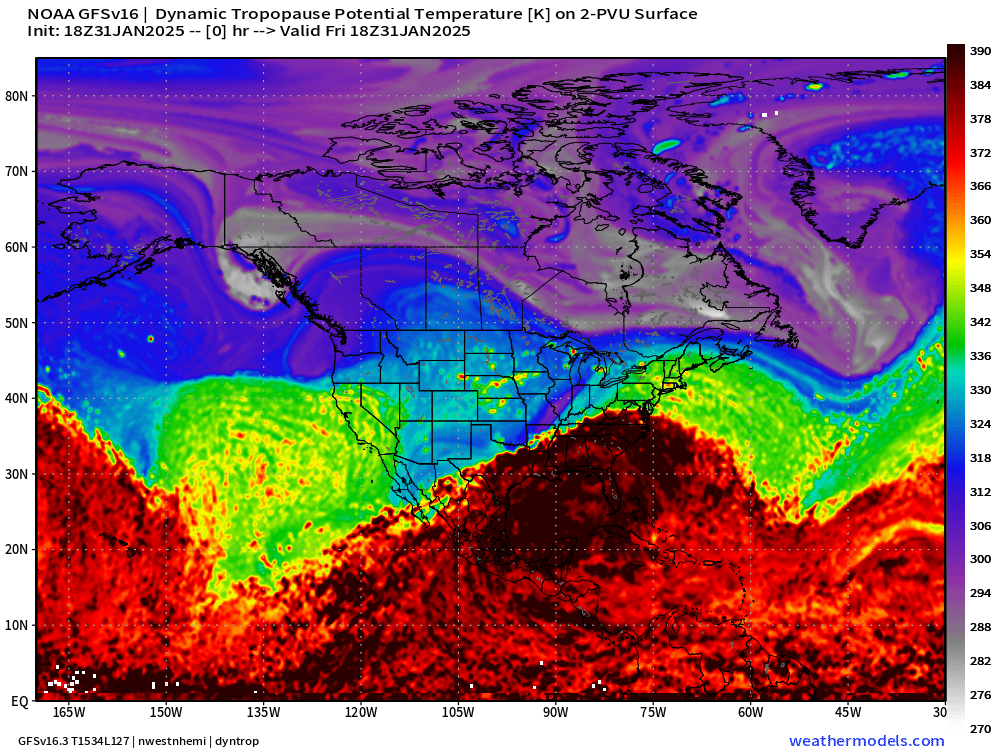
GFS Next 15-days Dynamic Tropopause
(My third favorite parameter)
The Pacific Northwest absorbs much of the cold pool formation over the next 10-days and fails to plunge any further south — just eastward after modifying. I don’t see a major “Arctic blast” in the cards for the next 10-days, instead seasonable cold at the margin e.g. Canadian border, Great Lakes, and New England.
Otherwise, VERY WARM across the southern 1/3 of the Lower 48 with Early Spring like warmth.
ECMWF AIFS 12z | Upper-Level Pattern Next 10-days
Keep reading with a 7-day free trial
Subscribe to Weather Trader to keep reading this post and get 7 days of free access to the full post archives.