


January 30, 2025 Thursday Weather Update
Spring like warmth into February as polar front remains bottled up in Canada

Good Evening from very snowy Northern Michigan.
Drove up from Atlanta yesterday to visit my hometown here in Manistee, a small mid-19th Century lumber town that grew into an industrial center, and now tourist trap. At least 3-feet of snow fell during the past 10-days but thankfully a thaw today in the upper-40s melted the roadways. Lake Effect snow will continue again as Lake Michigan ice cover stopped growing — just need some more Arctic air.
Weather Headlines for Next 2-days
Huge West Coast moisture feed and atmospheric river into Northern California
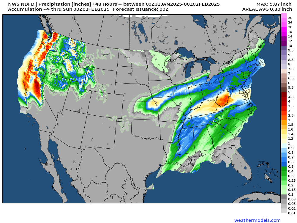
Storm system moves into the Ohio Valley with a front + Gulf of Mexico (America) moisture — mostly rain except for some back-side snow early Saturday. The rainfall will be quite welcome into the Mid-Atlantic.

Frontal Systems Friday Evening
January ends with a very mild pattern for much of the Lower 48.

Snowfall Next 48-hours

Could be a light dusting or 1-3” snowfall across New England early Saturday.
48-Hour Precipitation Total
The 1-inch from Kentucky into Maryland and South Jersey is very welcome.
Boatloads across the West Coast, especially north of San Fran, just beginning
Pineapple Express | Precipitable Water Next 6-days

I think we can call this a Pineapple Express especially with the origin of the low pressure center and atmospheric river out of the subtropics near Hawaii.
This is a very moisture laden system — we’ll see with the Integrated Vapor Transport. We can thank the deep trough associated with the polar vortex over Western Canada and the U.S. Pacific Northwest for rerouting the subtropical jet stream into the West Coast.
ECMWF AIFS 12z | Upper-Level Pattern Next 10-days
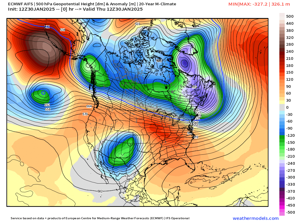
The polar vortex related trough lingers around the Pacific Northwest for the next 8-days before sort of progressing into the northern Rockies.
Note, the Great Lakes and Northeast are brushed by the Arctic front as the blocking ridge in charge of the Lower 48 breaks down slowly but surely. However, it could be Days 10-12 before we see this pieces of the cold pool over the Northwest move east.
Temperature Anomaly Next 15-days
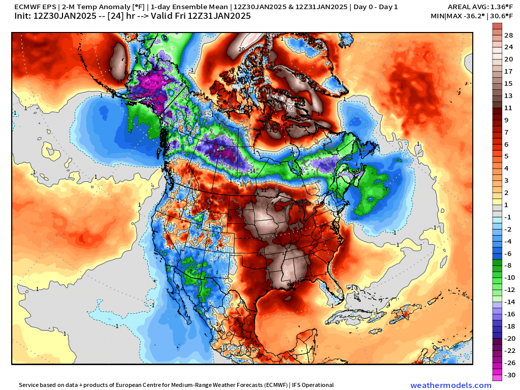
The cold over Washington to Montana will be exceptional — but the ridge blocks it from blasting south and east like early January. Instead, the ensemble mean shows a washed out pattern with slightly below normal temperatures reversing again to above normal in the Southeast by Valentine’s Day.
Keep reading with a 7-day free trial
Subscribe to Weather Trader to keep reading this post and get 7 days of free access to the full post archives.