


January 30, 2024 Massive Pacific Storm
Powerful cyclone to bombard the West Coast of USA
Weather Trader | Tuesday Update
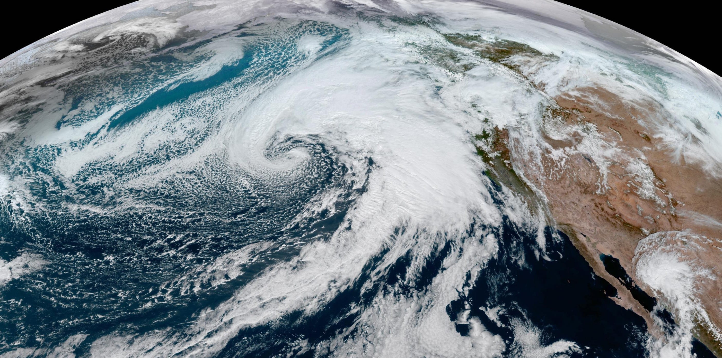
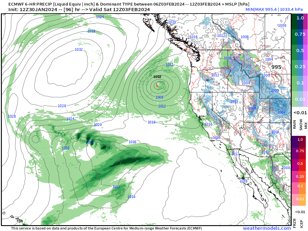
A powerful storm has intensified over the Pacific just off the West Coast of the U.S. with a ribbon of moisture called an “atmospheric river” extending from Hawaii into British Columbia. Central pressure will drop into the 950s, which is rather remarkable for an eastern Pacific storm at this latitude.
The low is “hurricane force” with wind gusts over 75-mph mainly to the west of the center along the bent-back warm front in the cold air. You can see some sleet and snowfall on the periphery over the ocean, which is still relatively warm in the 50s.
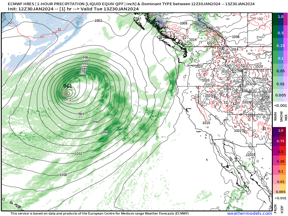
Wind gusts early Wednesday morning in knots — large area of 64+ knots (75 mph) west of the center.

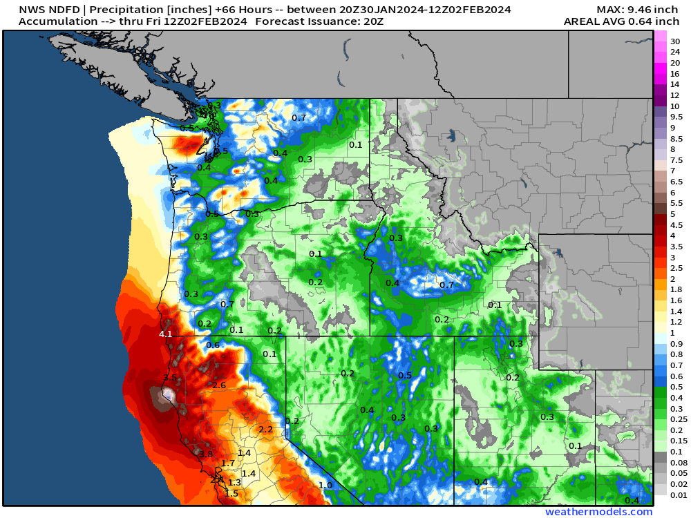
Rainfall along the California coast will be excessive in the range of 2-4” but could locally exceed 6-8” depending upon the banding and training of the showers.

Less rainfall in Oregon and Washington, but snowfall at higher elevations.
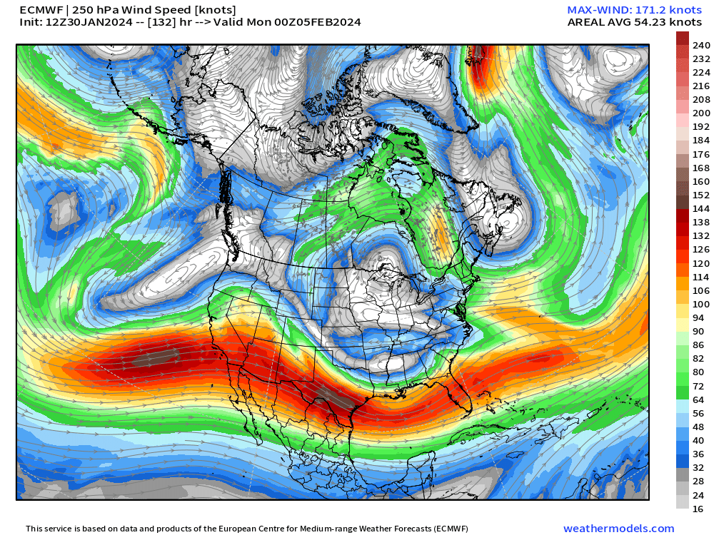
Potential for severe weather along the Gulf Coast on Saturday and Sunday moving into Florida. This is a weird weather pattern with cut-off lows underneath the strong “heat dome” ridge stuck over Canada. The subtropical jet is strong and will help impart wind shear upon the atmosphere and help rotate supercells that develop. Early February is severe weather season in the Southeast.
Weird 500 hPa geopotential height pattern on late Sunday with a series of cut-off troughs.

And the subtropical jet extends along from the Pacific across the southern U.S. into the Atlantic.

[Update: I was able to install WRF on a 48-core server and run a simple 48-hour forecast based upon GFS from Hours 120-168 at 9-km over the Southeast in about an hour. The goal is to downscale severe and extreme weather events within the global models to provide a higher level of detail, more parameters, and prettier maps. I’m not sure of too many outfits that provide telescoping WRF downscale runs on areas of interest in the medium-range e.g. past day 3 when the typical mesoscale models quit.]
Another powerful storm system along the West Coast into California on Sunday and Monday looks very impactful.


February Thaw — exceptional warmth continues
Keep reading with a 7-day free trial
Subscribe to Weather Trader to keep reading this post and get 7 days of free access to the full post archives.