


January 29, 2024 Afternoon Update
Stormy and very wet pattern for Western US
Weather Trader | Monday Update
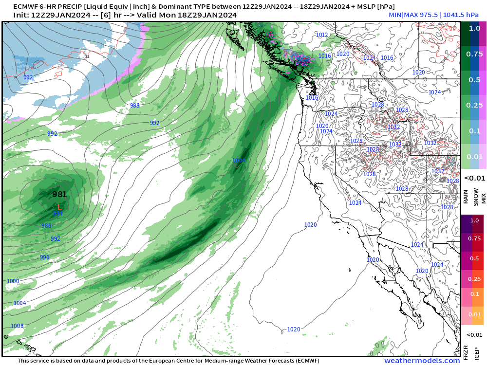
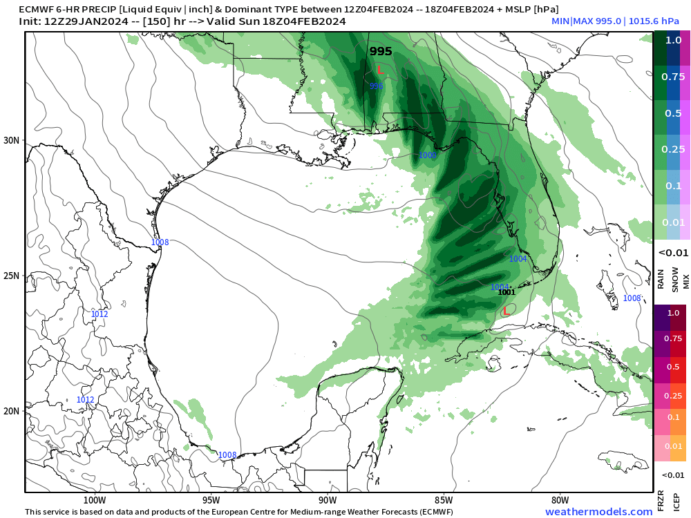
A powerful atmospheric river will bombard the West Coast with the low dancing off of Washington. A secondary “bomb cyclone” develops in 7-days that could be extremely serious in terms of wind and rainfall along the California coast. Need to closely monitor for this weekend (Sunday) into Monday.
Potential for severe weather in Florida and the Southeast next weekend with a very strong jet max at 500 mb and wind shear. Quick run through of the next 7-days show what look like supercells in the Gulf on the 9-km ECMWF HRES.
[Note I am going to run WRF and downscale GFS, ICON or KMA/CMA to higher resolution around 7-9 km in order to produce 30-minute products w/all the severe parameters, coming to Weather Trader shortly. I set up the servers and just need to install WRF, which I’ve done 20x or more in the past 10-years]


Wind gusts on Sunday at 18z show 94 mph from thunderstorms in the ECMWF model. These are wicked.

This looks bad on Sunday! Will monitor for tomorrow’s update.

January into February Thaw — Exceptional Warmth
Keep reading with a 7-day free trial
Subscribe to Weather Trader to keep reading this post and get 7 days of free access to the full post archives.