


January 27, 2025 Monday Winter Weather
Significant warming trend on the way

Good Morning!
While there’s plenty of winter weather ongoing since it is late-January especially across the Great Lakes and Northeast, a sustained warming trend is on the way for early February especially east of the Rockies.
January 1-26, 2025 Month-To-Date Temperature Anomaly

Maine and California are the main hold-outs from January’s exceptional cold. Overall, the Lower 48 is -4.3°F below normal with 5-days left to add to the month.
Looking ahead to the next 15-days from the Ensemble Mean:
A lot of red on the map except for the Pacific Northwest and perhaps down to California. +8°F (above normal) in Iowa and the entire Lower 48 (minus Maine) more than 5°F above normal. Of course, early February can be brutally cold, so if we can put a lot of red on the map, then that gets us closer to Spring.

Next 9-days Temperature Anomaly
Some cold air trying to intrude into the Midwest by next week, but much above normal temperatures blanket the Lower 48.

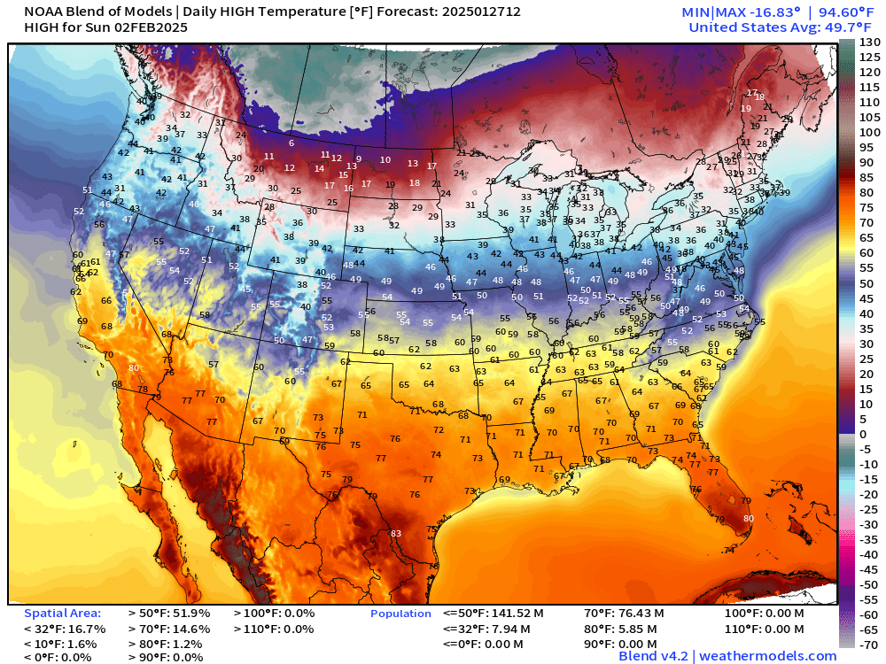
Next Weekend High Temperatures
Saturday the Lower 48 average high temperature is almost 49°F.

Sunday the Lower 48 average temperature is almost 50°F with 50s into the Ohio Valley and 60s almost to St. Louis and Cincinnati. The coldest air remains bottled up in Canada — hopefully.
Integrated Vapor Transport Next 10-days

One of my favorite atmospheric variables or parameters showing the movement of weather systems and moisture. You can quickly see what’s going on with the Gulf of Mexico moisture plume extending back into the Caribbean around a ridge that eventually shifts into the Atlantic.
Keep reading with a 7-day free trial
Subscribe to Weather Trader to keep reading this post and get 7 days of free access to the full post archives.