


January 28, 2024 Week Ahead
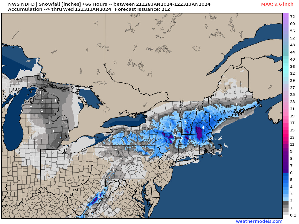
Northeast coastal storm is a snowfall threat
Weather Trader | Sunday Update
Unseasonable warmth continues for the week centered on Canada and the Midwest. Cooler conditions seep southward along West Coast with troughing.
Weak clipper system heads through Great Lakes with light snowfall into Tuesday

Alaska still well below normal into the -50s including Bettles at -57°F Sunday morning and Fairbanks at -43°F. Meanwhile, Edmonton, Albert is going for 51°F on Tuesday after being in the minus 50s a couple week ago.
Total snowfall over the next 2.5 days into Wednesday morning from NWS:

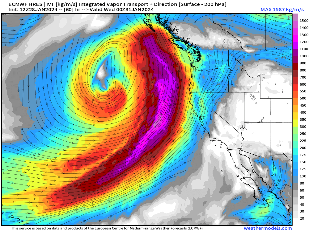
West coast atmospheric river to bombard British Colombia directly or perpendicularly. The front then lays out along the West Coast delivering more rain and snow. But cold air from Alaska drains into the Western U.S. with a trough by late next week. Wind gusts > hurricane force over a large area of the Pacific.

The Integrated Vapor Transport (my favorite variable) shows the plume of moisture extending from Hawaii to British Columbia = pineapple express.

The next 10-days from ECMWF HRES shows the very busy west coast with multiple waves of moisture. The system in the 7-10 day time period could be cold enough for snowfall at/near sea-level along the California coast.
Worth noting potential for severe weather in Florida and the Southeast next weekend with a very strong jet max at 500 mb and wind shear.
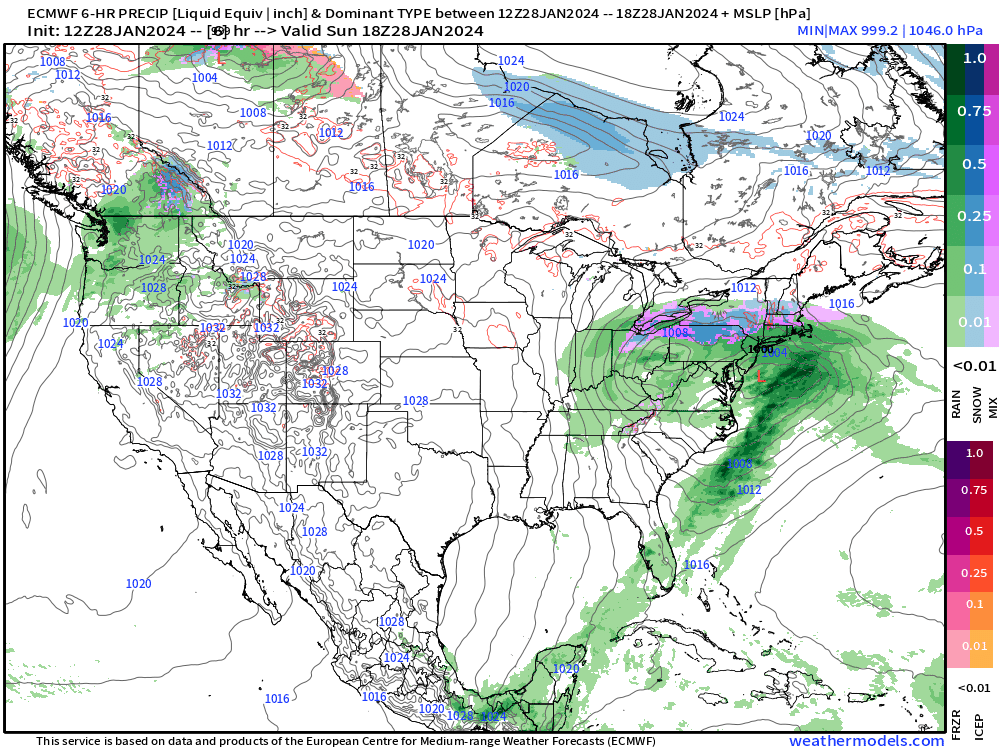
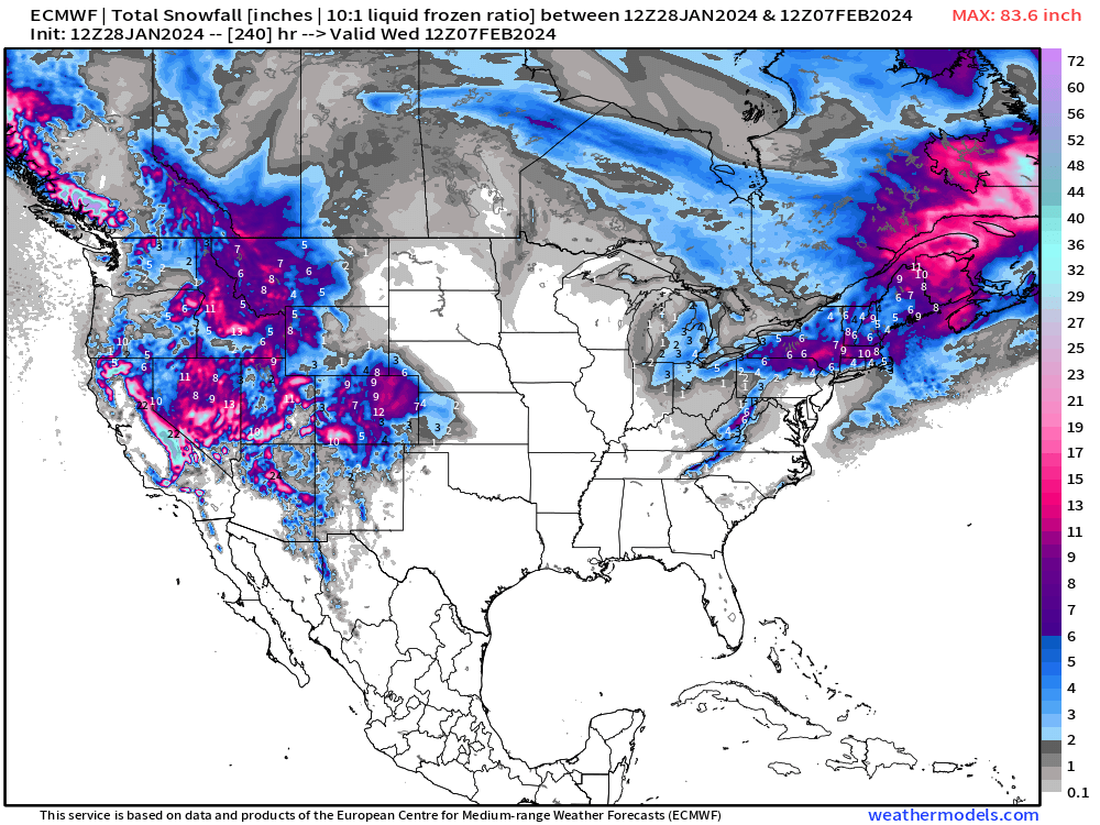
Plenty of western snowfall in the next 10-days. A series of Clippers and weak precipitation events could keep light accumulations coming in the Northeast as it should be cold enough for mostly snow.

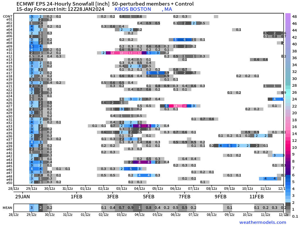
The EPS ensemble snowfall matrix from Boston does not show a major storm system but many chances for nuisance or light accumulations.


January into February Thaw — Exceptional Warmth
Monday Highs | January 29, 2024

Overall, the Lower 48 average high temperature over 51°F with 98% of the area over freezing — amazing for late January.
Tuesday Highs | January 30, 2024

Warmer yet on Tuesday with 60s and maybe 70 into Montana. Meanwhile, New England remains chilly in the 10s and 20s including Boston.

Next 14-days Temperature Anomaly
7-day Chunks from January 28 to February 11, 2024


Arctic air will remain bottled up until next weekend when the coldest air from Alaska drains down the west coast behind the sequential storm systems affecting the Pacific Northwest. That cold air actually goes underneath the Canadian/Midwest “heat dome” ridge and settles over the Southeast.
7-day Total Precipitation from WPC

10-day Snowfall Ensemble Median Accumulations


Note, opportunities for surprise snowfall over the next 2-weeks in the South, but the stars would need to align. However, it might not take much for snow at/near sea-level along the California coastline.
You can probably put away your snow shovels in Minnesota, Iowa and Chicago at least until Valentine’s Day.
(Maps from weathermodels.com)
Thank you to my paying subscribers!
Your support pays for my Linux servers and product development. Also, it allows me to provide (usually) interesting and valuable commentary on scientific topics on X. Feel free to say hello and follow on X/Twitter (@RyanMaue)