


January 25, 2025 Saturday Winter Weather
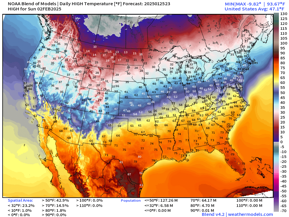
Warming trend for most of the Lower 48 except for Northeast

Good Evening!
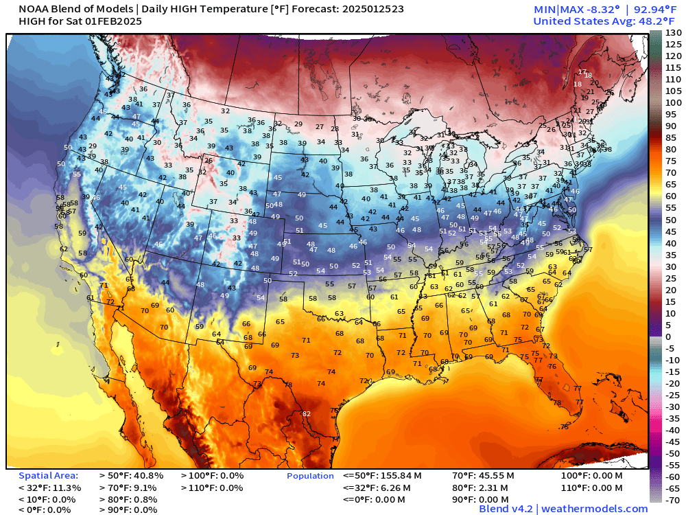
Excited to show next Saturday and Sunday’s high temperatures — look at the 60s into the Ohio River Valley! 70s maybe in Atlanta. Yay!
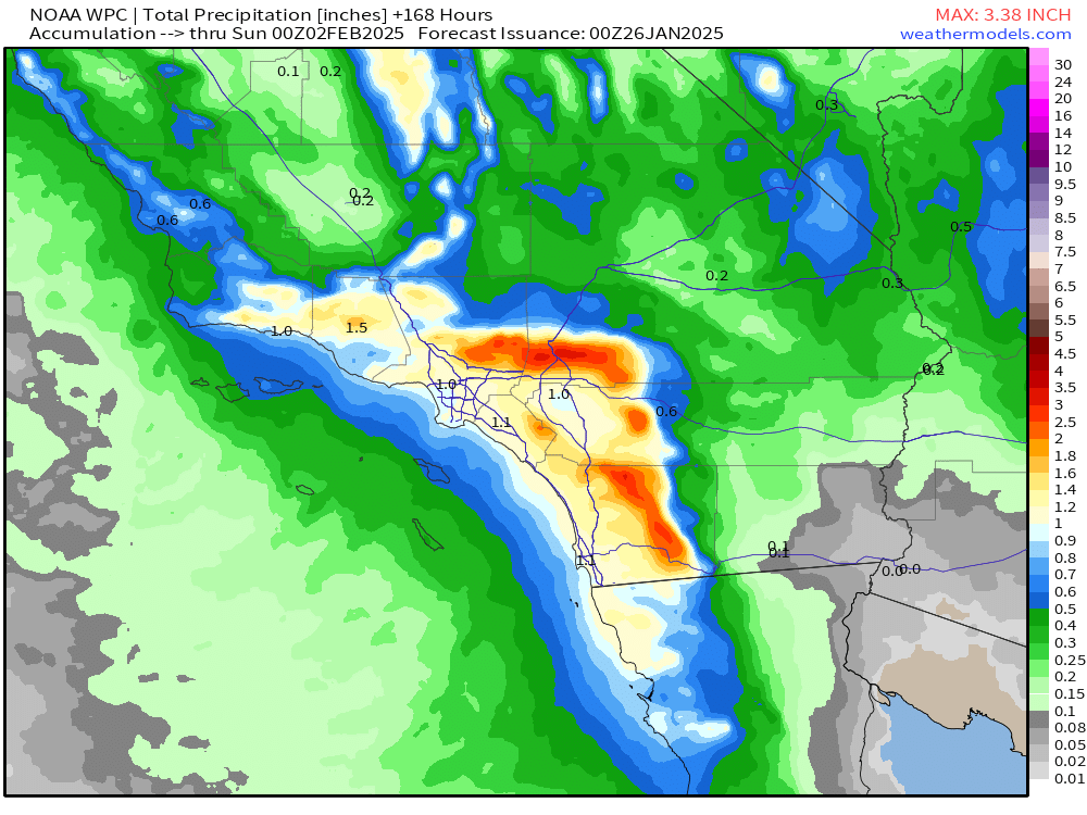
Precipitation amounts in Texas and Louisiana have increased even more in the 7-day QPF from WPC. Now over 8-inches.

Looks like Houston is in the 5” shaded contour, and 3-inches in Austin and Dallas. This might come as a surprise to folks expecting more snow and cold into February, but not across the Gulf coast for a change.

Still showing significant rainfall from the cut-off low over Southern California. Hopefully everyone gets at least 1-inch with over 3-inches at elevation.
Integrated Vapor Transport Next 10-days
One of my favorite atmospheric variables or parameters showing the movement of weather systems and moisture. You can quickly see what’s going on with the Gulf of Mexico moisture plume extending back into the Caribbean around a ridge that eventually shifts into the Atlantic.
For the Northeast, moisture from the Pacific actually does go through Alberta and then into the Great Lakes — Alberta Clippers!
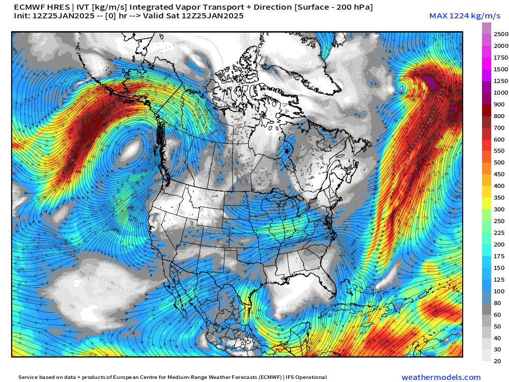
The cut-off low over Southern California doesn’t have much moisture or a circulation but it’s enough. It will then kick east and help form a surface cyclone over Texas that will tap the Gulf of Mexico moisture.
The weather over North America is usually from left to right (west to east) and many features develop further like storms only where and when the timing/location is just right for amplification. If the upper and low levels are too far out of phase, then nothing happens.
Southerly flow out of the Gulf of Mexico will be quite warm for early February!
Next Week 3-days Polar Vortex Cold Blast for Northeast
This is the HRES 12z (ECMWF) to show the sustained warmth over the Eastern U.S. minus the mid-week Polar Vortex episode over the Northeast.
At Day 10, brutally cold air sags from Alaska into the Pacific Northwest.
But, where does it go into the second week of February? I’m not sold on this blasting east across the Rockies without some additional Polar Vortex input from Canada or the Arctic.

Day 5 Upper Level Pattern
Cut-off over Baja Mexico with a ridge into the Upper-Midwest.
Keep reading with a 7-day free trial
Subscribe to Weather Trader to keep reading this post and get 7 days of free access to the full post archives.