


January 24, 2025 Friday Winter Weather
Northeast very cold next Thursday after snow from Clippers

Good Evening!
Quick update while the current weather remains quiet, so we can look ahead to next week and into early February.
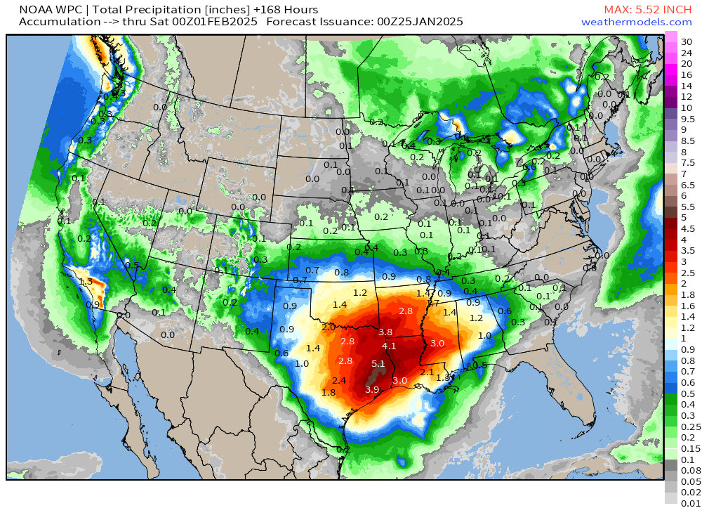
Huge moisture plume out of the Gulf of Mexico mainly late next week is showing up with a storm system that will develop in the Plains. But, that’s a ways off. A cut-off low over Southern California will provide very beneficial rainfall that continues to trend upward in the forecast.
Now 3-inches in the hills around Los Angeles and widespread 1” to 1.5” over LA County. Can’t ask for much more — perfect timing.

Next Week Polar Vortex Cold Blast for Northeast
I removed the geographic lines to better show the outline of the cold pool enveloping Ontario and Quebec by next Thursday morning. Depending upon the tilt and intensity of the trough, New England could be going into the deep, deep freeze. The Great Lakes are still holding up, however, and keeping the coldest air away from Michigan.

Prior to the coldest air arriving in New England, there will be a series of snowfall events with Clippers that could add up to several inches over multiple events.
Then, by Thursday, the upper-level pattern is highly amplified with a very sharp trough along the Northeast U.S. coast.
There’s our little cut-off over the U.S. Southwest. And, as that moves east, the circulation will advect moisture into Texas and Louisiana, eventually fueled a surface low in the Plains by next weekend.
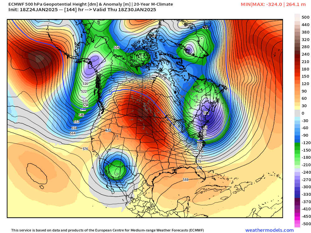
Quite a cold pool also developing over Alaska with the extent well southward into the Pacific.
Keep reading with a 7-day free trial
Subscribe to Weather Trader to keep reading this post and get 7 days of free access to the full post archives.