


January 23, 2024 Western Deluge
Powerful zonal Pacific jet to stream moisture and warm air onto the West Coast
Weather Trader | Tuesday Update
Western Deluge on the way
Warming trend in full force across the Lower 48 and Canada minus Alaska
Chance of snowfall in Sunday/Monday in Pennsylvania and New England?
Tropical Cyclone 07P named northeast of Queensland, Australia but not expected to intensify much before landfall
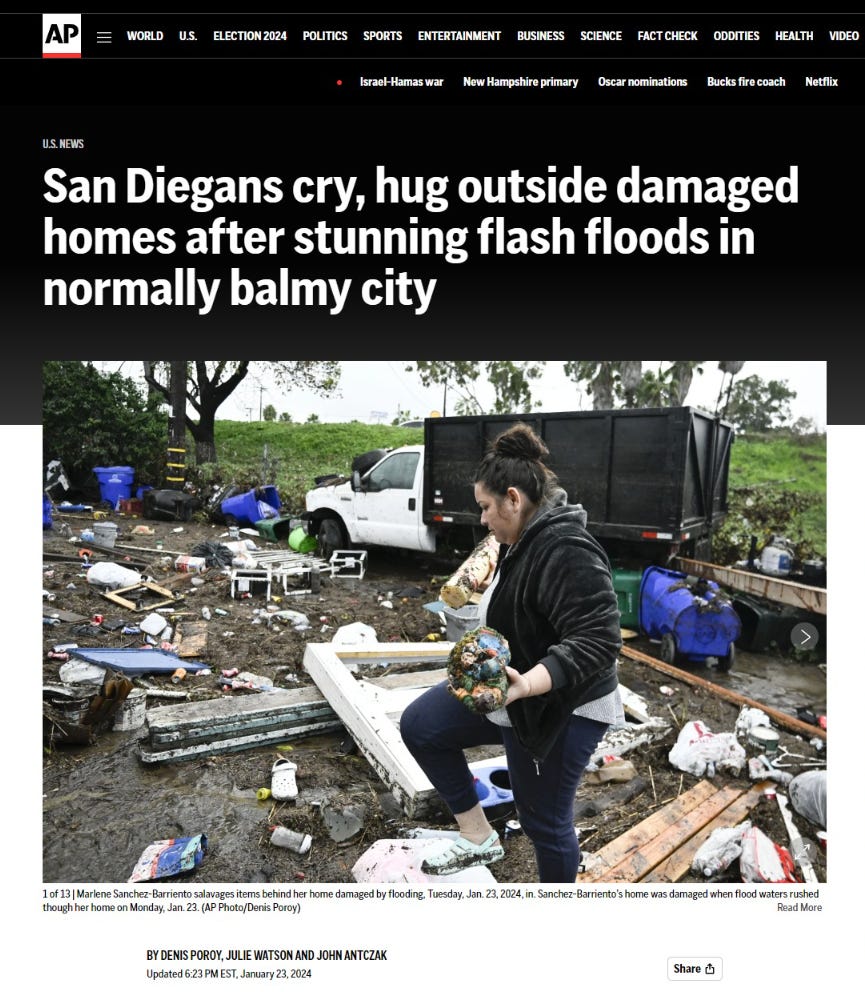
San Diego Flooding
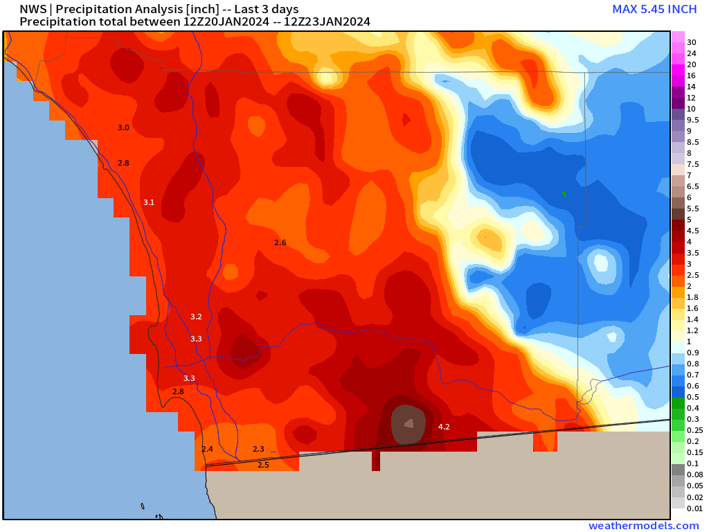
Your humble correspondent was quoted in AP national news piece on the enormous quantity of rainfall that occurred in San Diego. I calculated about 150 billion gallons over San Diego County based upon some easy math:
[17.4 million Gallons / inch / square mile] * 2.5 inches * ~3500 square miles in San Diego County [entire county is 4526 sq mi] = 152.25 Billion Gallons
A rough calculation shows that more than 150 billion gallons (568 billion liters) of water fell on San Diego County over three days, much of it in a three-to-six-hour period, Ryan Maue, former chief scientist for the National Oceanic and Atmospheric Administration, said in an email to The Associated Press. He said the city’s drainage canals and infrastructure are not able to handle such a deluge.
“The rainfall rates and duration ... overwhelmed the capability of the urban and natural interface to reroute the water back to the ocean especially with so much also falling inland at high elevations,” Maue said.
My affiliation seems to be the highest rank I’ve achieved in my career — a very brief stint as NOAA Chief Scientist — but I should be WeatherTrader founder. That was a political appointment in 2020 and quite an experience with so much misinformation in 6-months! Sticking to weather here!
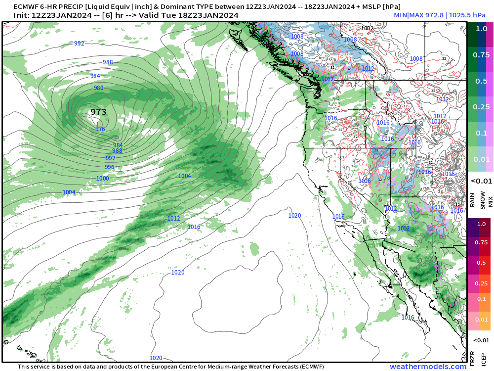
The rainfall into the Pacific Northwest will be measured in feet with atmospheric rivers on full-blast into the coast. Only need 1 or 2 in the next 10-14 days to push into California and it’s going to be trouble with all of this Pacific moisture piled up and pushed onshore. Need some of the cold air from Alaska to pinch off in early February to lower snow levels across the West.
January Thaw — Warming Trend
I’ve received & registered no complaints about any cold weather!
Wednesday Morning Lows | January 24, 2024
Heaters across the Southeast getting a break. 40s and 50s will be much more tolerable from Ohio Valley down I-75 to Atlanta.
Wednesday Highs | January 24, 2024

Look at those 60s trying to creep northward into Cincy and D.C. Less than 1-million will be at/below freezing for high temperatures. Florida solidly in the 80s!
Next 15-days Temperature Anomaly
5-day Chunks from January 23 to February 7, 2024
Broken record here with 2-weeks of “blow torch” warmth across North America — except for Alaska and Greenland.


7-day Total Precipitation from WPC
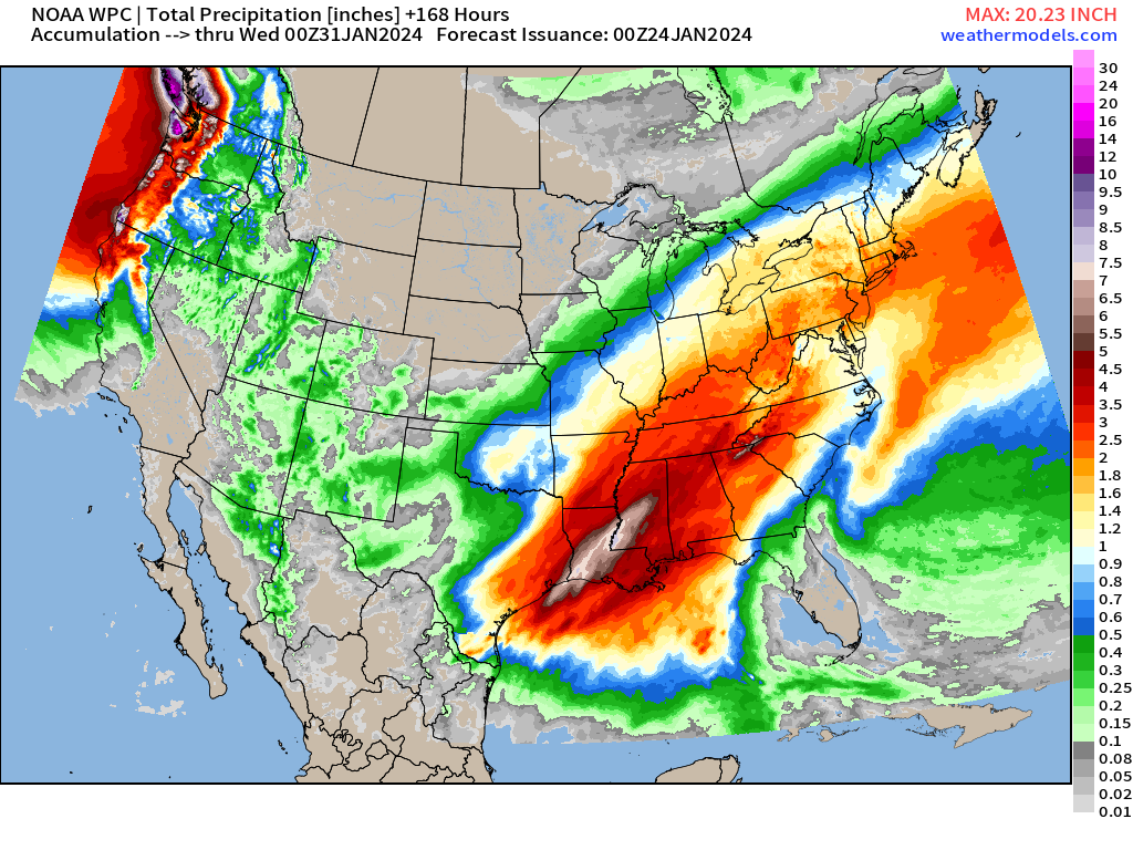

Heaviest precipitation over the next 7 days will be in the South from Houston to Baton Rouge and across the Gulf Coast to Pensacola up into Atlanta.
The rainfall will be very welcome over drought ridden LA/MS/AL over the past several months, running a significant deficit.
Need to note that the Western U.S. will be affected by major atmospheric river(s) next week. Major Integrated Vapor Transport (IVT) signal from ECMWF at Day 9. And that will lead to enormous higher elevation snowfalls — again for the entire Western U.S. over the next 2-weeks. 7-day totals across coastal range in Washington and B.C. could be 20-inches of rainfall!
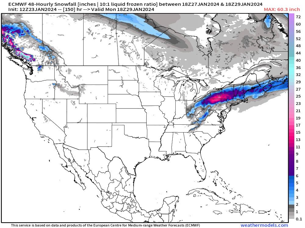
15-day Snowfall Median Accumulations:

There is a snow signal in the Northeast and I found it next Sun/Mon with a coastal low developing.
What are the chances that this low phases better with the jet and deepens/intensifies a bit more — some cold air is available — and it dumps a surprise jackpot?
Can’t stick a fork in winter in late January since night-time is always (usually) cold enough for snow.

That’s a nice little 12-inch area of snowfall in NY/PA that could slide east a little bit!
Or it could poof. We’ll watch it and adjust.
Tropical Cyclone [07P] to landfall as a TS in Queensland, Australia on Thursday
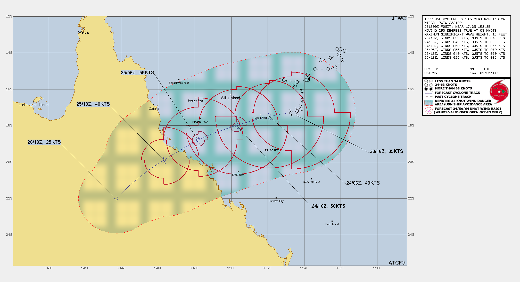
Talk about a modeling bust — in our favor! Tropical Cyclone 07P (Kirrily) has been initialized by the JTWC, but it’s turning out to be only a rainmaker with minimal intensification expected prior to landfall. The system blew up with extremely cold convection the other morning, and then proceeded to poof out and remain disorganized. The weather models all seemed bullish about significant intensification to a major hurricane status. The good news is that won’t happen with maximum winds expected at 55-knots or a strong tropical storm.
(Maps from weathermodels.com)
Thank you to my paying subscribers!
Your support pays for my Linux servers and product development. Also, it allows me to provide (usually) interesting and valuable commentary on scientific topics on X. Feel free to say hello and follow on X/Twitter (@RyanMaue)