


January 22, 2025 Wednesday Winter Weather
Some beneficial precipitation in Southern California from cut-off low

Good Evening!
Our snowfall map has indeed filled in nicely across the Gulf coast from Houston to Tallahassee and into the Carolinas. And, earlier in the week, we saw some light accumulations in Washington D.C. into the Northeast. Lake Effect snow in the Great Lakes continues but Lake Erie is > 80% ice covered, so the end might be near for folks downwind.

Snowfall over the past 3 days:
Reports continue to come in to be combined with the underlying model and radar analysis. The most extreme totals in the 10”-12” range were in Louisiana south of New Orleans and the western Florida panhandle including Pensacola.

Interstate 10 is closed from the Alabama state line to almost Tallahassee due to rock solid ice conditions on the roadway.
This the most extreme winter storm perhaps since 1899 in terms of snow coverage, but not quite with extremely cold temperatures. It could be a lot colder with Arctic blasts well into Florida, but usually no precipitation accompanies the high pressure. This time around, we had enough Gulf of Mexico moisture pulled northward ahead of a developing storm system — that is on its way to Ireland with a powerful 220-knot jet stream.

Santa Ana Winds Continue
Sadly, wind gusts 40-60 mph will burst into the evening across Southern California to fuel ongoing fires. Precipitation is coming, but several days away.

Ireland Bomb Cyclone
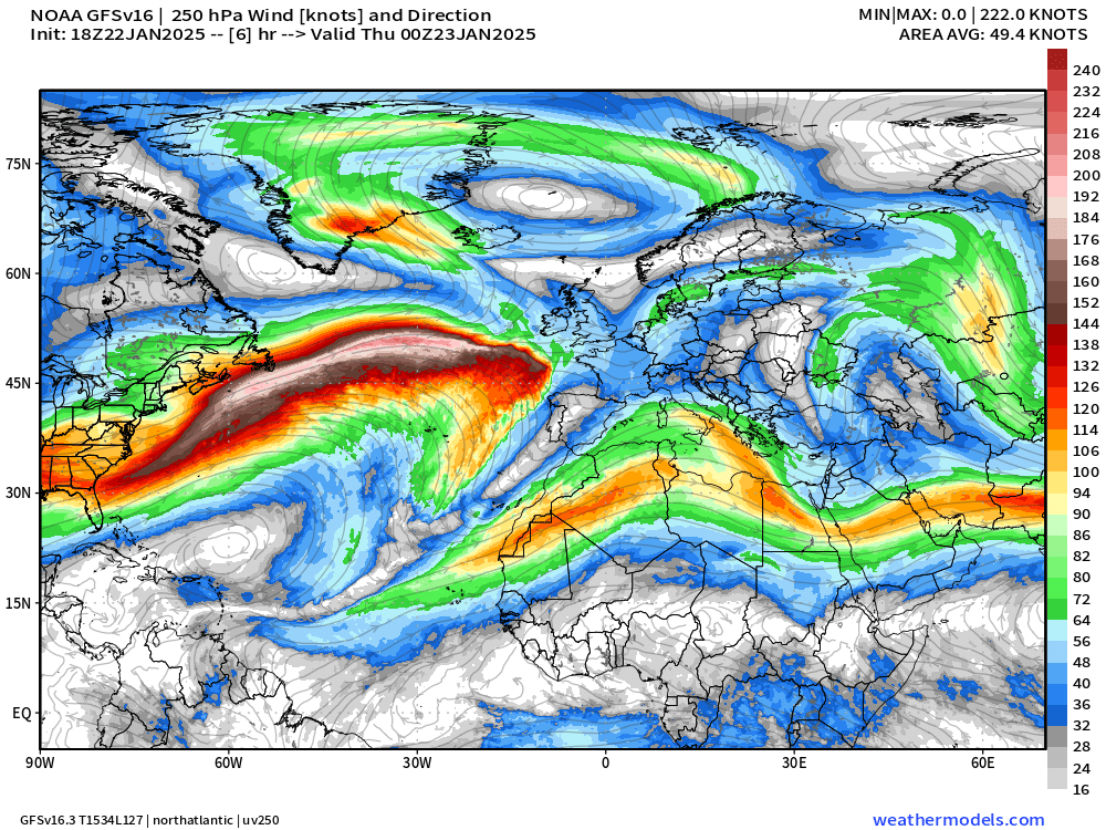
A 220-knot jet stream is zooming across the North Atlantic. A frontal wave is developing in the right front quadrant ahead of cold Canadian Arctic air that was previously over the U.S. Northeast.

Animation of 850 mb Winds
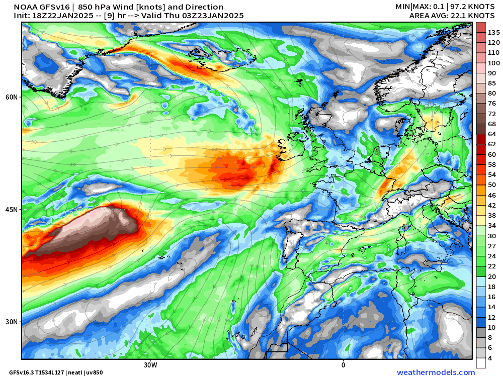
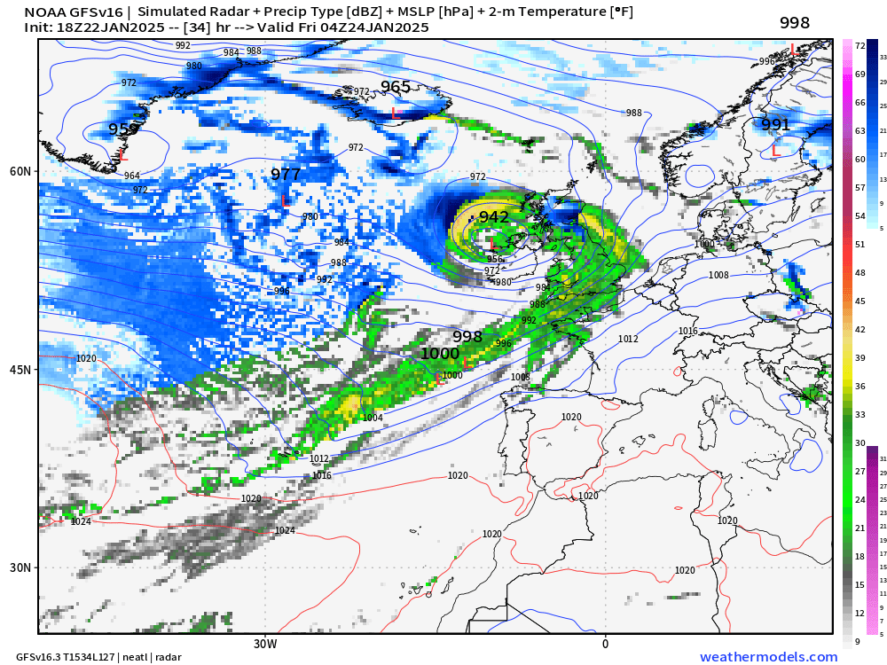
This is a textbook bomb cyclone deepening by 60-mb in 24 hours to the low-940s. The most extreme winds will be along the bent-back warm front and coincide with the tropopause fold. Here, with descending, dry air, sting jets can briefly accelerate near-surface winds well over 100 mph.
GFS has 100-meter wind speeds > 100 knots which is easily major hurricane force when gusts are considered. There is high risk of damaging winds especially to Ireland.

The storm will be all rain as the track maintains the warm sector into the United Kingdom and Europe. The much colder Arctic air remains well to the west.
Watching the Polar Vortex over the next 8 days
Keep reading with a 7-day free trial
Subscribe to Weather Trader to keep reading this post and get 7 days of free access to the full post archives.