


January 19, 2024 Frigid Weekend
Extended break from polar air for next 2-weeks
Weather Trader Evening Update
Tropical Cyclone [90P] threat to Queensland, Australia

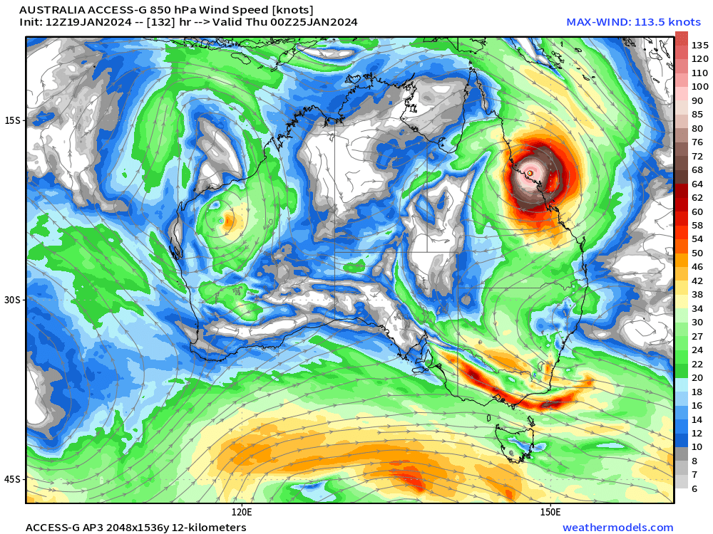
Still watching Invest 90P in the SW Pacific on a slow SW track toward Queensland coast. More ensemble members show a landfall in 5-6 days, next Wednsday. The ACCESS-G global model from Australia BOM also is showing a landfall at 940 mb.
Curiously, GraphCast and FourCastNet A.I. do not landfall 90P as a powerful cyclone instead stalling off the coast before looping back to the southeast away from land.
Arctic Blast 2
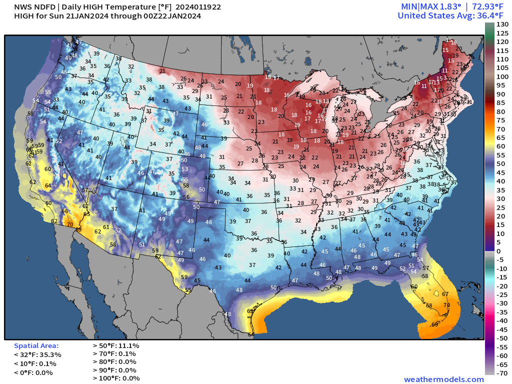
Morning lows on Saturday will be frigid across much of the Lower east of the Rockies except for central and South Florida. 250 million Americans at/below freezing and 85% of the area. Coldest around Omaha in the -20s°F
17°F in Atlanta and 21°F in Dallas, only 5° or 7°F in Nashville. 2°F around Chicago.
Saturday Morning Lows | January 20, 2024

Saturday Highs | January 20, 2024
Not making freezing here in Atlanta on Saturday - which is a record low maximum for the day. It has been much colder in the past, but this is a significant challenge for heating.

Sunday Morning Lows | January 21, 2024
Even colder here in the Southeast. 15°F in Atlanta and mid-30s into the northern Orland metro. 40 Million at/below 0°F.

Sunday Highs | January 21, 2024
Slight improvement on Sunday before a significant warming trend for next week, finally.
Western storm systems + Texas/LA Gulf Coast moisture feed

Not much update to the synoptic forecast. Heavy west coast precipitation will combine with Gulf of Mexico flow to inundate the Gulf Coast from Texas to Louisiana. It will go from winter Arctic blast to tropical January downpours. The overall Lower 48 will warm dramatically with above freezing temperatures across the entire Lower 48 by this time next week.
Nice animation of the warming trend over the next 10-days! (ECMWF HRES 12z at Wehatermodels.com)
Snowfall Forecasts Next 3-Days and 15-Day Temperature Anomaly
Keep reading with a 7-day free trial
Subscribe to Weather Trader to keep reading this post and get 7 days of free access to the full post archives.