


January 18, 2025 Saturday Winter Storm
Memorable next week of weather across the Lower 48

Good Afternoon!
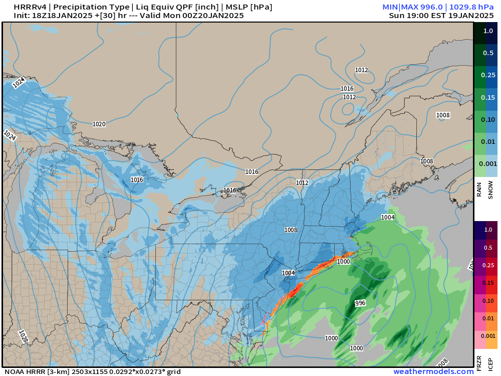
A coastal low that could be called a Nor’easter will have just enough moisture to produce a decent footprint of snowfall from Washington D.C. into New England mainly on Sunday.
The central pressure is 996 mb around 7 pm ET on Sunday, so gusty winds will be in the 30 mph range enough to lower visibility and make travel difficult on Interstates. The Arctic Polar Vortex is behind this storm system and its front — so heavy Lake Effect snow will continue as the Great Lakes remain very warm and largely ice free.
Inauguration Day Activities mostly moved indoors with Noon time temperatures probably slipping into the teens in Washington D.C.

HRRR 18z snowfall totals for 48-hours are quite impressive.

Comparison with NWS for the next 66-hours

I was skeptical of the much higher NWS snowfall totals than ECMWF, but HRRR seems to agree and ECMWF HRES has significantly increased the QPF — which will fall into colder air = 10:1 or 12:1 ratios.

Next 60-hours in Washington D.C.
ECMWF 12z HRES has more snowfall than NWS, up to 5” from 0.5” of QPF.
Keep reading with a 7-day free trial
Subscribe to Weather Trader to keep reading this post and get 7 days of free access to the full post archives.