


January 16, 2024 Another Arctic Blast
Much warmer next week but we need to get through more Arctic air
This newsletter now has a more specific name: Weather Trader
Please consider upgrading to a Paid subscriber [$5/$50] to get the best/latest content going forward. The goal is to provide the same professional weather analysis and advice that is otherwise unaffordable to the general public. Access to the companion https://weathertrader.com will come with this subscription here (I’ll periodically export the paid subscriber list).
Another Arctic Blast on the way but slightly less worse. A warming trend is on the way with January ending “blow torch” — ?

Temperature anomaly over the next 7-days shows the quick erosion of the Arctic air mass by warmer Pacific flow as well as Gulf of Mexico moisture. Definitely a much milder pattern compared to the brutal cold we’ve experienced over the past several days.

A strong ridge will build over the Great Lakes into the Mid-Atlantic by early next week intensified by southerly flow with plenty of moisture coming out of the Gulf of Mexico.

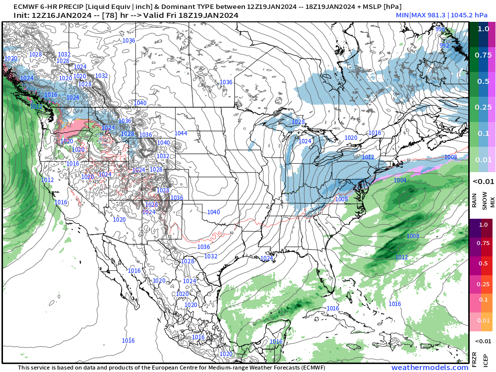
There is a decent chance for light accumulation snow again for Washington D.C. to NYC on Friday, but hopefully nothing too impactful for travel. This is shaping up to be a 1”-3” or 2”-4” type system as it moves quickly off the coast before being able to intensify.
The serious freezing rain accumulation threat [> 0.50”] in Portland, Oregon materialized this evening with Ice Storm Warnings. Colder air at the surface in the 20s is being overridden by much warmer Pacific moisture = freezing rain once it reaches the surface. Hopefully there is no significant damage or power outages.
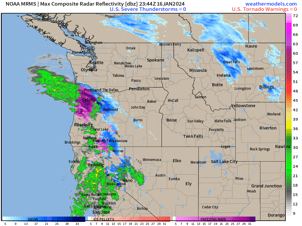
NWS even has an area of 1.2” of ice accumulation.

NDFD NWS Temperature Forecasts
Arctic Blast 1
Keep reading with a 7-day free trial
Subscribe to Weather Trader to keep reading this post and get 7 days of free access to the full post archives.