


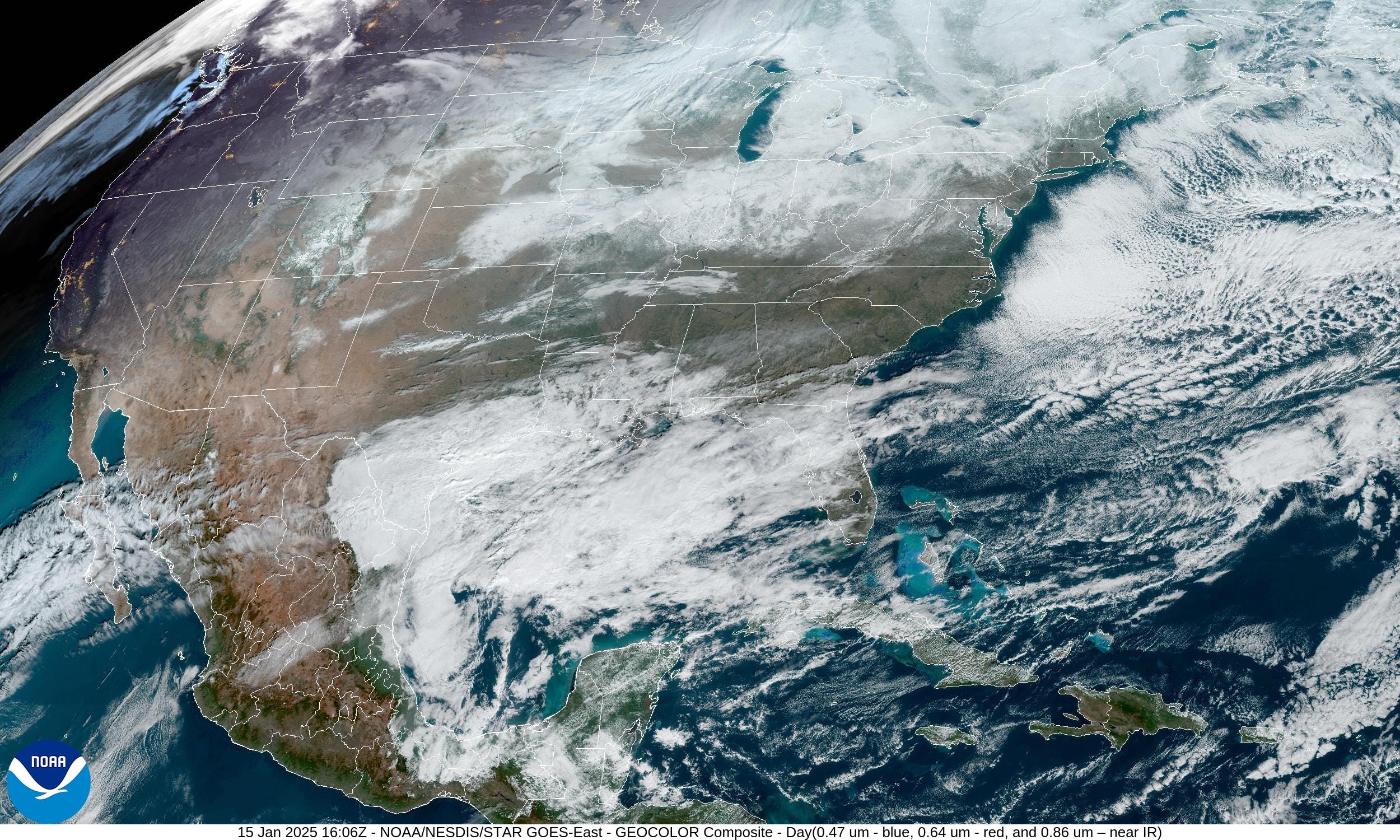
January 15, 2025 Wednesday Morning Update
Arctic blast still on schedule with 80 million below 0°F

Good morning.
Please consider upgrading to a paid membership to receive all posts to email (or via the Substack App) as we head into a very eventful mid-January winter period. Your growing support allows me to dedicate more and more time to this platform, eventually hoping to be full time.
Headlines for Monday Morning
Severe Arctic blast to affect almost the entire Lower 48 starting this weekend. The peak of the cold will rival the nationwide temperature average from the “Polar Vortex” episode of January 2014.
At the margin of the cold air pool along the Gulf Coast from Texas to Florida, subtropical moisture could bring wintry precipitation, however there is considerable uncertainty: if the cold air pool and surface high pressure is too strong, the moisture will not be able to accomplish much = minor impacts. It will just be too cold and dry.
The Eastern U.S. will get a break from the Arctic air by middle of next week. The next trough will instead set up along and west of the Rockies! This is a pattern shift that might not matter much, as the enormous reservoir of cold air just sloshes to a new location to haunt.
Full update this afternoon after the 12z model suites [Subscribe]
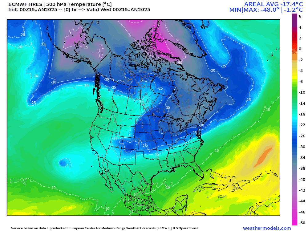
ECMWF 00z HRES forecast of 500 mb Temperature — actual temperature, not anomaly — shows nicely the outline of the coldest Arctic air associated with the tropospheric polar vortex. Pink = -40°C and is solidly “extremely cold” and anytime that color goes over your head, it’s bad news.
You’ll see that the western extent of the polar trough often thins (Rossby wave breaking) and forms “pesky cut-off lows” that linger in the lower latitudes like Texas. This features are critical to the prediction of winter precipitation as they focus moisture transport out of the Gulf of Mexico.
The rest of January 2025 | EPS 15 day Forecast Average
While the “Arctic blast” period will feature extreme anomalies on 5-days or so in a row, the overall picture for the rest of the month is somewhat less daunting. However, a -11°F anomaly in Denver or Columbus, Ohio is no picnic against already cold January climatology.

Will we see snow across the Southeast?
Measurable snow is 0.1” in the model ensemble, so there is a very good chance from Shreveport to Atlanta to Charlotte, better than 70%. Much lower chances as you head south in Florida, but not 0. 12% in Tallahassee and 2-4% in Tampa. We don’t expect such an outcome, but it would be within historical bounds.

Texas will likely see some wintry precipitation over the next 2-weeks, but there’s uncertainty about the amounts. We won’t know much more until probably 3-4 days prior to the main precipitation events, which would not be scheduled until next week.

Ensemble Mean vs. Median
I’ve mentioned many times the limits to our snowfall prediction over longer time periods. The mean of the ensemble will average higher amounts with a bunch of zeroes. The median will only provide a value at your location if more than half of the members produce snow.
I should probably develop a map that combines the two: if it snows, then what is the average amount expected. Efforting on that.


Wednesday and Thursday Weather

A clipper system will move through the Great Lakes. Not much else to report!
Precipitation Type and MSLP Next 10-days
Keep reading with a 7-day free trial
Subscribe to Weather Trader to keep reading this post and get 7 days of free access to the full post archives.