


January 1, 2025 Wednesday Winter Update
Strong winter storm early next week across Ohio River Valley

Happy New Year 2025!
Today, we reset the calendar for climate related metrics like temperature and precipitation for a new year. Of course, our decision for using January 1st is arbitrary as the Earth’s climate operates on a variety of time scales. Meteorological winter is from December to February in the Northern Hemisphere since preponderance of land surface allows for much faster cooling.
Overarching theme going into the New Year from me (Ryan) for weather and climate: create engaging, informative, and beautiful maps and data visualization that do not require the user to do a lot of work. Interactive dashboards or maps waste time of the user, and introduce enormous friction with any interface, especially when you want the same information for your home, business, or vacation destination on a regular basis. More to come, very soon.
11:15 AM ET Temperatures across the Lower 48

Lower 48 temperatures are seasonable with average of about 33°F.
Temperature Anomaly | 11:15 AM ET

Overall the Lower 48 is only slightly above normal +0.4°F (above normal) with warmest relative to normal in the Northeast.
Weather Headlines for Wednesday
A storm system will track through the Northeast with colder air eventually flowing in out of Canada. A cold front will push through South Florida with high pressure dominating across the Southeast for the next few days. Clear skies and dry conditions will be welcome after last week’s gloom.

Radar Simulation Next 18-hours | Through Thursday 3 AM
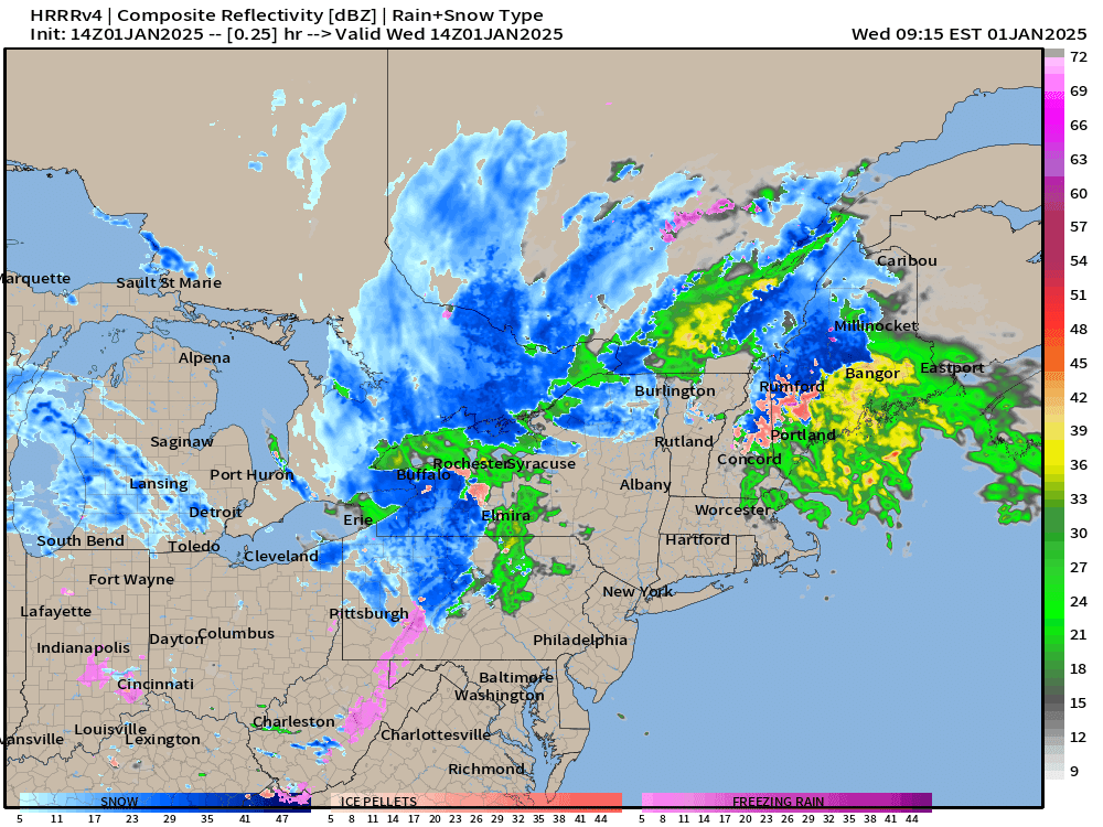
Snowfall continues through the day with minor accumulations of “system snow” but the colder air = significant Lake Effect machine
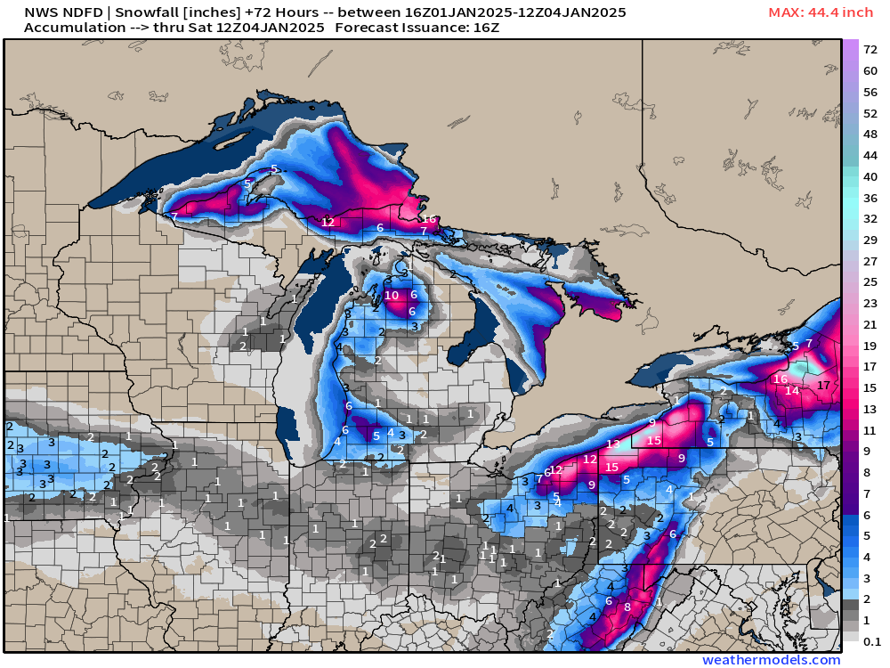
NWS Snowfall Next 3-days
Iowa with a patch of up to 3” of snowfall from a weak system into tomorrow that could also dust Indianapolis to Columbus with nuisance snow of 1-2”.

Lake Erie and Ontario 3-day snowfall totals over 12” up to 3 or 4 feet.

Lake Michigan snowbelts near Traverse City could see a foot. No surprise Upper Peninsula will see 12-18” of lake effect snowfall.
Next Week’s Winter Storm
Upper-level height anomaly next 6-days (ECMWF 06z)
First, I want to show the origin of this upcoming storm system. You can track a shortwave in the mid-levels from the North Pacific into the West Coast, across the Rockies, and then Central Plains. Over the next 3-4-days, any slight deviation of that “piece of energy” could cause a deviation of the surface low, moisture advection, and the resulting [narrow] snowfall ribbon through the Ohio River Valley.
Keep reading with a 7-day free trial
Subscribe to Weather Trader to keep reading this post and get 7 days of free access to the full post archives.