


January 1, 2024 Happy New Year
Winter storm watching with A.I. models
Quick update while I watch the Michigan Wolverines in the Rose Bowl. The weather is perfect in Southern California as it normally is in January. Sunny in the 60s to low-70s.

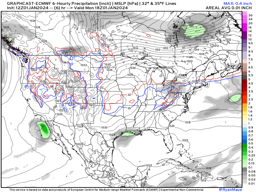
The GraphCast-ECMWF [experimental/non-commercial] A.I. model stil shows 2 systems in sequence tracking from the Southeast into New England with heavy precipitation.
Let’s zoom in on the Mid-Atlantic:
The 32°F line is right over Washington D.C. so that’s obviously going to be heavy snowfall. The GraphCast does not have a precipitation type, and I have not coded up a vertical profile based snowfall as of yet. This is late Saturday evening Jan 7, 2024.
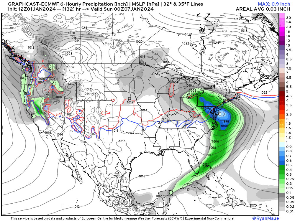
12-hours later, the Nor’easter tracks off the New England coast. Again, all snow for NYC and Boston.

This is the first real-time test of GraphCast’s winter precipitation and Nor’easter forecasting skill. I did not see any research or literature on how this A.I. trained model handles historical coastal storms of the non-tropical variety.
Conventional physics based weather models are still on board with an impactful Nor’easter. EPS 12z median snowfall in D.C. is 2” and 6” in NYC and Boston.
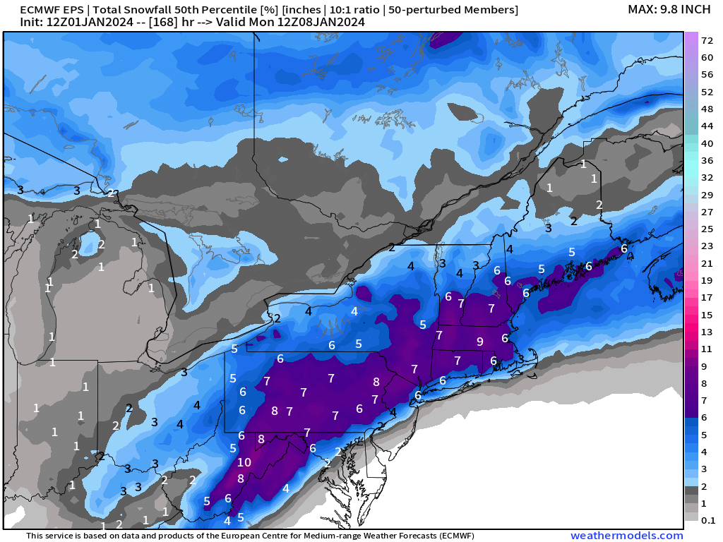
The range in NYC is from 0” to 15” with a median of 6”.
What the ensembles are trying to figure out is the rain - snow dividing line and the mixture because there is over 3” of QPF to partition!
As the event gets closer in the coming days, we’ll be able to provide better details. However, this weekend looks to be heavily impacted by a Winter Storm with significant snowfall potential.

Tuesday High Temperatures and Anomaly | January 2, 2024

Only 6 million Americans are at/above 70°F.
The southern U.S. remains cooler than normal while the upper-Midwest is near freezing — but that’s 15°F above normal.

Temperature Outlook Next 2 Weeks
The cold across NW Russia is insane, more than 50°F below normal at its most intense centered over St. Petersburg with actual temperatures of -30°F or colder.
Global temperatures have come down significantly from the exceptional warm anomaly from the past 6-months. This is due to the Northern Hemisphere land masses cooling down.
Week 1: January 1 - January 8, 2024 [EPS Mean 12z]

Week 2: January 8 - January 15, 2024 [EPS Mean 12z]

7 Day Precipitation Outlook

NOAA WPC 7-day Total Precipitation including rain and snow together.
The next week will see significant QPF across the Gulf Coast from Texas to the Florida panhandle. Then, we’ll see how much of the precipitation falls as heavy, wet snow in the Mid-Atlantic and Northeast from the Nor’easter.
All maps are probably from weathermodels.com (please subscribe there for affordable, professional, and beautiful weather maps created by yours truly).
Thank you to my paying and freemium subscribers!
Your support pays for my Linux servers and product development including (coming soon) weathertrader.com.
Also, it allows me to provide (usually) interesting and valuable commentary on scientific topics on X. Feel free to say hello and follow on X/Twitter (@RyanMaue)
Old News:
This newsletter will rebrand in 2024 as part of roll out of [WT] https://weathertrader.com