


Hurricane Laura Powering Up in Central Gulf of Mexico
Landfall late Wednesday as a Category 3+
There was little doubt that Hurricane Laura would become a large, powerful storm as the conditions in the Gulf of Mexico are just too perfect to hold it back. I am expecting a mid-range Category 4 with central pressure in the 940s mb but probably not a Category 5. The large size of Laura actually works against wrapping up a tight inner-core. But, that is a double-edged sword as the wind field (storm force or gales) will be massive. The entire NW Gulf of Mexico is about to be mixed.
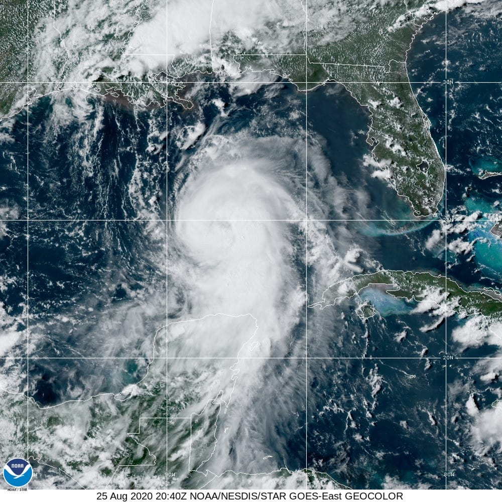
4:40 PM ET Satellite image (GeoColor from NOAA GOES-East)
On Twitter, I have been posting the ECMWF EPS ensemble mean model forecast spaghetti for Laura since it has been very consistently showing landfall just east of Galveston Bay in Texas. Since I run weathermodels.com, I can create fancy products that help decision-makers in real-time like the 06z/18z EPS ensembles. Anyways, here is the map of previous EPS forecast “mean” showing the last five 00z/12z solutions within 50 miles of each other straddling Galveston. This provides higher confidence in a solution slightly west of the NHC forecast landfall location within Texas — but east of Houston sparing the city from a direct Category 4 landfall disaster.

I’ll be watching the 18z model updates (GFS at 545 pm and ECMWF/EPS at 800 pm) to see if any further track adjustments are warranted now that Laura is powering up with an eye. I would be very concerned if the model tracks went westward again.

Even with our fancy models, satellites, and experience, hurricane forecasters still must use their intuition to provide the best actionable information. With Laura, they are earning their paychecks as they work under pressure.
Why are you predicting a cat 4 when other outlets (twc, accuweather) are predicting cat 3 at landfall?