


How not to get a hurricane in June
Factors that inhibit storm development
Ocean temperatures are too cool
June is not typically an active month for Atlantic tropical storm and hurricane development. The main reason is that ocean temperatures in the Main Development Region (MDR) from 10° to 25°N are generally too cool to support organized deep convection. While there are African easterly waves that spin off the coast, they sputter and fail to develop, and won’t until at least mid-July.
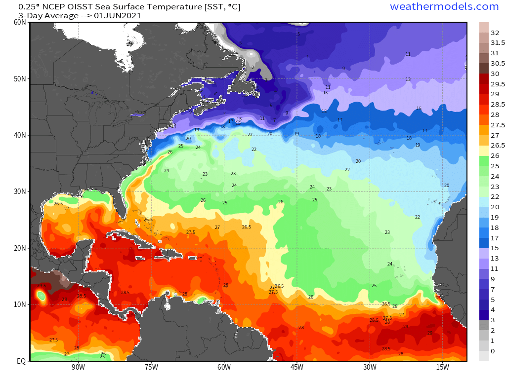
The June 1st Sea Surface Temperature map shows the 26°C isotherm along 10°N latitude until about 45°W longitude. It’s plenty warm in the Caribbean and southern Gulf of Mexico. Indeed, the Caribbean is year-round warm enough to support even a major hurricane. So, we will look for areas of thunderstorms that can develop in the Caribbean and slowly head northward into the Gulf of Mexico.
Too much Saharan Dust
Winds sweep across the Sahara and pick up enormous amounts of sand and dust, suspend it well above the boundary layer, and then head over the Atlantic is massive clouds. The Saharan Air Layer (SAL) is very dry and warm and completely inhibits convective development and shows up as a milky haze on satellite imagery. Storms can battle the dust layer and still develop, but it’s a slow process and may require many days. The SAL can extend across the entire Atlantic, cross the Caribbean and end up in Texas or Florida. There is some research that links SAL dust outbreaks to red tide and other critter development in the Gulf of Mexico. Amazing how the winds over the Sahara desert can cause major problems thousands of miles away.

Vertical wind shear too strong
In order to sustain convection and a strong, vertically coherent vortex, wind shear cannot be too strong. What is too strong? Depends on the stage of development. Weak storms can overcome 20-30 knots of shear, and still manage to develop. The structure is not pretty, but it still spins. A hurricane can thrive in 10-15 knots of shear, but may be torn apart if the magnitude increases over 20-knots.
In June, the tropical Atlantic is inhospitable for storm development with shear magnitude of 50 knots+ over a large swath of real estate. The Gulf of Mexico and Caribbean are pretty rough in the GFS forecast map below: westerly shear at 42-60 knots — way too strong for a tropical storm.
As July arrives, the wind shear relaxes and we see huge pockets of favorable low-shear.

Week 1 Tropical Storm Development
None expected.
Week 2 Tropical Storm Development
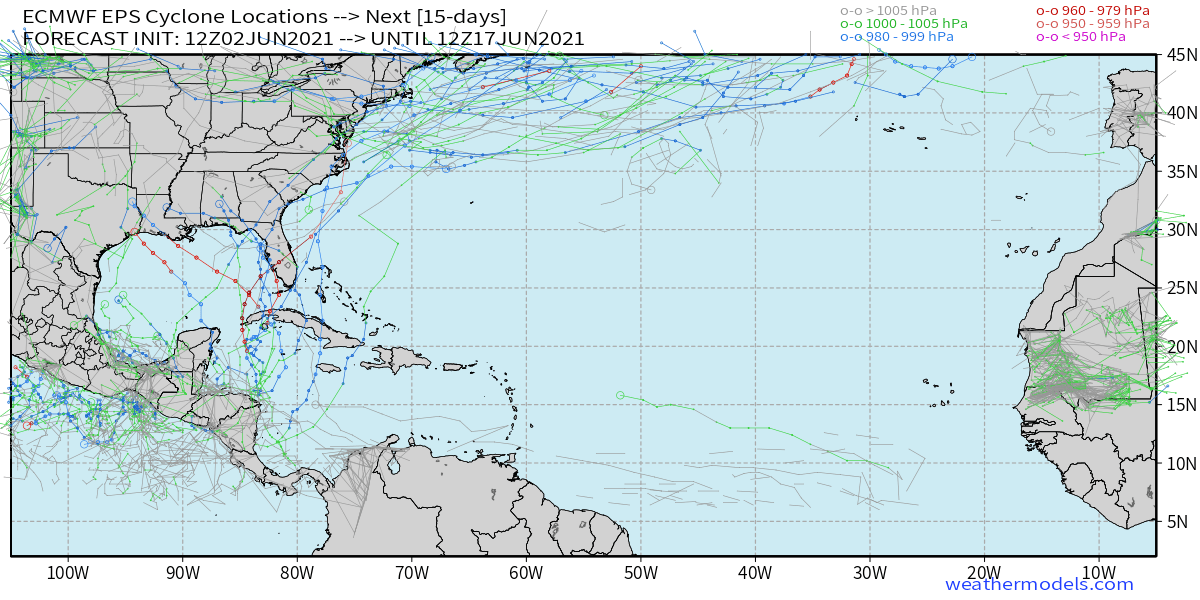
The Gulf of Mexico and Caribbean is the favorable area climatologically in mid-June. And, the ensemble modeling systems (EPS and GEFS) both show a few scenarios with a storm or hurricane. This is in the June 11-15 time frame. From the Weather Models storm tracker, you can eyeball at least 10 distinct tracks — so that’s about a 20% chance of development — without calibration. That’s basically climatology so can’t really say much more than that.
Seasonal Forecast Update:
Colorado State — Phil Klotzbach updates the 2021 Atlantic Seasonal Forecast on Thursday, June 3.