


Fred and Grace struggle while another system brews
Area of low pressure near Bermuda shows high potential
Heading into the second half of August, and we are already through Grace with the potential of Henri at 90%. Yet, even with 7 named storms (1 Hurricane), the storms have been relatively weak, and that is expected in the first 10-weeks of any season. Looking at the last 30-50 years, we only expect to see 10% of seasonal cyclone energy (ACE) activity season-to-date on August 15th. That means 90% or the “meat of the season” lies ahead when major hurricanes are expected. Ocean temperatures are much warmer heading into September in the “Main Development Region” between the Lesser Antilles and coast of Africa. Tropical waves tend to be more vigorous. And, Saharan dust outbreaks are generally much weaker meaning less dry, stable air at low-levels to quash thunderstorms or convective development.

Fred and Grace
GFS vorticity animation (maximum through 5-days) shows Fred making landfall around Destin by Tuesday with winds near hurricane strength — likely over water and in a small area east of the center. The heaviest weather will likely be in Panama City with some storm surge impacting the Big Bend coastline. This map sequence does highlight the tough time Grace will have surviving Hispaniola with a coherent circulation. Whether a weak tropical storm or a powerful hurricane, tropical systems do not do well with very high elevations like Hispaniola, Taiwan or the Philippines. And, for whatever reason, once genesis is interrupted by mountainous land interaction, weak tropical storms do not re-intensify in the short-term even over warm waters.
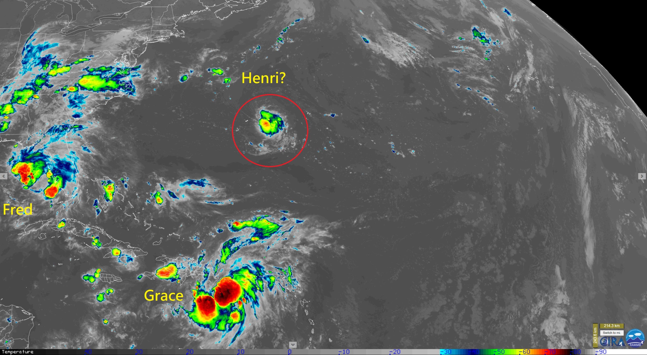
Henri
Next up is Tropical Storm Henri near Bermuda in the subtropics. NHC is giving this Invest 96L a 90% chance of developing into a tropical cyclone. Fitting the trend, the system is small and not vigorous drifting within a marginal thermodynamic environment. Indeed, with the 3 systems on the board, we are rather fortunate to be dealing with weak storms rather than full fledged hurricanes.
Next 2-weeks Tropical Outlook
I am going to be providing a 2-week outlook every day going forward in order to provide as much “heads up” as possible for tropical trouble.
The best tool in my box is the twice-daily 15-day ECMWF EPS ensemble system which I helpfully run a storm-tracker or finder upon all 51-scenarios. And, then we get a bonus on Mondays and Thursday: the same weather model system is extended to 46-days.

51 ensembles or scenarios through 15-days provides many opportunities for new tropical storms and hurricanes to develop and go on their merry way. During the last 2-weeks of August, climatology would dictate a storm or two perhaps becoming a hurricane. That means you would expect something to develop just as part of an average season and looking at history.
The snapshot map is a good summary but is incomplete, so the 15-day animation helps out. No reason to panic about any one of these trajectories hitting land because the probability is still very low, only 2% per ensemble especially more than 7 or 10-days in the future. Nevertheless, we should be cognizant of the fact that such outcomes even low probability can and will happen eventually.
(1) Need to watch Grace for re-development in the Gulf of Mexico
(2) Tropical waves coming off Africa do not look robust but may develop after many days heading west.
(3) The subtropics near Bermuda look to be another “hot spot” this hurricane season continuing a trend.

New forecast maps and products are always available at Weather Models (subscription) with unique and interesting things being added all the time.