


February 9, 2025 Sunday Winter Weather
Arctic cold pool finally dumps out of Canada and Montana

Good Evening!
Hopefully you’re enjoying the Super Bowl, which is indoors in New Orleans. However, if the game were in any city outdoors this evening, while it might be cold, the weather would be tolerable for February 9th. Some scattered showers attached to a front sagging through the Gulf Coast, sadly wiping out my 70s here in Atlanta. Light snow showers into northern New England, but nothing impactful.

Colder air across the Great Lakes will mean Lake Effect snow showers during the next 24-48 hours. HRRR 18z had about 2-feet coming off Superior, and maybe 1-foot off Ontario.

Polar Vortex centroid spinning over Hudson Bay
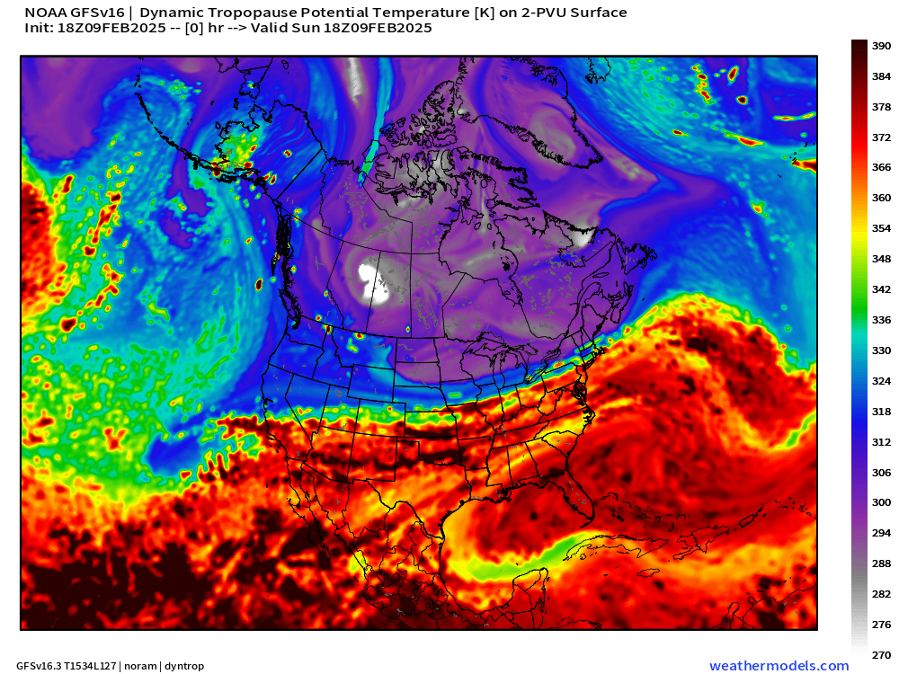
Showing GFS 18z dynamic tropopause potential temperature to show the clashing airmasses: cold Arctic air in the purple with white fuzzball vortices and much warmer subtropical origin air in red.
The excursions are most stunted at the Canadian Border keeping the coldest air bottled up nearby. However, upper-level waves from the Pacific can phase with the polar front and drag colder air much further south during the next 1-2 weeks. There is an enormous cold pool over Montana that’s been locked up for a week.
GFS 18z Snowfall Next 12-days

I circled Eastern Greenland where strong low-pressure systems are inundating the coastal mountains with 30-50 inches of precipitation = 500-800 inches of snowfall. While GFS is probably overdone, this is well within the realm of possibility.
Lower 48 Snowfall Next 10-Days | GFS 18z

Good to see significant Western U.S. snowfall including California.
A storm Wed-Thurs will affect the mid-Atlantic, and then additional winter storm potential on a more northward track through the Great Lakes into the Northeast.
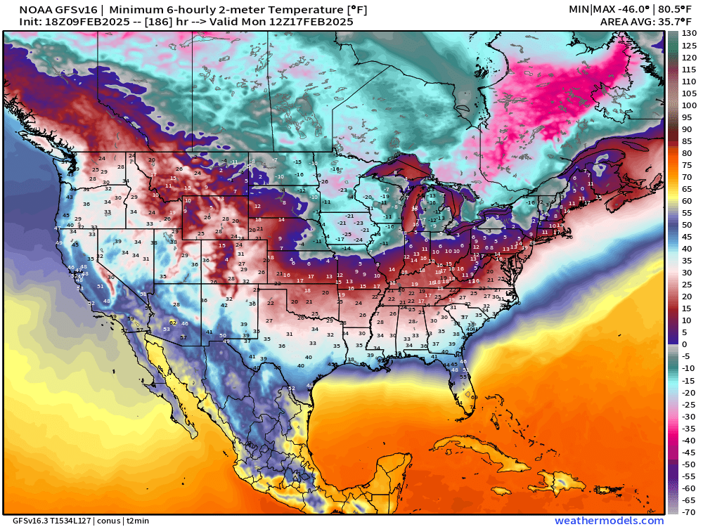
Monday Morning Extremely Cold

I’m watching Monday morning as the coldest for the Midwest and Great Lakes. Temperature anomaly of almost 50°F below normal in Iowa would be brutally cold in the minus 20s.
This Evening Temperature Analysis 6:15 PM ET

Warmth hanging on south of the frontal boundary with 65 million at/above 70°F.
Temperature Anomaly 6:15 AM ET

Lower 48 Temperature anomaly = -1.9°F below normal.
Upper-Level Height Anomaly Next 10-days | AIFS 12z

Anomalous troughing across the West finally moves across the central U.S. but runs up against an eastern ridge into Day 7. However, another strong Polar Vortex trough intrusion wipes that out for much colder air into Days 8-10.
ECMWF EPS 12z | 15 day Temperature Anomaly
Cool to watch the Montana/Canada cold pool flood eastward, get stopped / moderated, and then reload into the third week of February.
That’s major cold for Feb 17-21, as we’ll see in the 5-day Temperature Anomaly Chunks
Keep reading with a 7-day free trial
Subscribe to Weather Trader to keep reading this post and get 7 days of free access to the full post archives.