


February 9, 2024 Nor'easter Update
Bomb cyclone to dump a foot of snow on Northeast
Weather Trader | Friday Morning Update
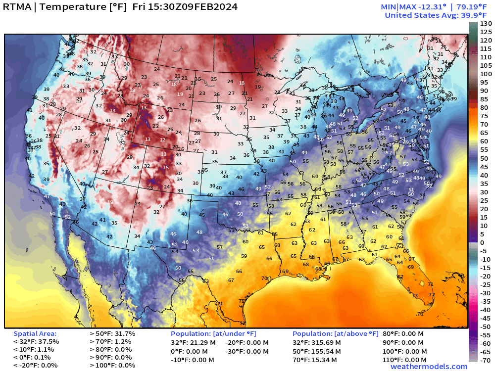
Very mild across the eastern U.S. with temperatures already into the 50s into Detroit, with 60s on the way later this afternoon.
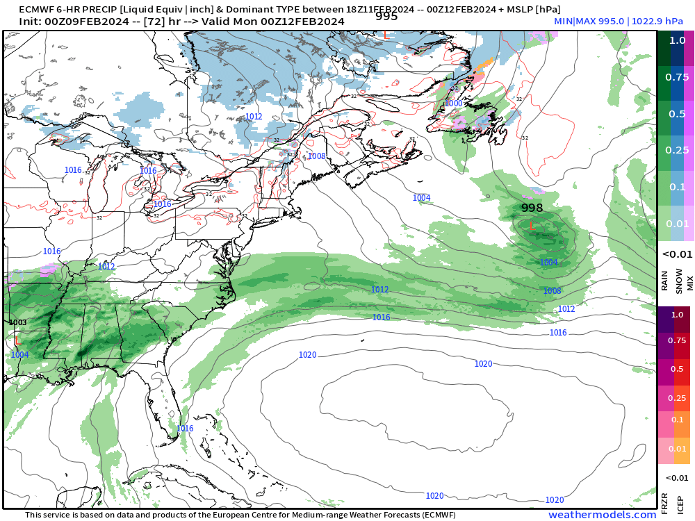
The “bomb cyclone” will originate in the lee of the Rockies broadly in Texas/OK and move ENE into the mid-Atlantic/Northeast before explosively intensifying offshore.
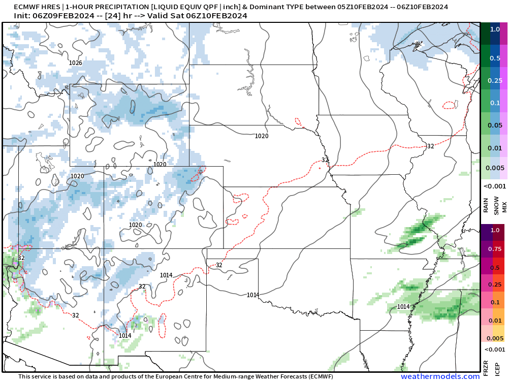
There is just enough cold air across the mountains to drag into the developing storm and drop a stripe of heavy snow accumulations from North Texas into OKC and maybe south of Saint Louis. However, the precipitation will mix or become rain during the warmer daytime, and unlikely any snowfall sticks around long. There is no Arctic blast behind this storm system in the central U.S.
Animation on Sunday and Monday of the forecast precipitation type:
The main event is the “bomb-o-genesis” that sets off the coast with pressure falls into the 940s mb — a fairly intense but not unusual intensity for mid-February. Of course, the most severe blizzards across the Northeast are known to happen around Valentine’s Day.
This 850 hPa (1.5 kilometer above ground level) animation of wind speeds shows a beautiful rapid intensification and lifecycle of a mature monster extratropical cyclone.
The circulation is broad and strong enough to bring cold air into the Northeast in the following several days into next weekend.

The band of heavy snowfall should encompass the coastal cities — at least as it appears right now. That could shift north/south and deliver more/less snowfall, since that backside baroclinic leaf will be moving quickly and is rather narrow in scope.
Tuesday morning (Feb 13th) it should be snowing “to beat the band” from Philly to Boston. SN++
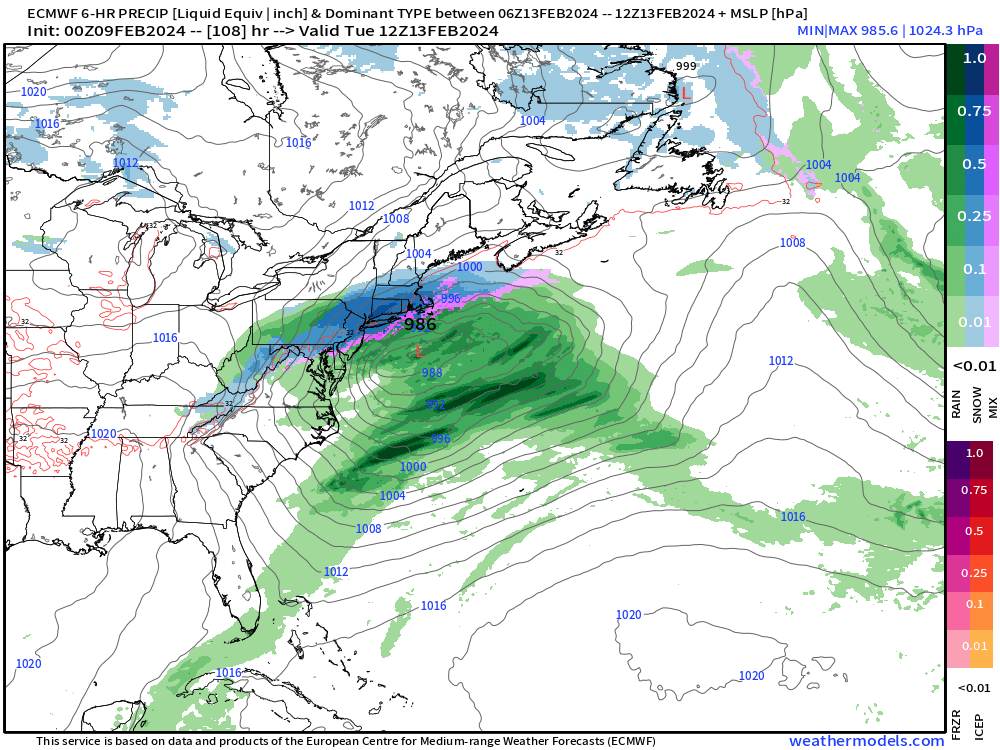
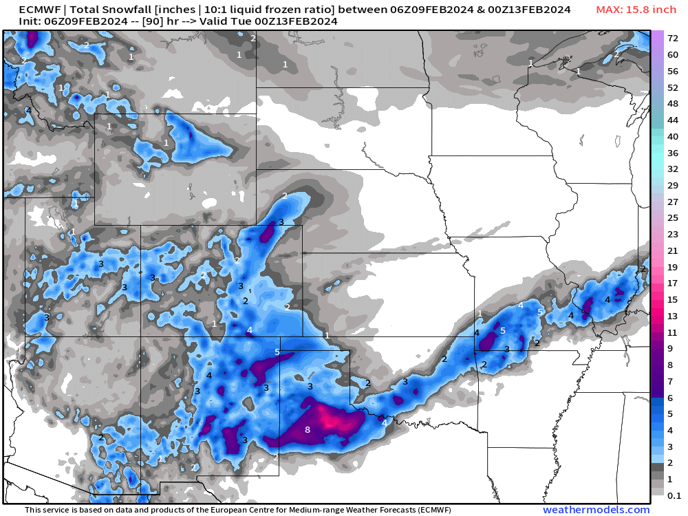
This is the total snowfall from the storm as it was modeled by ECMWF HRES at 00z. Looks like 6”-12” as the average from about 1-inch of QPF.

The ensemble mean is slightly less but not surprising considering the dispersive nature of the solutions:

So we look at the probability of 6-inches+ and it’s now in the 40-50% range from NYC to Boston. This tool loses its applicability as we get closer to the event since we want finer details rather than smoothness. However, the trend in the ensemble mean and probability can assist in adjusting or fine tuning the accumulation forecasts by NWS within the 72-hour window.

Overall, for the next 10-days, the probability of 6-inches+ across the U.S. is mainly confined to the mountains, north Texas, and New England.

GFS 12z arrived just as I was updating this newsletter. It is agreement with other global model guidance.
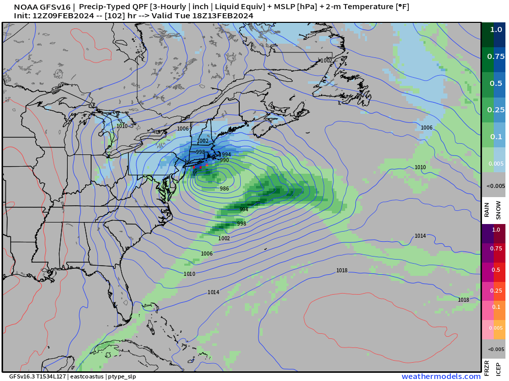
And the snowfall from GFS is actually more than ECMWF, so we could be in the 12”-18” range forecast!

The upper-level pattern for the next 10-days looks familiar with coastal troughs orbiting blocking ridges over Canada and the Arctic. If there was cold air in the Arctic, then it would spill out — but alas, there isn’t much.

NYC ensemble matrix for snowfall. I like these charts b/c it’s quick for the eyeball to see future storm chances as well as the accumulations for upcoming systems. The upcoming Nor’easter is in the bank, and then another chance (albeit small) at this juncture, about a week later.

(Maps from weathermodels.com and weathertrader.com)
Thank you to my paying subscribers! Also, it allows me to provide (usually) interesting and valuable commentary on scientific topics on X. Feel free to say hello and follow on X/Twitter (@RyanMaue)