


February 5, 2025 Wednesday Winter Weather
Montana Cold Pool expands

Good Afternoon!
We have Winter and Spring separated by only a matter of 50-miles across the Plaines and into North Texas this afternoon with near freezing temperatures next to 70s and 80s.
I’m happy to be in the 70s here in Atlanta rather than the 20s up in Michigan.
February looks to be seasonably cold for the northern half of the Lower 48 but very cold for Montana and the northern Rockies where a long-lasting cold pool remains stuck for the next 7-10 days, or longer.
However, this means that moisture from the Pacific will quickly surge eastward into the Great Lakes and Northeast to combine with Gulf of Mexico (America) atmospheric rivers = many winter storm chances!
Temperature Analysis 3:45 PM ET

More people at/above 70°F than below freezing! Even 15 million+ above 80°F
Cold air in the Mid-Atlantic and Northeast will set the stage for mixed precipitation or freezing rain.
Temperature Anomaly 3:45 PM ET

Lower 48 Temperature anomaly = +3.3°F above normal.
Evening Frontal Positions
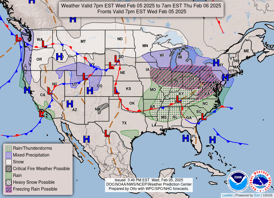
A storm system is pushing a shield of moisture into the Ohio River Valley and Northeast over the next 24-hours. The main threat is freezing rain and icing, and some snowfall in New England.
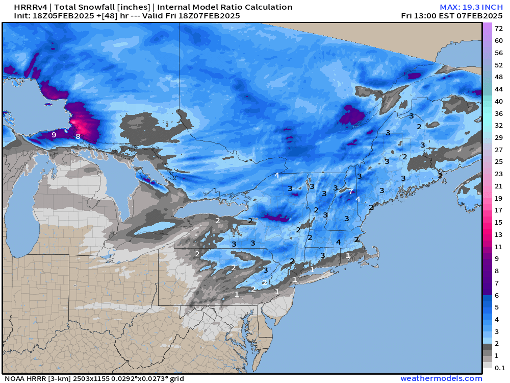
HRRR simulated radar next 48-hours

The atmospheric river continues to plow ashore in California, with moisture and warmth heading into Idaho and Wyoming. On a southerly track, most of it would be drained out by the Sierra.
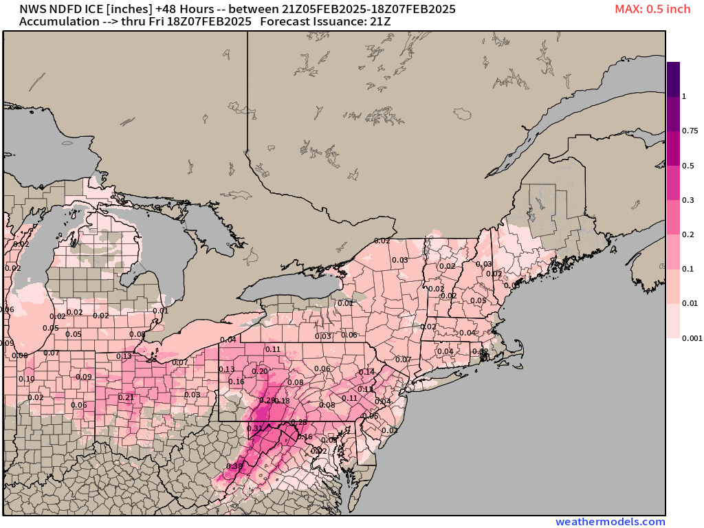
NWS Snowfall and Ice Accumulation Next 48-hours

The amount of accumulated ice is small, but could be impactful for slippery roads and sidewalks around the Great Lakes. Maybe more icing in the mountains of WV and Maryland and Pennsylvania.

3-4” in Boston … maybe an inch in NYC according to NWS.

HRRR 18z is mostly in agreement with a bit more snowfall in PA and NY.
The Next 15-days of Snowfall | ECMWF 12z

So how does this look for the next 2-weeks in terms of snowfall? There’s a 3-foot stripe through Boston, and 12-inches+ stretching from St. Louis through Ohio, including NYC.
Where does all of this moisture come from in mid-February when the Lower 48 is usually bone dry and under the effects of Northwesterly Flow out of Canada?
The Pacific moisture stream + subtropical (Gulf of Mexico) are all southerly component and warm/moist, so the Arctic or polar vortex related air mass is locked up in Canada and Montana at the margins.
Precipitation Anomaly Next 15-days
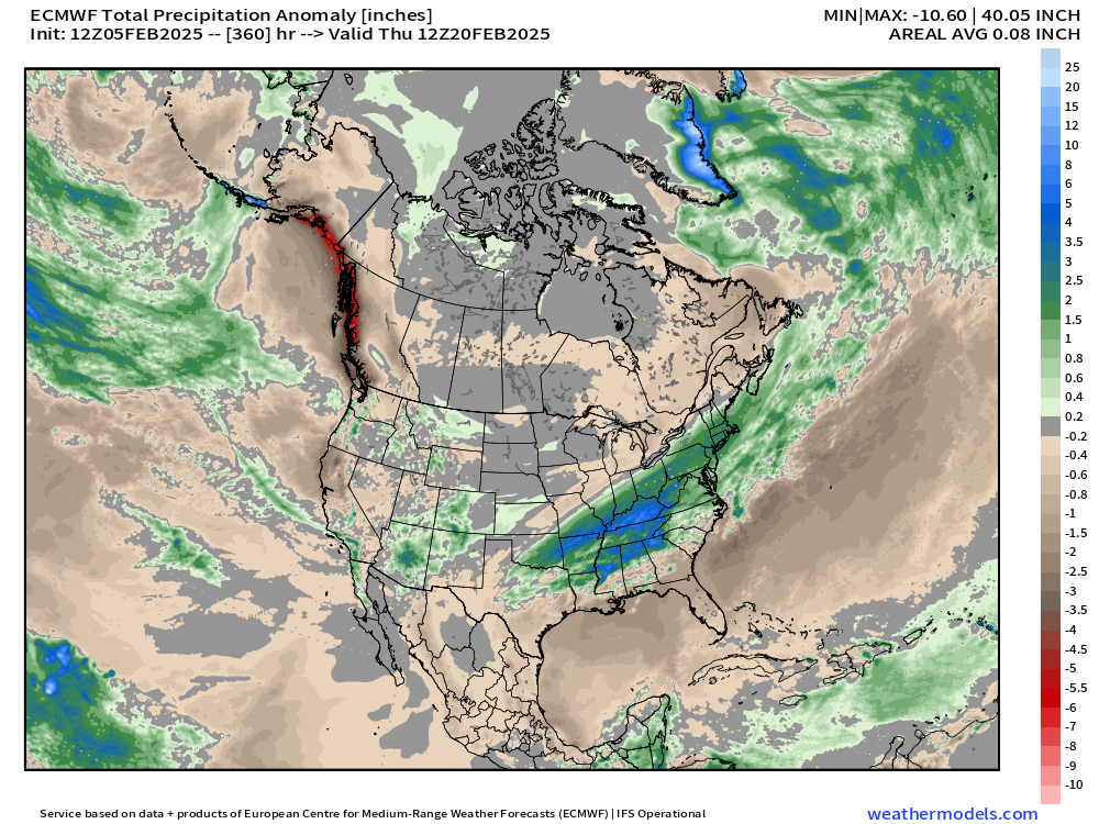
Take the precipitation away from Alaska and British Columbia and give it to the Ohio River Valley and Northeast!
Precipitation Type and MSLP Next 10-days | Storms!
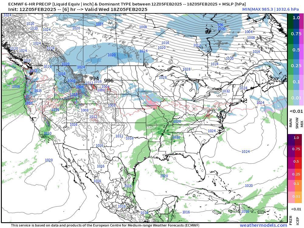
A sequence of storms are on the way mainly on a SW to NE track. We can see from the Integrated Vapor Transport (IVT) my 2nd favorite variable the weather systems over the next 2-weeks and the boatloads of moisture available to them.

Keep reading with a 7-day free trial
Subscribe to Weather Trader to keep reading this post and get 7 days of free access to the full post archives.