


February 5, 2024 Monday Update
California flooding continues. Chance of Plains Winter Storm this weekend.
Weather Trader | Monday Evening Update
The flooding firehose remains aimed at Southern California right over Los Angeles — continuing to exacerbate an ongoing emergency situation for several more hours.
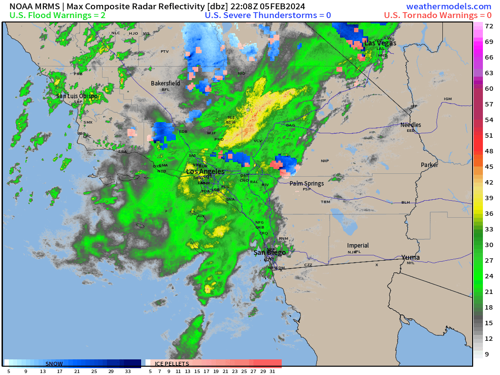
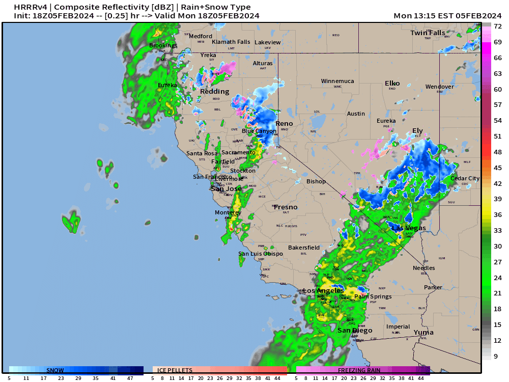
HRRR model shows a let up in rainfall later Tuesday morning. Until then another 2-3 inches of rainfall is likely. Then another batch of rain arrives from the Pacific but this time from the north continuing this unsettled pattern across California.
NWS forecast precipitation for the next 48-hours.

Overall this extreme rainfall event from the “bomb cyclone” and atmospheric river was well forecast more than 1-week in advance.
I’d like to know if the average person in Southern California had any idea more than a few days in advance that this situation would unfold. Did their phone apps alert them of exceptional rainfall amounts or flooding? I doubt it.
While I enjoy medium range forecasting, I do not like short-term or nowcasting. I do not like to see the disasters unfold — I usually check out and try to focus on the next weather system. Also, I find it necessary to step back and let more experienced emergency communicators to take over the warning process. And, I almost always defer to the NWS maps/grids + warnings to avoid mixed messages. More on that soon …
A winter storm chance?
This has been popping and poofing in the ECMWF HRES for the past couple days: a storm system in the Plains to Great Lakes with a stripe of heavy snow on the backside extending from Denver to KC and Chicago into Ontario. However, this isn’t a sure thing, yet. Need another 2 model cycles, so by tomorrow evening, we’ll know much better. I’ll show the probabilities + median snowfall through 7-8 days at the end — evidence of a 15-30% shot of this happening.


Kansas City ensembles do have a bunch of decent accumulation solutions. So, we do have something to watch!

ECMWF Seasonal Day
Today, the ECMWF seasonal forecast came out for the next 7-months showing a developing La Nina by mid-summer. The Atlantic looks warmer than normal so I’d expect a busy hurricane season just based upon that configuration. However, much too soon to put numbers or landfalls for 2024 out. However, I will put out a forecast for the hurricane season on April 5 after the ECMWF seasonal grids arrive, and we get a good indication of the SST across the Pacific. In grad school, I actually devised a decent seasonal forecast system that depends upon NPAC SST, and it still (sort of) works.

Temperatures
Tuesday Highs | February 6, 2024

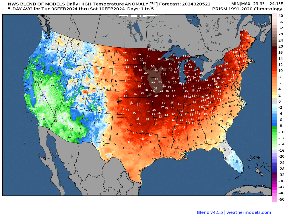
Beautiful weather across the Southeast now that the cut-off low exited the stage. 60s widespread from Texas to Florida — only 2M or so at/above 70°F. Warmth continues for the rest of the week across the Lower 48 east of the Rockies.
5-Day Average High Temperature Anomaly | Feb 6-10, 2024
Next 15-days Daily Temperature Anomaly
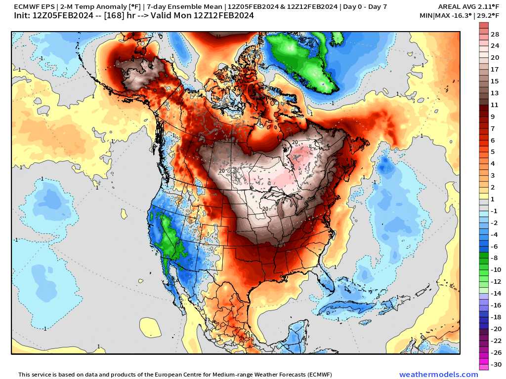
The block breaks down and Alaska finally warms up. Somewhat cooler air across the Lower 48 into the middle of February, but as of yet, no coastal winter storm signals, only the Plains —> Great Lakes storm shown above for this weekend.

7-day Total Precipitation from WPC

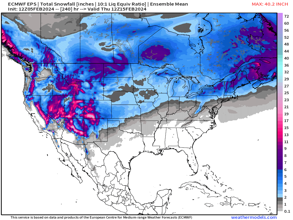
15-day Snowfall ECMWF EPS Mean Accumulation

The perils of using ensemble means, medians, and probabilities!
If you scroll back to the Kansas City map, then you could count up the number of 3-inch+ members through 8-days, or consult the map above with about 30% chance.
In the 7-8 day range, that’s a decent signal for a winter storm, but we have plenty of time to watch it trend/evolve.
The Western U.S. continues to be buried in snowfall because of the combination of boatloads of Pacific moisture and plenty of cold air from Alaska.
(Maps from weathermodels.com and weathertrader.com)
Thank you to my paying subscribers! Consider upgrading to a Yearly Plan if you find these updates valuable and wish to support my development at Weather Trader. Here is a little discount valid until February 9th:
In addition, the products that you would typically see at AG2 (old WSI-trader) or other commodity weather services will be available for access. The goal is not to make another weather models site w/a catalogue of millions of updating images, rather provide value-added serves curated to specific verticals e.g. gardening, farming, energy, transportation, tourism.
Also, it allows me to provide (usually) interesting and valuable commentary on scientific topics on X. Feel free to say hello and follow on X/Twitter (@RyanMaue)
Always appreciate your work, Ryan
Great, informative update.