Good morning!
Quick update on 2 tropical cyclones in the Southern Hemisphere:
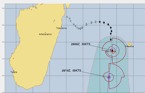
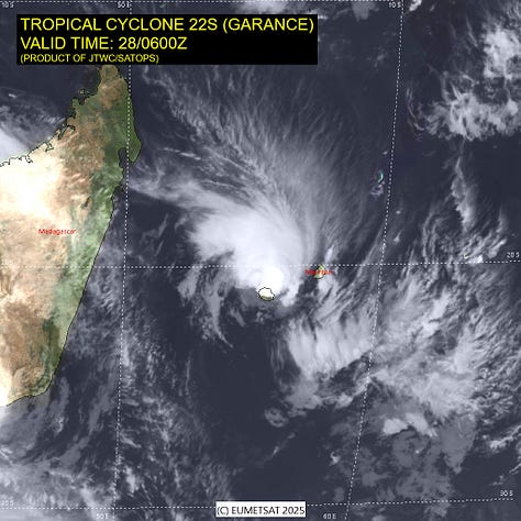
Garance (22S) has moved over La Reunion at 90-knots intensity after encountering strong southerly shear. Fortunately, the wind shear disrupted the inner-core somewhat, so hopefully news out of the island will be less catastrophic.
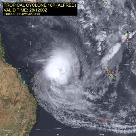
Alfred (18P) continues onward to the south east of the coast of Australia, and won’t affect land. The intensity remains Category 3 (105-knots)
Hurricane season in the Atlantic is 3-months away! (June 1st)
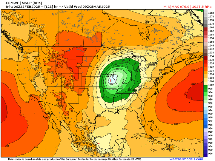
Very Strong Cyclone | Severe Weather next week
Remarkable over-land extratropical storm system early next week dropping into the lower-970s mb central pressure over Missouri. While ECMWF does overdo the intensity of these storms, this one is a doozy.
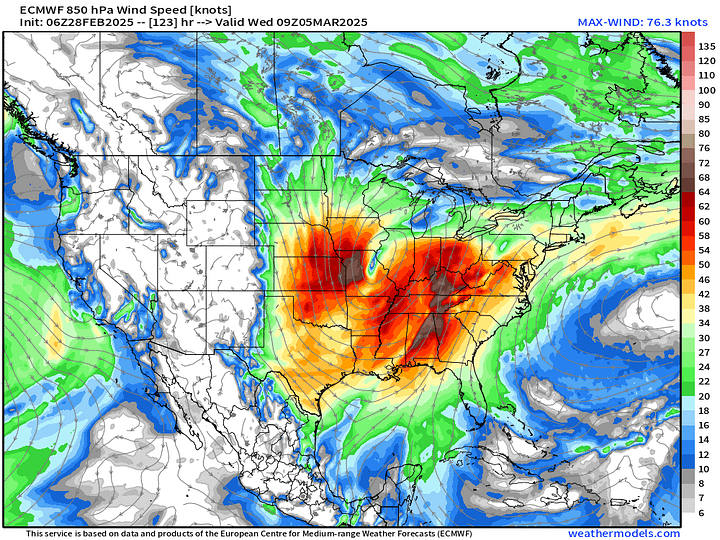
Gulf of Mexico moisture, strong surface cyclone, and mid-level wind shear will all combine for potential for severe weather along a squall line late Tuesday into Wednesday from Texas to Louisiana and along the Mississippi.
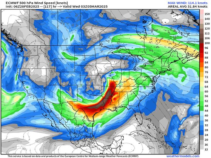
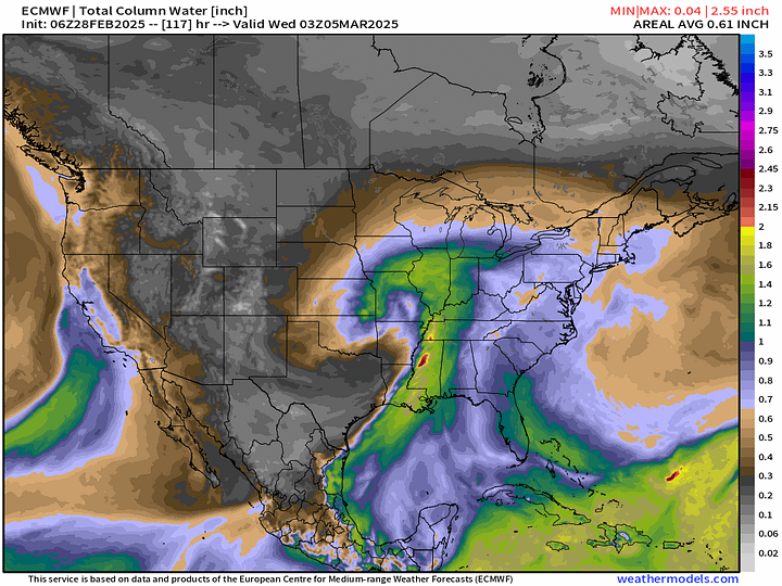
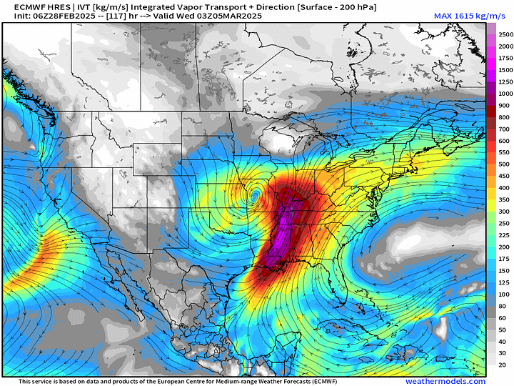
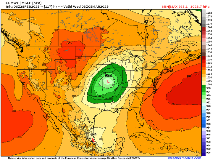
Strong mid-level and upper-level winds spread out over a large distance will mean gusty winds even outside of thunderstorms.
Precipitation Type Next 6-days | ECMWF 06z
An Alberta Clipper is sailing through the Great Lakes and into New England over the next 1-2 days dropping decent snowfall.
A week system impacts California over the weekend.
The major storm system is in the central U.S. into Tues-Wed tracking to the Great Lakes.
Precipitable Water Next 6-days
Temperature Analysis 10:30 AM EST
Very cold air loitering over Ontario and Quebec still in the minus 20s!
Temperature Anomaly 10:30 AM ET
Lower 48 Temperature anomaly = +7.2°F above normal.
HRRR Next 48-hours
The Clipper System will have just enough cold air behind it with Northwest winds to kick off some Lake Effect snow showers.
Snowfall from HRRR Next 48-hours — in order to show Canada
Heaviest snowfall over Canada — which continues to add up into very tall piles.
HRRR Precipitation Next 48-hours
Otherwise, rather quiet across the Lower 48.
High Temperatures on Friday
Widespread 70s for 25% of the Lower 48 and 114 million population.
Low Temperatures on Saturday
High Temperatures on Saturday
55.0°F average Lower 48 High Temperature. 90 million at/above 70°F
High Temperatures on Sunday
58.5°F average Lower 48 High Temperature! 100 million at/above 70°F
NWS WPC Precipitation | Next 7-days
Next week’s strong storm should dump 1-2” of precipitation over a large portion of the country east of the Mississippi.
Blend of Models 10-day Precipitation | Snowfall
Polar Vortex Watch AIFS 06Z Next 10-days
Keep reading with a 7-day free trial
Subscribe to Weather Trader to keep reading this post and get 7 days of free access to the full post archives.


