


February 27, 2025 Thursday Weather
Severe weather potential next week

Good morning!
Cyclone Garance (22S) has developed a ragged eye — analyzed at 105-knots (Category 3). Oddly enough, the storm formed just off the coast of Madagascar and drifted east for several days. Now, it turn to the south and cross over France’s La Reunion island with potential for significant damage. The landfall (island-fall) intensity is forecast by JTWC to be around 95-knots, just on the edge of Major Hurricane equivalent.
Cyclone Garance (22S)


Cylone Alfred (18P)


Cyclone Alfred is even stronger at 115-knots (Category 4) east of Australia in the SW Pacific. Alfred will track south and avoid land.
Over the past week, the Southern Hemisphere blew through 6 named storms.
Temperature Anomaly Next 6-days
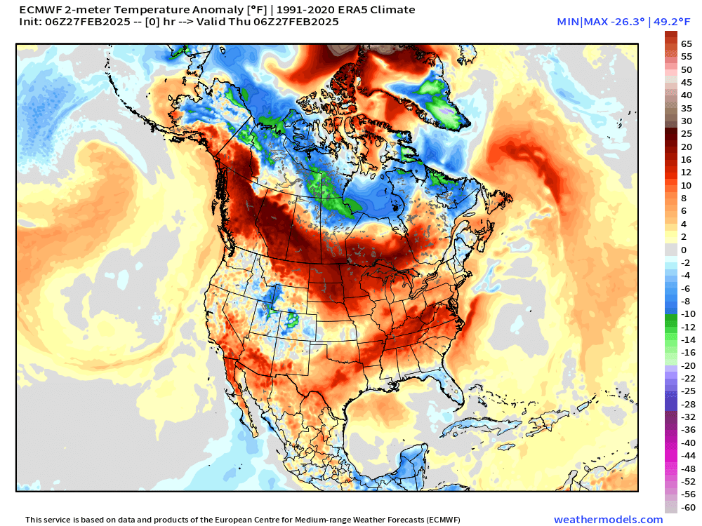
The long advertised extreme cold with the remaining polar vortex over Quebec will rotate through the Great Lakes and Northeast over the next few days. Then, warmth returns to the central and eastern U.S. while the west cools down with a LOT more mountain snowfall into early March.
Temperature Analysis 9:30 AM EST

Temperature Anomaly 9:30 AM ET

Lower 48 Temperature anomaly = +6.8°F above normal.
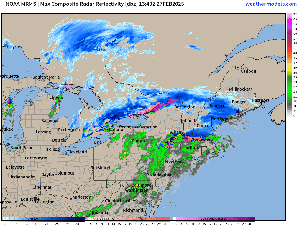
Recent Radar Composite
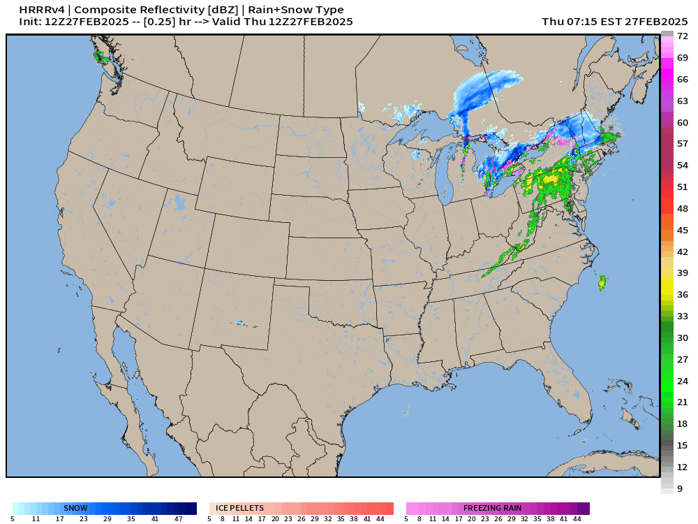
HRRR Next 48-hours
Clipper system follows behind weak storm leaving New England later Thursday.
Snowfall from HRRR Next 48-hours — in order to show Canada


Total Precipitation Next 72-hours from NWS

Total Snowfall Next 72-hours from NWS


High Temperatures on Thursday

Low Temperatures on Friday
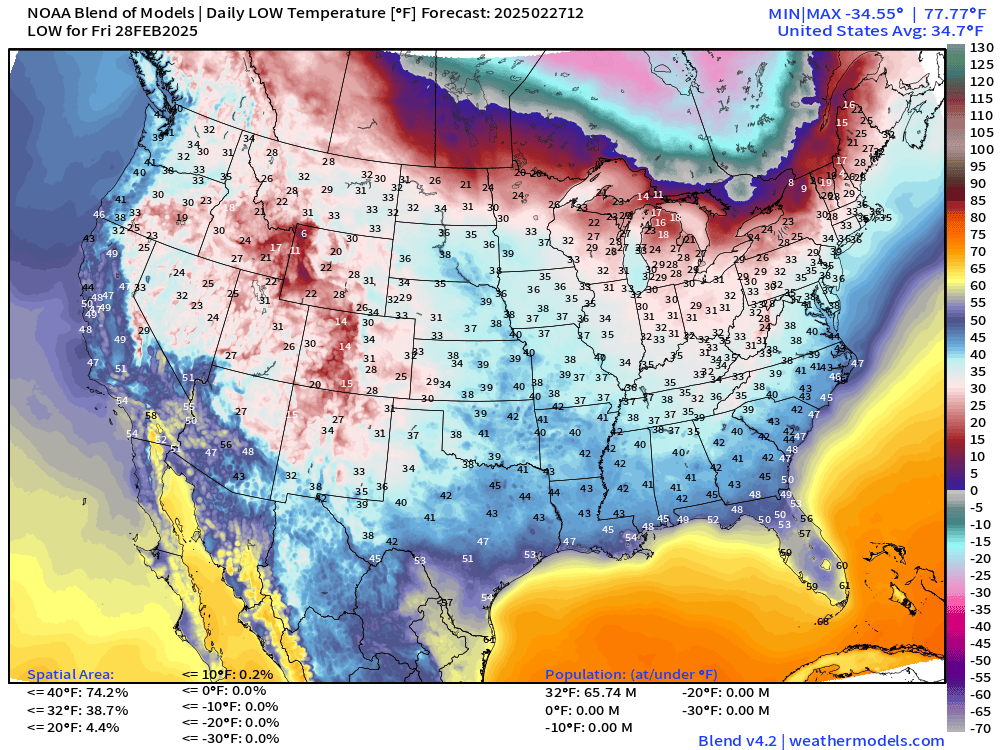
Check out the large area of -30s lurking in Ontario and Quebec!

High Temperatures on Friday

58.5°F average Lower 48 High Temperature! 100 million at/above 70°F
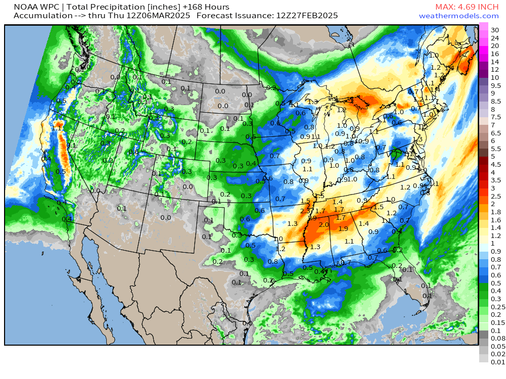
NWS WPC Precipitation | Next 7-days
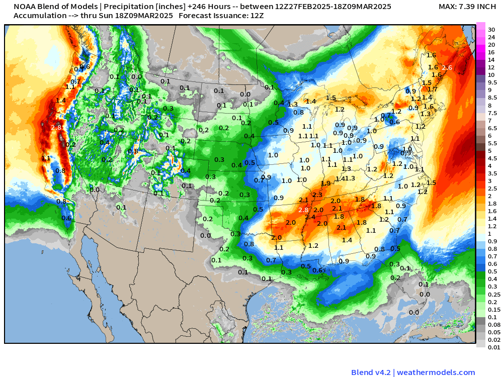
Blend of Models 10-day Snowfall and Precipitation

Polar Vortex Watch AIFS 06Z Next 10-days
Keep reading with a 7-day free trial
Subscribe to Weather Trader to keep reading this post and get 7 days of free access to the full post archives.