


February 21, 2025 Friday Weather Update
Watching the polar vortex spin in Canada for the next 2-weeks

Good Evening!
Best place to start is to show the upper-levels from the dynamic tropopause map for the next 12-days.
The coldest colors are mainly polar air with anomalies on the tropopause showing up as “white fuzzballs” that continue to rotate around cyclonically over the Arctic and dip into Canada. As Pacific short-wave disturbances race eastward with the jet stream, sometimes they can capture some of the “white fuzzball” and create a tail into the Lower 48 that serves as a pathway for extreme cold. Add in the formation of a long-lasting cold pool with high pressure at the surface, and you get what we just experienced as some of the coldest/latest winter air on record.
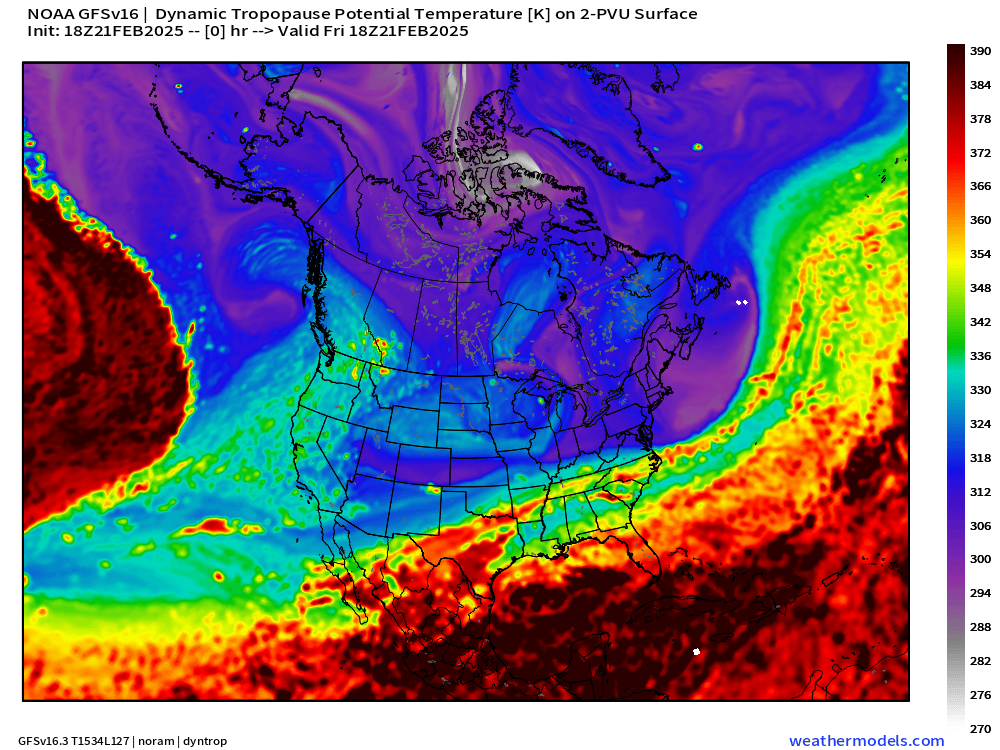
The tropospheric (not stratospheric) polar vortex is shown in this map sequence and you can see how perilously close the most intense circulation is to the Great Lakes and Northeast. Many tails emanate from it into the Lower 48 and we will see brief but perhaps intense shots of cold air by next weekend.
ECMWF EPS 15-day Ensemble Mean Temperature Anomaly
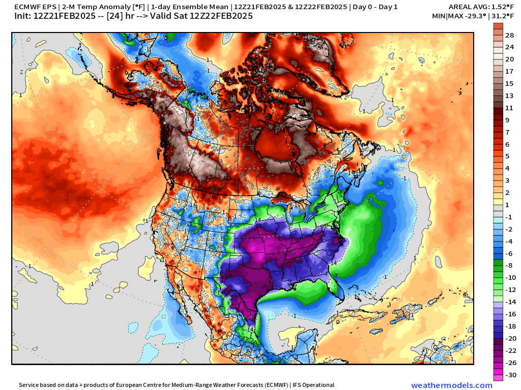
While a different modeling system, we can see from ECMWF EPS mean temperature anomaly that warmth across the country next week will eventually give way to below average temperatures across the Lower 48 — again into the following weekend and the first week of March.
Looks like winter will continue for the northern states again in early March.
Short-term weather … HRRR Next 48-Hours Radar and Snowfall
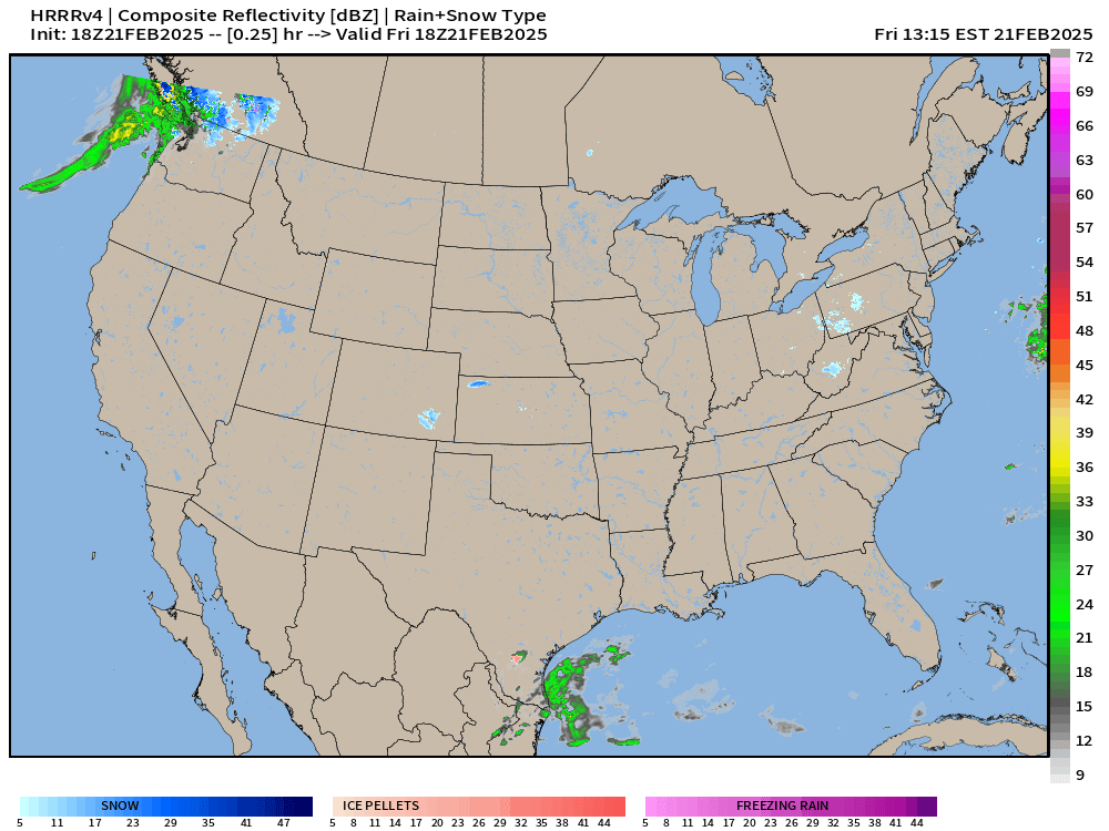
Heavy rain from an atmospheric river this weekend across Oregon and Washington.
Also, some rainfall along the Texas and Louisiana Gulf coastline — to finally replace the polar air mass that’s been stuck over the Lone Stone start for several days.
However, the cloud cover from the Gulf rainfall will keep temperatures down even into Sunday with a “wedge like” flow pattern.
Keep reading with a 7-day free trial
Subscribe to Weather Trader to keep reading this post and get 7 days of free access to the full post archives.