Good Evening!
Well deserved period of quiet weather across most of the Lower 48 with warming temperatures — slowly but surely into this weekend, and next week.
Still watching the “polar vortex” anchored over far NE Canada with a couple opportunities for Pacific short-waves to pull on the Arctic PV, form a trough or tail, and whip a brief cool shot through the eastern U.S. later next week.
Snowfall From Recent Winter Storm
The big winners for the recent snow storm were along the Atlantic coasts of Virginia and North Carolina. Weird — but that was a “snow hole” that needed to be filled in on our seasonal maps.
2024-25 Winter Season Snowfall
Quite amazing to see the coverage across the Southeast USA even though some folks in central Mississippi and northern Louisiana were left out from this winter’s fun.
All Lower 48 states saw snowfall of many inches, and it continues unabated across the Rocky Mountains and Lake Effect snow machine in the Great Lakes — although the lakes are freezing over > 50% combined by Friday. Michigan and Superior are mostly wide open because of their depth.
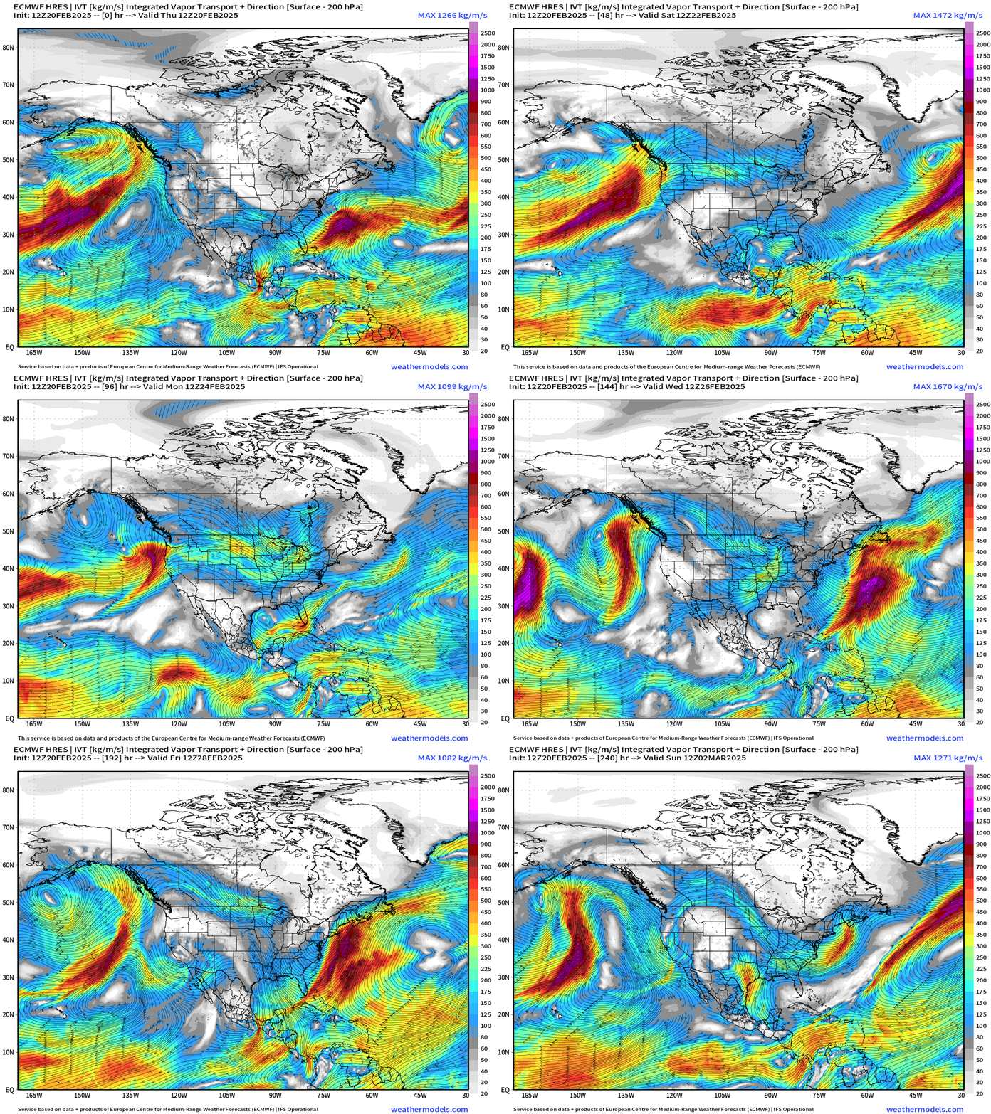
Water Vapor Transport Next 10-days
A sequence of atmospheric rivers will crash into the Pacific Northwest but mainly miss California. The moisture goes up and over the Western U.S. ridge, and what’s left heads into the Great Lakes and Northeast with Clipper Systems.
Can’t foreclose the possibility of a Nor’easter next Thursday-Saturday.
Keep reading with a 7-day free trial
Subscribe to Weather Trader to keep reading this post and get 7 days of free access to the full post archives.


