


February 2, 2024 Major California Storm
Atmospheric River may deliver over foot of rain to Southern California
Weather Trader | Friday Update
The groundhog did not see his shadow so that means an early spring. Hard to doubt this critter after looking at the upper-level weather pattern and medium-range weather models. Of course, Phil knows all of that already based upon his keen awareness of the weather. The problem with an “early spring” in the Southeast is that a cold snap could still happen in late March and harm plants that were tricked into budding or leafing earlier than normal especially with citrus.
Severe weather risk for the Southeast Sunday —> Monday in the warm sector of a low-pressure system developing ahead of a dynamic upper-level trough. This is an unusual pattern for sure with the subtropical jet zipping along the Gulf coast.
The major California storm is now only 48-60 hours away from “landfall” north of the Bay Area but potentially catastrophic impacts including flooding and landslides from upwards of a foot of rainfall are forecast in Southern California. We’ll see from the precipitation maps where the most rain will fall.
Heavy snowfall in the Sierra will be helped by cooler air at upper-levels that arrived from Alaska over the past 2-days otherwise this would be a wipeout rain event for the mountains.
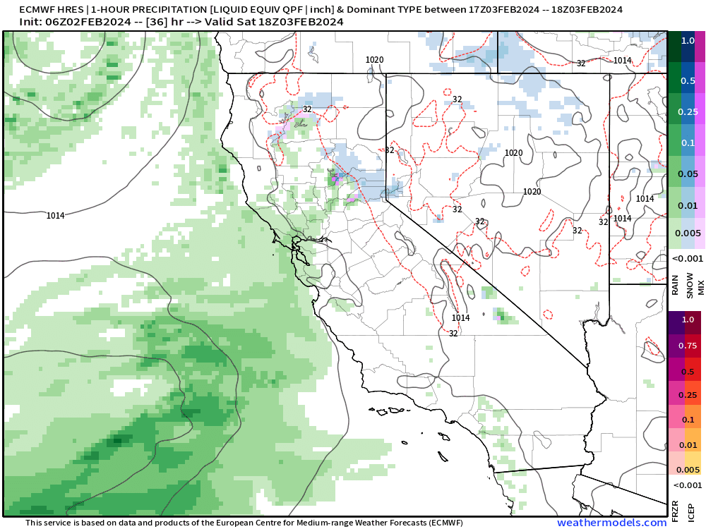
Animation of precipitation from ECMWF HRES 06z using a pixelated QPF (quantitative precipitation forecast) design — which I really like — to show the hourly intensity of rain/snow/sleet across California. This is a long duration event with the “atmospheric river” component in the warm sector south of the Low Pressure center. The AR collides (or landfalls) perpendicular to the SoCal coast so higher elevations will really wring out the moisture.
NOAA WPC rainfall amounts remain enormous, but have perhaps scaled back after the recent GFS model suite showed a significant decrease in precipitation amounts.
We are relying upon global models for the guidance at this time, but later this evening into tomorrow, the mesoscale suite [RRFS, HRRR, FV3] will zero in on the finer details of the onset, intensity, and amount of precipitation.
California + Southern California Zoom
Total precipitation (including snow as liquid) for the next 5-days from NOAA WPC:

Weather Trader is a +daily — reader-supported newsletter service. To receive new posts and support my work on WeatherTrader.com, consider becoming a free or paid subscriber [20% until February 9]
Your support pays for my Linux servers and product development. So far, I have been able to build RRFS, downscale WRF, and other “Forecast Point” products that I am rolling out as soon as today and this weekend on https://weathertrader.com. The idea is that Substack subscribers will get forecast(s) at a location(s) with considerable value-added information. I will create an example page for LAX and you’ll see.
Keep reading with a 7-day free trial
Subscribe to Weather Trader to keep reading this post and get 7 days of free access to the full post archives.