


February 18, 2024 Week Ahead
Warming trend accelerates into March

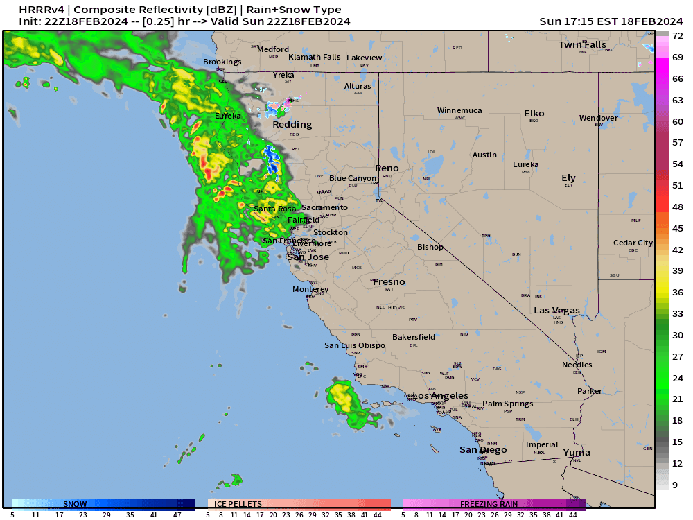
Sunday evening update
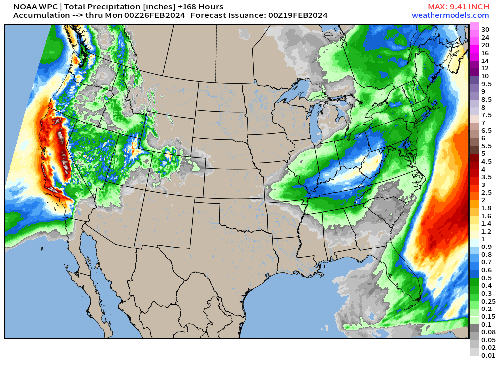
Heavy rain and mountain snow underway across California which could evolve into severe weather on Monday as warmer air from the south cuts under cooler air aloft. The atmospheric river will dump trillions of gallons of precipitation including 6 to 10-feet of snow in the Sierra.
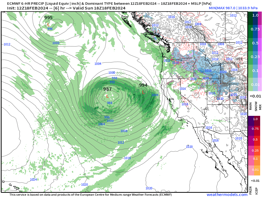
This storm is not a bomb cyclone or particularly intense but it is located optimally for huge surge of onshore moisture. After Wednesday, the West Coast may get a little break from the action.
SPC Day 2 Categorical Outlook (slight) with 5% Tornado
Rare to see California as the focal point for Lower 48 severe weather, but the rest of the nation is relatively quiet. Storm chasers are heading to the Sacramento Valley — not kidding.
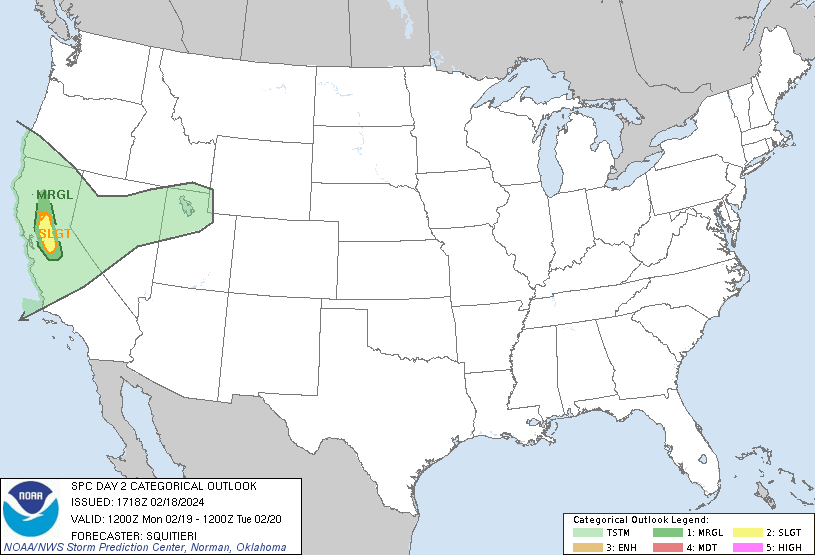
Severe weather chances are slight, but could be a tornado in the Sacramento Valley.
From SPC:
   Over portions of the Sacramento
   Valley in CA, the low-level moisture return beneath cold
   temperatures aloft, will foster enough buoyancy to support organized
   thunderstorms with some severe potential given the presence of
   vertical wind shear.
Total rainfall over the next 3-days will top 2-inches in LA and 1.5” in San Francisco. Could be up to 4-6” along the coastal higher elevations. The snowfall in the Sierra will be the conversion from 7-9” of QPF to snow, so 7-10 feet, or more.
Daytona 500 Monday 4 PM ET
We’ll see if the rain/sprinkles finish up by early afternoon. May still be dealing with light rain until 2 PM ET, at least according to this model output (HRRR 18z).

Very Warm Pattern into March across Lower 48
Week 1 | February 18-25, 2024

Week 2 | February 25 - March 3, 2024

A bullseye of 10-18°F above normal centered upon Iowa including the Midwest and Great Lakes heading into the first week of March. Whoa!
More Ensemble Clustering Tools at Weather Trader

I’ve updated the Clustering Tools — here is the 4-panel panel of the ensembles from ECMWF EPS, NOAA GEFS, and Canada GEPS + the 103 member mean in the animation above.
Rather than posting too many maps and filling your email inbox, you can see these Clustering Tools freely at WeatherTrader.com: and continue to support these products (which will earn any subscriber to this Substack a golden ticket into the Weather Trader interface as founder/supporter, and friend of Ryan)
Lower 48 Temperatures
Monday Highs | February 19, 2024
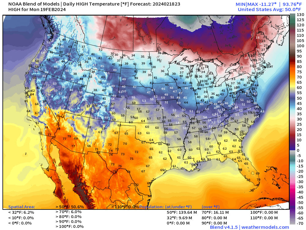
Temperatures continue to warm up — and will be Spring Fever by later in the week. Enjoy the sunshine and beautiful weather east of the Rockies.
WPC 7-Day Precipitation Totals
Next 10-days precipitation type + MSLP:

We lost the Nor’easter. Instead, looking at the 8-10 day range for a weather system that looks mostly wet heading into Leap Day.
15-Day ECMWF EPS Median Snowfall

And, the 15-day ECMWF median does not show any major snow storms on the map east of the Rockies.
Stick a cork in Winter in the East?
(Maps from weathermodels.com and weathertrader.com)
Thank you to my paying subscribers! Consider upgrading to a Yearly Plan if you find these updates valuable and wish to support my development at Weather Trader. Here is a little discount valid until February 20th:
Also, it allows me to provide (usually) interesting and valuable commentary on scientific topics on X. Feel free to say hello and follow on X/Twitter (@RyanMaue)