


February 15, 2025 Blockbuster Blizzard
Model disagreement remains on track of storm system

Good Morning!
No doubt about the intensity and longevity of the “Polar Vortex” fueled Arctic blast to bury the Lower 48 next week. However, still some remaining uncertainty about the development and track of a “blockbuster” blizzard for the Mid-Atlantic and Northeast.
ECMWF + ensembles, Canadian GEM, and MetOffice Unified Model are crush the coast with 1-2 feet of snowfall. However, the GFS 06z and Germany ICON have a flatter track solution, less phasing with upper-levels, and mostly a miss out-to-sea. Which model should we believe? When you have an outlier, all you can do is wait for the next model update to gauge trends in the position of the 500 mb trough and the low pressure center (vorticity maximum) on track out of the Southeast. But at this juncture, it would be difficult to bet against the ECMWF, GEM, and UM.
ICON Model Depiction of Extreme Cold Next 5-days

Over the next 5-days, the purple (colder than 30°F below normal plunges into Central Texas. The general motion of the continental polar air is southward with some eastward progress, but not much beyond the Mississippi River through Wednesday.
The still rather warm late-February sun angle will help modify the Arctic air prior to its major progress into the Eastern U.S. — thankfully, preventing an 1899 Great Arctic Blast redux.
Temperature Analysis 8:00 AM ET

Warm sector of storm system has temperatures in the 60s and 70s across the Deep South. Atlanta remains stuck in the wedge, of course.
Temperature Anomaly 8:00 AM ET
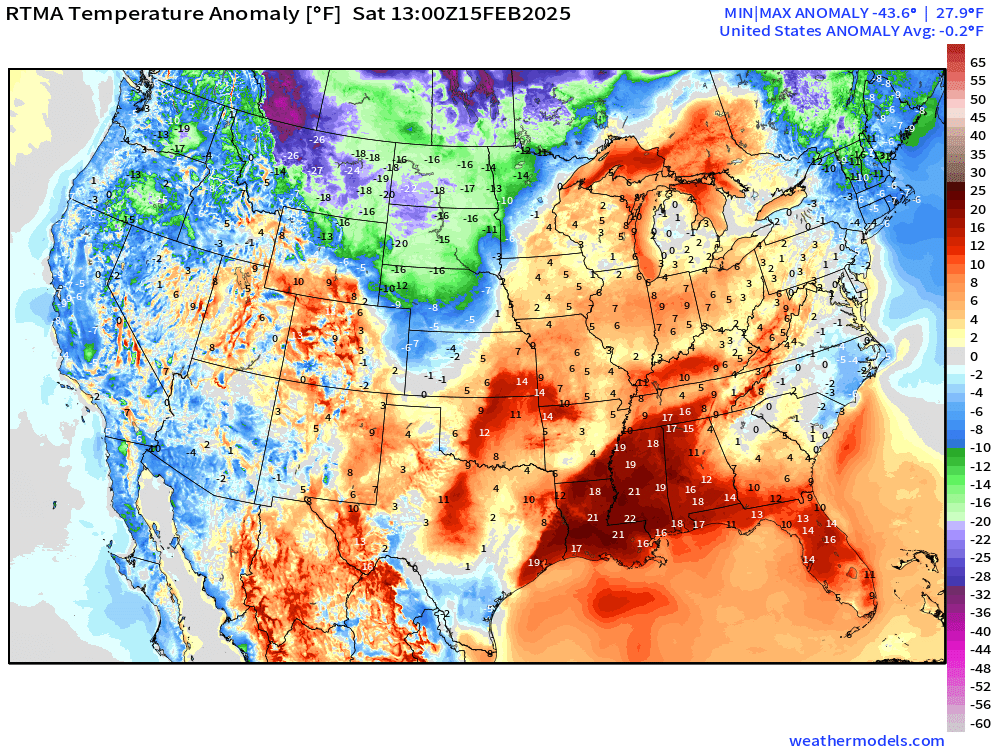
Lower 48 Temperature anomaly = -0.2°F below normal
High Temperatures on Saturday

Rather warm day across the South with 70s in Texas and maybe 80°F around New Orleans. Solidly 80s in Florida — total of 20 million Americans. However, severe weather will complicate your outdoor plans.
Low Temperatures on Sunday
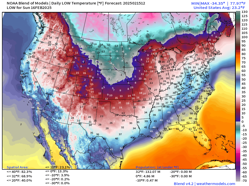
Subzero air invades the Plains into Nebraska. 13% of the Lower 48 is < 0°F while 69% is below freezing. But only 132 million population.
Thank you to my community of subscribers and supporters. If you’ve enjoyed the Winter 2024-25 so far, and want to see more weather maps and analysis for the coming Spring and Summer, then please consider upgrading to a paid / annual plan. That helps me secure additional computing resources and dedicate more time and effort to this growing enterprise. 20% off coupon through February 19.
Keep reading with a 7-day free trial
Subscribe to Weather Trader to keep reading this post and get 7 days of free access to the full post archives.