


February 13, 2024 Tuesday Update
Seasonable temperatures giving way to warming trend to end February
Weather Trader | Tuesday Afternoon Update
The winter storm has exited the Northeast U.S. and will continue to intensify to about 953 mb central pressure more than qualifying as a bomb cyclone. Heavy snow will continue over Nova Scotia and into Newfoundland with 2-feet likely.
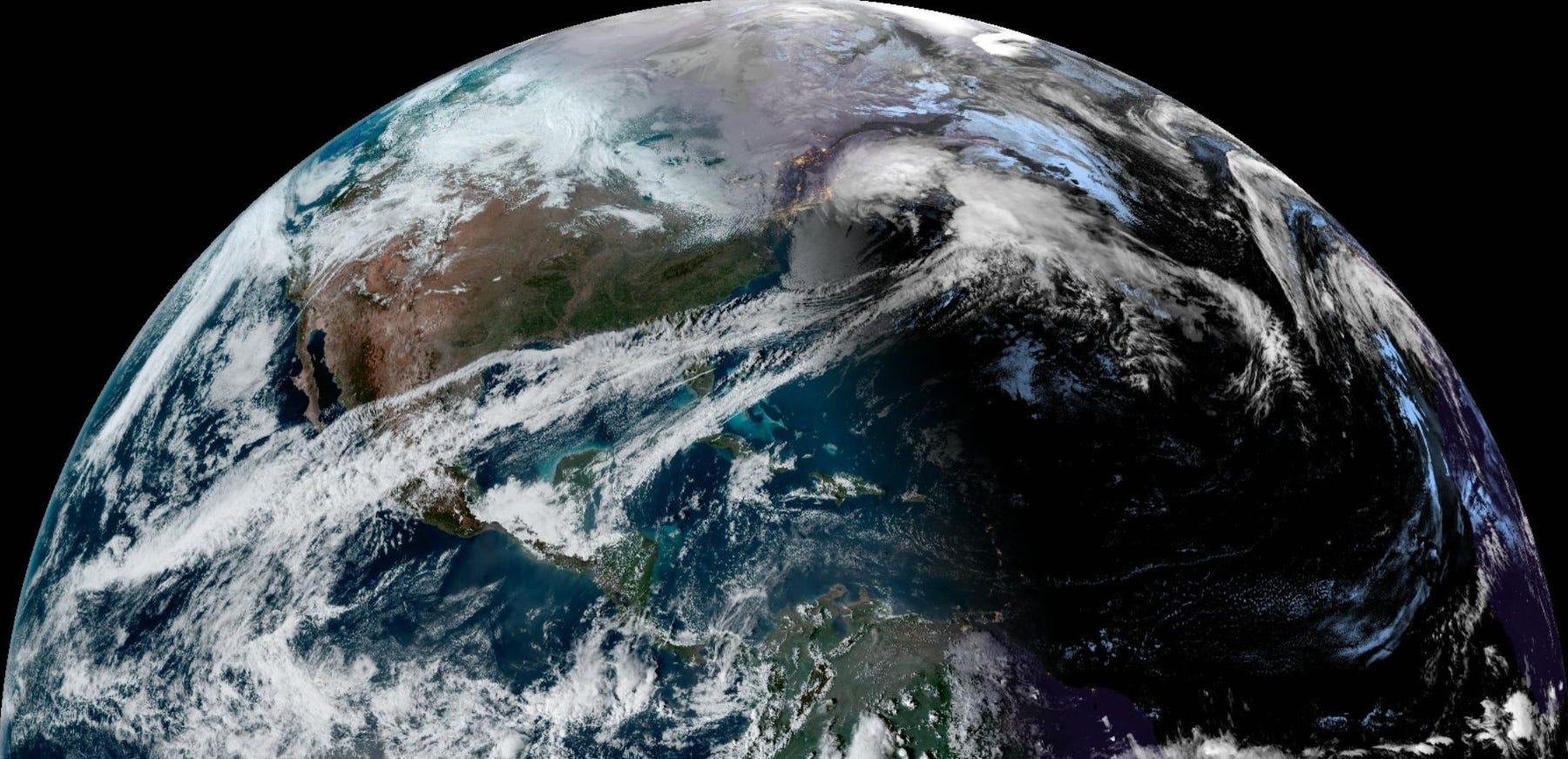
Wednesday 7 PM ET weather map depiction of Nor’easter with very heavy snow on the backside of the low pressure at 953 mb burying Newfoundland with up to 2-feet of snow.

Snowfall during the next 3-days will occur mostly over the Atlantic but Maritime Canada will be buried.

Warming Pattern to End February
During the next 2-weeks, after brief shots of Arctic air in the Great Lakes and Northeast, a substantial warming pattern takes over North America and the Lower 48 to end February.
We’re quickly running out of winter.

Clustering Tools at Weather Trader
As part of new development tools that you’d typically pay a ton to view, I’ve posted in real-time a large selection of clustering tools. Please overlook the table of contents presentation on the website at Weather Trader, as that’s the final task to make a functional website.
The following is 153 ensembles from the last 3 00z/12z EPS ensemble cycles valid on Day 14 or February 27. I use 4 clusters of the 500 hPa height pattern (EOFs) and then composite temperature anomaly from the various ensembles. This is a lagged ensemble clustering approach.

This version uses the most recent model cycle (12z) but 3 different ensemble systems including the ECMWF EPS, Canadian GEPS, and NOAA EFS. There are 103 members and they are binned into their respective clusters.
We can then composite other variables including precipitation (anomaly), degree days, and height patterns in order to diagnose the various possible future Day 14s. Also, this is repeated for Asia, Europe, and soon Australia and South America.

Next 15-Days Weather Pattern at Surface
The EPS control is a full-resolution (9-km) model through Day 15. I like to look at the movement of the weather systems — letting it continuously loop — to get an idea of the various weather systems, their tracks, and intensity.
Plenty of snowfall in the Western U.S. and coastal California rainfall through 2-weeks. However, not seeing another major winter storm east of the Rockies for the next 2-weeks. Uh oh! Don’t fret just yet. This is just one ensemble or potential future, and can flip or change just enough to deliver another bomb cyclone like we just had. While I’m ready to put the cork in winter down here in Atlanta, still several weeks to go in the Great Lakes and Northeast before Spring.
Lower 48 Temperatures
Wednesday Lows | February 14, 2024

Wednesday Highs | February 14, 2024

60s into St. Louis and Nashville, Atlanta and Charlotte. Perfect weather for Valentine’s Day!
7-day Total Precipitation from WPC

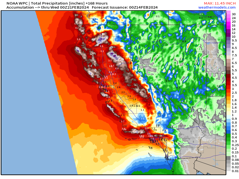
Significant rainfall and mountain snow again for California during the next 1-2 weeks.
15-day Snowfall ECMWF EPS Median Accumulation

Median snowfall to come in the Northeast needs to subtract some of the current storm which was still occurring between 12z and 18z today. That means the Northeast is looking at 2 Clipper systems from the NW (colder origin) with lighter accumulations Fri/Sat, with small chance of a larger storm middle of next week. The snowfall matrix from NYC has a decent signal in 9-11 days, which we’ll watch.

(Maps from weathermodels.com and weathertrader.com)
Thank you to my paying subscribers! Consider upgrading to a Yearly Plan if you find these updates valuable and wish to support my development at Weather Trader. Here is a little discount valid until February 20th:
Also, it allows me to provide (usually) interesting and valuable commentary on scientific topics on X. Feel free to say hello and follow on X/Twitter (@RyanMaue)