February 11, 2025 Tuesday Winter Weather
Parade of winter storms with a Nor'easter blizzard possible down the road
Good Tuesday Morning
The parade of winter storms is now underway with several highly impactful systems likely across the Eastern U.S. during the next 2-weeks.
Today, an area of low pressure is forming in the Southeast and will track into the Mid-Atlantic with warm, moist air surging northward to the polar front.
The result is heavy snowfall — but brief — across the Ohio Valley into Washington D.C. with sleet, freezing mixed in between.
HRRR Next 48-Hours
A major atmospheric river arrives into California on Thursday.
And, a second storm system tracks out of the Central Plains into the Great Lakes.
3-storms in a 24-48 hour period across the Lower 48.
HRRR 48-hour Snowfall and QPF
While we stick with the NWS numbers for short-term snowfall amounts (< 2-days) it’s worthwhile to look at the most recent guidance from the models to see if the human forecasts need to be adjusted.
For the Plains — Great Lakes storm system, we have 0.3” to 0.4” of QPF translating to about 4”-6” of snowfall, which is a bit less than NWS.
Not thrilled about 5.5” of rainfall in Atlanta —> Flash Flood watches up across the south from Texas into Georgia for heavy rainfall from waves of rainfall.
Weather on Wednesday
May be some severe storms along the stationary frontal boundary in Louisiana and Mississippi.
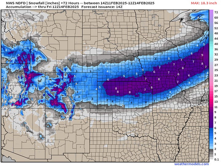
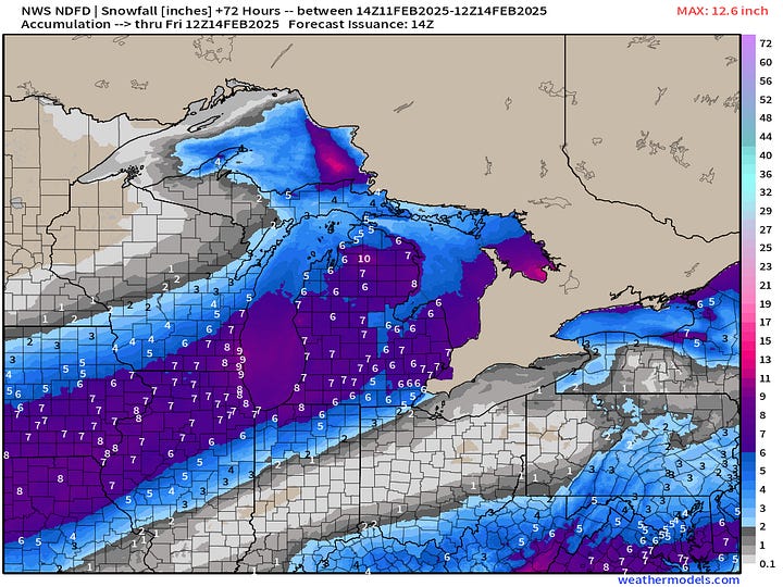
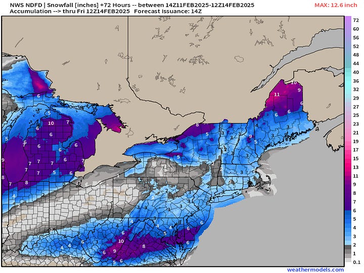
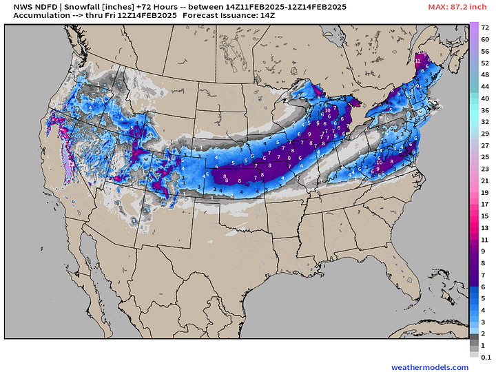
NWS Snowfall Totals next 72-hours


NWS QPF next 3-days across the Great Lakes is significantly more than HRRR, with blue (> 0.5”) = more snowfall with apparently higher ratios.
Most Recent 6-Days ECMWF Model Update (06z)
A mess forms when a storm system in the Great Lakes combines with a low out of Tennessee this weekend. The storm “bombs out” in the Northeast down to 972 mb — which is probably enough for a blizzard, but the big cities are all rain — in this ECMWF 06z update. However, as you can see from the snow swath, a southward adjustment of the storm track by 100-200 miles would mean a Northeast wipeout of 12”-18”+. However, that is a low probability at this juncture — so heaviest snow in northern New England.
Keep reading with a 7-day free trial
Subscribe to Weather Trader to keep reading this post and get 7 days of free access to the full post archives.


