


December 6, 2024 Friday Weather Update
Relief with significant warming until next Thursday when brief Arctic blast returns winter

Friday Headlines
Arctic front blasting through the Gulf Coast this evening with Lake Effect snow showers continuing in the Great Lakes. Friday morning will be very cold across the Southeast, and chilly during the day. Warming into the weekend and early next week … but …
United Kingdom powerful storm with hurricane force wind gusts is crossing over Ireland into England this evening. The system is in the mid-970s mb pressure, but is compact and has a robust “warm seclusion” structure with extreme winds on the southern flank.

Those extreme winds show up in the 850-hPa pressure level winds. A warm conveyor belt shows up as an atmospheric river into France.


ICON-EU 850 mb winds + Precipitable Water Mid-week Arctic blast: thankfully this cold shot will be short-lived and quickly replaced with more mild air.


EPS 12z 500 mb Height Anomaly | Days 5, 6, 7 
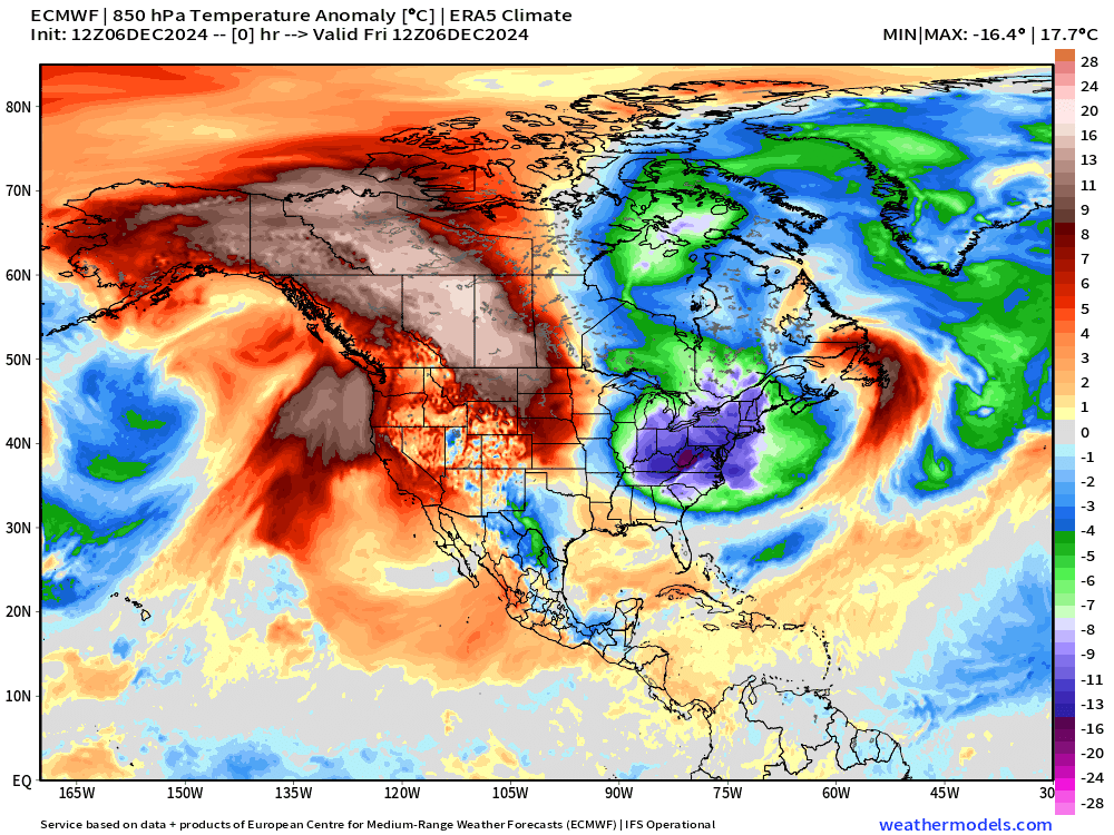
Warm Pacific air masses head into Alaska and the Arctic during the next 10-days so cold-pool formation cannot happen. This unloads the remaining polar air into the Lower 48.
Coldest morning is probably next Thursday


2:45 PM ET Temperatures across the Lower 48

Still about 80 million Americans failing to reach above freezing this afternoon.
Temperature Anomaly | 2:45 PM ET
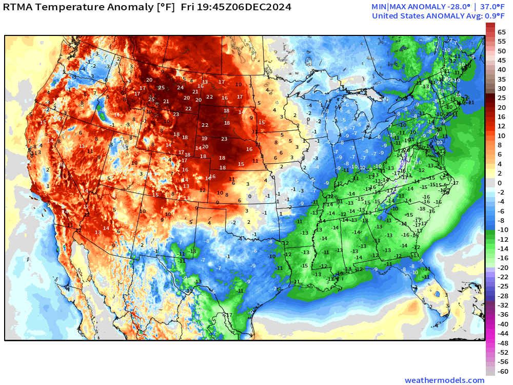
Overall the Lower 48 is +0.9°F (above normal) with a bipolar pattern with much above normal warmth in the northern Plains and Rockies = temperatures in the 50s and 60s in Montana. Sadly, barely in the 40s in Atlanta.
Next 8-days Precipitation Type | ECMWF 12z
Keep reading with a 7-day free trial
Subscribe to Weather Trader to keep reading this post and get 7 days of free access to the full post archives.