


December 5, 2024 Thursday Weather Update
Weather modeling curve ball with yet another Arctic blast next week!

Thursday Headlines
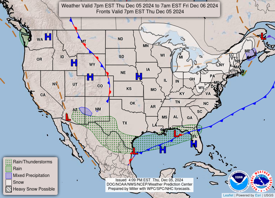
Arctic front blasting through the Gulf Coast this evening with Lake Effect snow showers continuing in the Great Lakes. Friday morning will be very cold across the Southeast, and chilly during the day. Warming into the weekend and early next week … but …

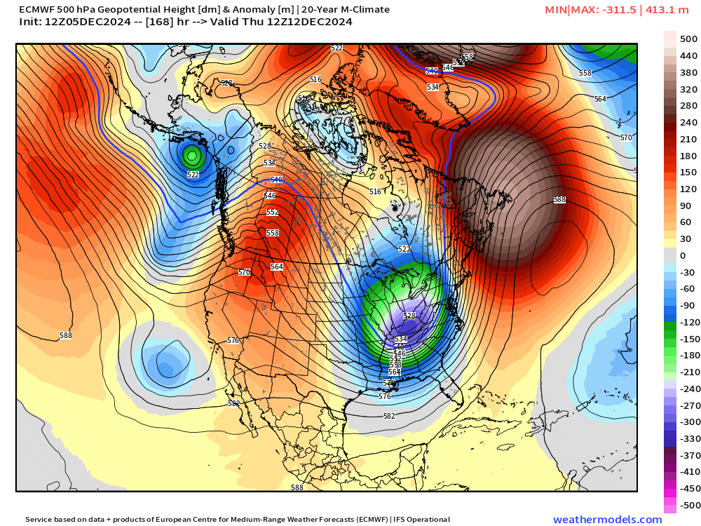
Major Forecast Switch for end of next week with an impressive Arctic blast! Previously, the expectation was that warmer Pacific flow would dominate the coming 1-2 weeks. Well, the ECMWF HRES 12z had other ideas.


850 hPa Temperature Anomaly | ECMWF 12z and 18z +144, +168H A sharp trough cuts into the Southeast on Thursday morning with cold air out of the Northwest, yet again.

Thursday morning 12z | ECMWF 7 day Height Anomaly


Temperature Anomaly | Next 8-Days

Heavy duty Arctic blast Wed-Friday!
7:15 PM ET Temperatures across the Lower 48
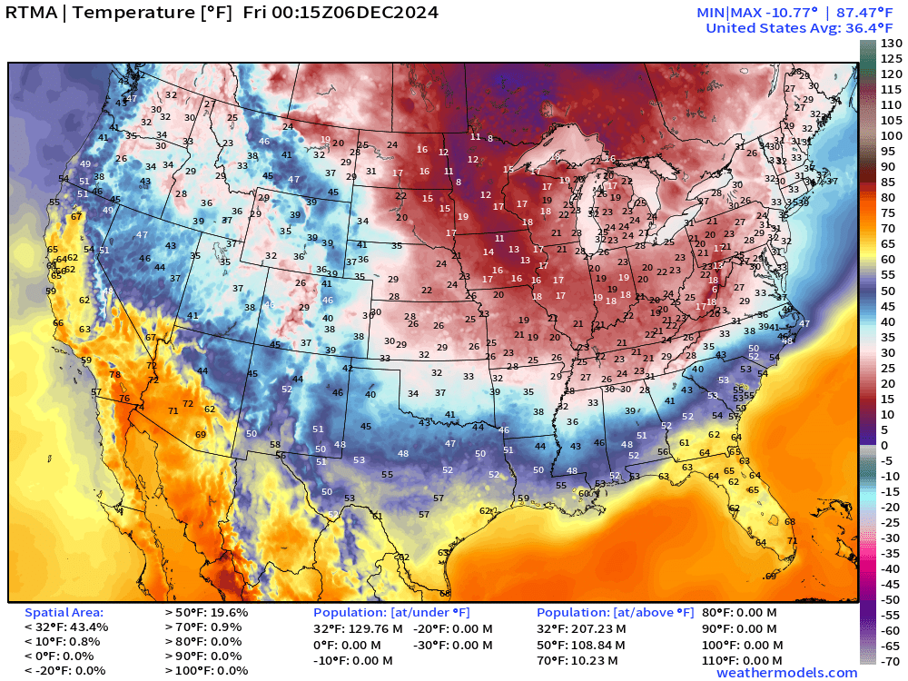
20s already into northern Alabama and Georgia with strong northerly winds behind the Arctic front.
Temperature Anomaly | 7:15 PM ET

Overall the Lower 48 is -2.6°F (below normal) with most anomalously cold air over TN and KY more than 23°F below normal.
Keep reading with a 7-day free trial
Subscribe to Weather Trader to keep reading this post and get 7 days of free access to the full post archives.