


December 4, 2024 Wednesday Weather Update
One more Arctic blast before relief and significant warming this weekend

Wednesday Headlines
Storm system tracking through Great Lakes into Northeast with heavy snowfall. Lake Effect snowfall kicks in behind the Arctic front. The pressure drop is almost a “bomb cyclone” heading away into Canada.

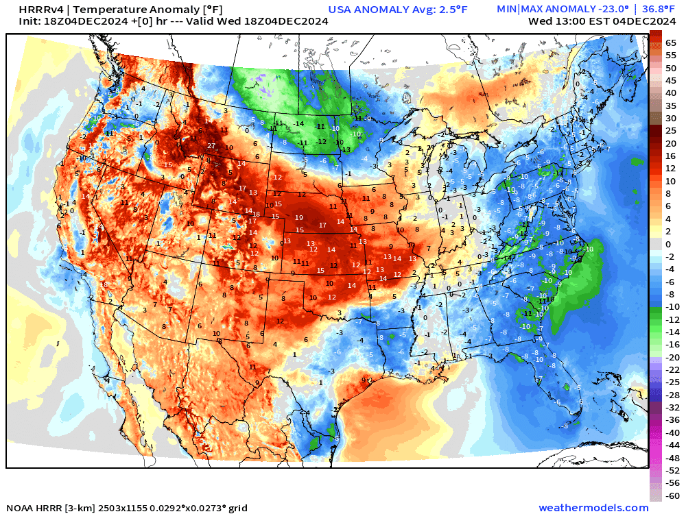
Front positions at 7 PM this evening | Weather through Thursday morning Arctic blast crashes into the Great Lakes, Ohio Valley, and Southeast into Friday. Temperature anomalies show the air mass making it to Central Florida in 48-hours. The intensity is in the 15°F to 23°F below normal for early December.

Much warmer pattern with Pacific origin air for next week. Still not seeing another major Arctic blast in the ensemble guidance in the 10-14 day range.

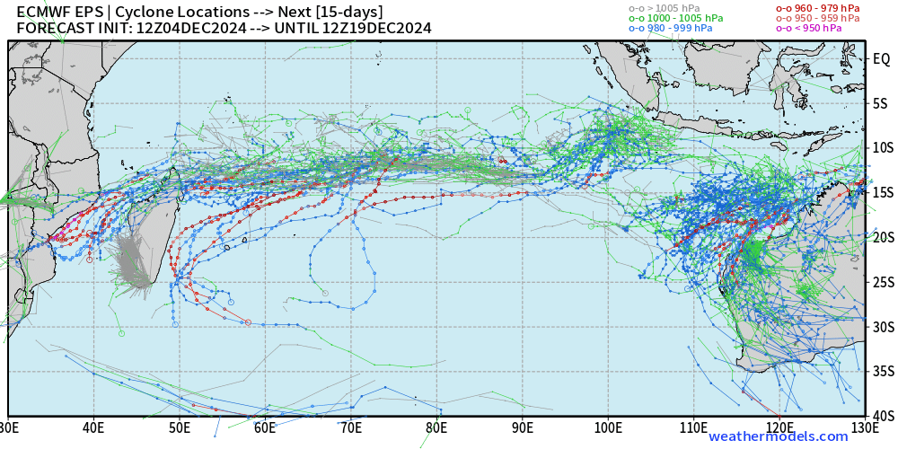
Southern Hemisphere Hurricane Season
Several areas to watch in the Indian Ocean over the next 2-weeks as Southern Hemisphere tropical cyclone season gets underway. The Southern Indian Ocean basin can support Category 5’s with quite warm ocean temperatures in early December mainly around Australia. There’s a sharp gradient at about 20°S latitude where SSTs drop below 26°C and TCs can’t form or intensify.

Global Major Hurricanes | 1980-2024

From my Climate Atlas tropical cyclone page —> Link
Updated the number of global major hurricanes (Category 3+) for November 2024. There have been 24 MH’s in the past 12-months, which is the long-term 30-year average. We do not observe a trend. The number of global hurricanes (Category 1+) is also near average. While the Atlantic saw a well-above average season in 2024, the Pacific in the Northern Hemisphere was relatively quiet, especially in the Eastern Pacific — with the Atlantic and Pacific acting like 2010 — another La Nina summer/fall.
4:15 PM ET Temperatures across the Lower 48
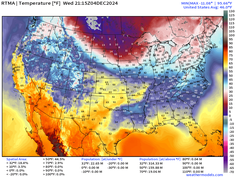
Very cold air coming into the upper-Midwest with single-digits. Otherwise, mild in the central U.S. and tolerable in the Southeast with sunshine.
We can look at the map vs. climatology:
Temperature Anomaly | 4:15 PM ET

Overall the Lower 48 is +2.9°F (above normal) as the western U.S. warmth considerably outweighs the moderating Arctic cold sinking into the Southeast and the new Canadian air mass crashing into the Midwest and Great Lakes.
Snow Storm + Lake Effect | Next 48-hours | HRRR
Keep reading with a 7-day free trial
Subscribe to Weather Trader to keep reading this post and get 7 days of free access to the full post archives.