


December 29, 2024 Sunday Winter Weather
Still watching extreme cold and snow in Week 2 east of the Rockies

Special Holiday Offer to Subscribe or Upgrade to Annual plan for 20% off. Your support is important for research, development, and growth of this platform into 2025.
Good afternoon, Sunday!
11:15 AM ET Temperatures across the Lower 48

60s pushing into Mid-Atlantic including Philadelphia ahead of storm system.
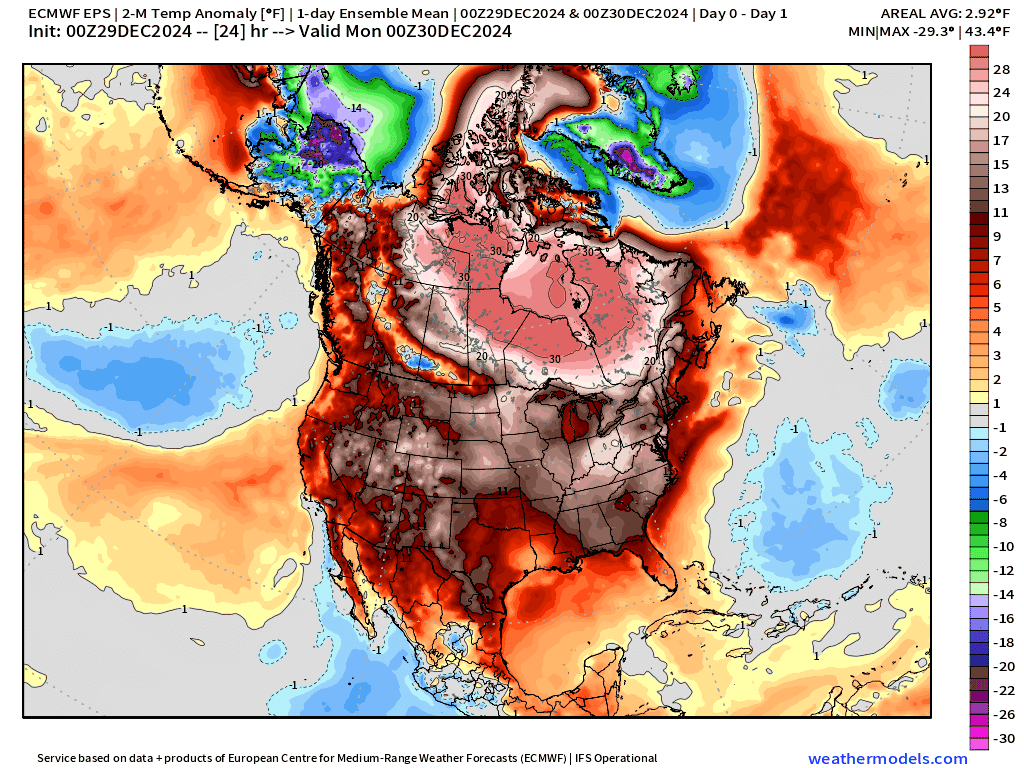
Temperature Anomaly | 11:15 AM ET

Overall the Lower 48 is a whopping +12.1°F (above normal)
Sunday High Temperatures

Exceptional late-December warmth with 50s into New England, 60s Buffalo, and 70s into Virginia.
Monday Low Temperatures

Only 30 million freezing tomorrow morning — population < 10% of Lower 48. But almost 40% of the real estate!
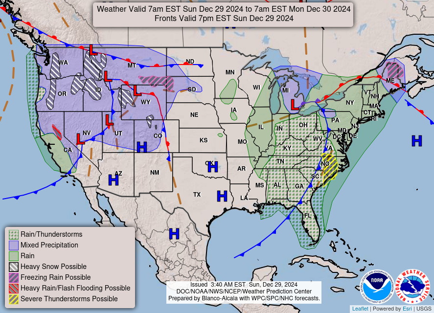
Weather Headlines for Sunday
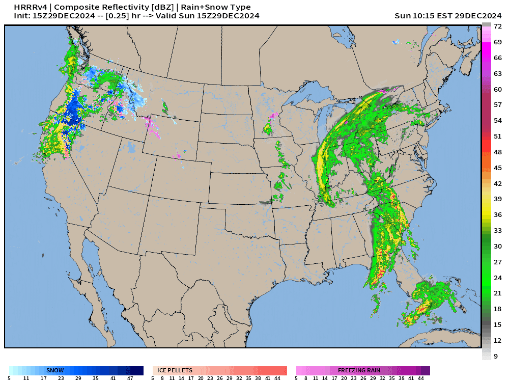
Moisture plume heading into Pacific Northwest pushed through Montana and Wyoming resulting in heavy mountain snow. Quite welcome!

Area of low pressure and attached frontal boundary that spawned all of the severe weather across the Southern U.S. will track eastward. The low will move into Michigan by later this evening with heavy rain and some mixed snow on the backside around Detroit.
Temperature Anomaly (Ensemble Mean) next 15-days:

Much colder temperatures into next weekend centered upon the Southeast, then the main event “polar vortex” Arctic blast collapses down the lee of the Rockies into the Lower 48 with extreme high pressure & cold. There is a tail risk for “historical” cold and snow (blizzards) amounts > 6-12” in Atlanta or any snow in Florida. I say “tail risk” because while such extreme events are plausible and in the bundle of ensemble member solutions, there is no way to pinpoint the details at the margin of the event — where the gradient is strongest along the Gulf Coast. This is dependent upon the penetration of the upper-level trough across the Eastern U.S. and the likelihood of a surface low developing and phasing with the trough. However, I don’t think you can have one without the other — meaning you will get the most extreme cold behind the blizzard, if it happens.

Keep reading with a 7-day free trial
Subscribe to Weather Trader to keep reading this post and get 7 days of free access to the full post archives.