


December 26, 2024 Thursday Winter Weather
Colder Canadian air arrives again by later next week, but very warm until then

Special Holiday Offer to Subscribe or Upgrade to Annual plan for 20% off. Your support is important for research, development, and growth of this platform into 2025.
Good evening! Thursday Evening Headlines
Pacific Northwest storm system and atmospheric river into Friday and Saturday.
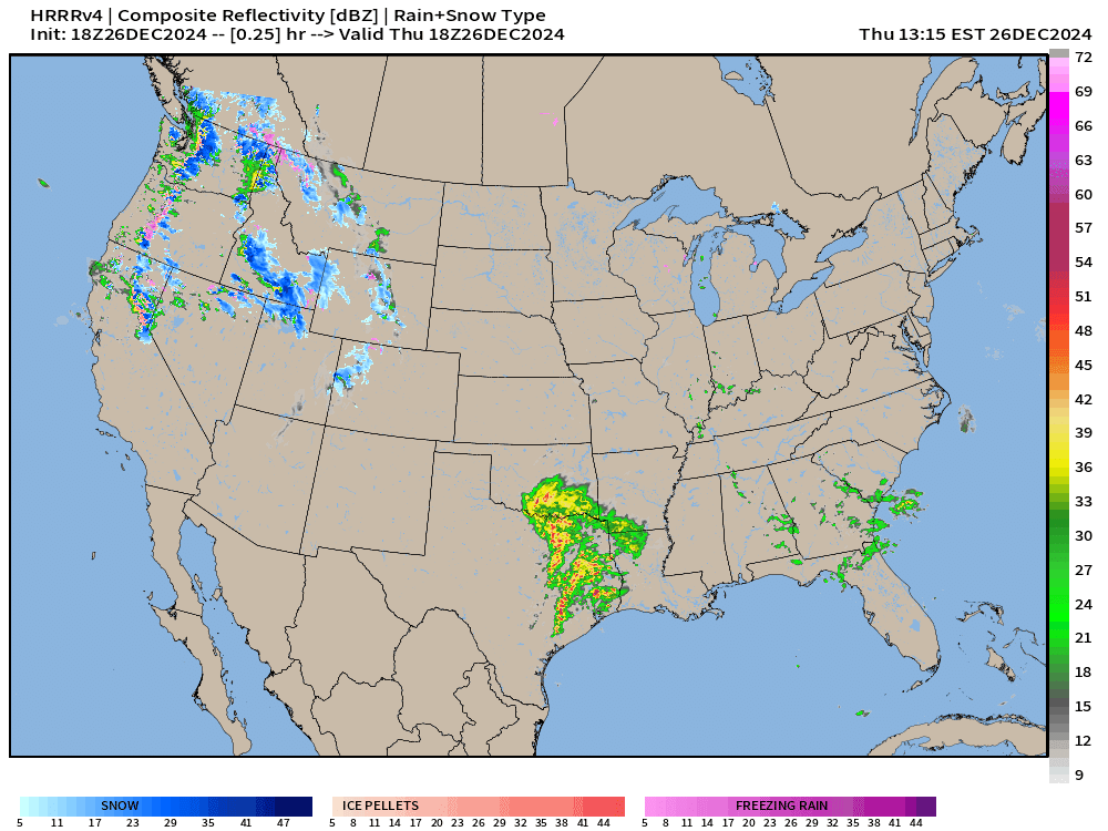
Heavy rain and thunderstorms moving into Arkansas and Louisiana: Weather this evening:

More Gulf of Mexico moisture fuels a storm system tracking out of Texas/Gulf Coast into the Northeast Sunday into Monday — all rain, not seeing frozen precipitation
The wasted Nor’easter: next Wed/Thurs coastal low (so far) does not look like a major NYC/New England snowfall threat — too warm. However, as the storm system deepens and tracks into Quebec, much colder air finally blasts out of Canada by next Thurs/Friday — colder at Day 7 across the eastern Lower 48.
HRRR simulated radar | Next 48-hours through Friday afternoon

Friday’s Weather

ECMWF 12z precipitation type and MSLP next 10-days
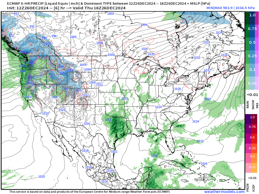
The Pacific moisture from the atmospheric rivers mostly goes into the Northwest and is dumped onto the coastal sea-level as rain, and heavy snow in the mountains. Some of that moisture does make it eastward across the Rockies, but not much. The bulk of the rainfall across the Eastern U.S. is courtesy of the Gulf of Mexico.
By next Friday, the pattern looks more winter-like with NW’ly flow out of Canada.
NWS | Total Precipitation Next 72-hours

Large area of 2-inches+ rainfall from Louisiana into the Southeast including Atlanta and the Carolinas, and into the Mid-Atlantic.
3-day totals of precipitation in the 6” to 10” range across northern California into the Cascades where higher elevations will see enormous snowfall.
NWS | Total Snowfall Next 72-hours

While the storm systems are relatively warm with Pacific moisture from subtropical origin atmospheric rivers, the air mass is cold enough at elevation to see many feet of snowfall.
January 2025 begins with Eastern U.S. Troughing


By next Friday, much colder air floods into the Southeast U.S. connected all the way back to Alaska. That pattern remains by Day 14 — way down the road — with the Western U.S. very warm.
Keep reading with a 7-day free trial
Subscribe to Weather Trader to keep reading this post and get 7 days of free access to the full post archives.