


December 24, 2024 Tuesday Winter Weather
Pacific storms continue to bombard the West Coast

Special Holiday Offer to Subscribe or Upgrade to Annual plan for 20% off. Your support is important for research, development, and growth of this platform into 2025.
Good afternoon and Happy Christmas Eve!
Weather Tuesday Evening

Heavy rain and thunderstorms moved through Dallas-Fort Worth this afternoon with flood warnings. Gulf of Mexico moisture streaming northward into the Lower Mississippi River valley will continue to fuel heavy rainfall.
Simulated radar shows the West Coast getting a brief break from the “atmospheric rivers” but only for 18-hours until the next major storm comes on shore.
HRRR simulated radar | Next 48-hours

Weather on Wednesday | Christmas Day

Warming temperatures will mean any precipitation east of the Rockies is probably rain, but no major travel trouble spots for Christmas Day activities.
ECMWF Precipitation Type and MSLP Next 6-days into Next Tuesday

Same story as yesterday: Gulf of Mexico moisture streams northward up the Mississippi River valley over the next several days leading to heavy rainfall accumulations — maybe upwards of 4-6”.
The West Coast continues to be hammered by atmospheric rivers.
Much warmer air will sweep across the Midwest and Great Lakes after Christmas, so any precipitation would be rain.
Atmospheric Rivers | Next 10-days
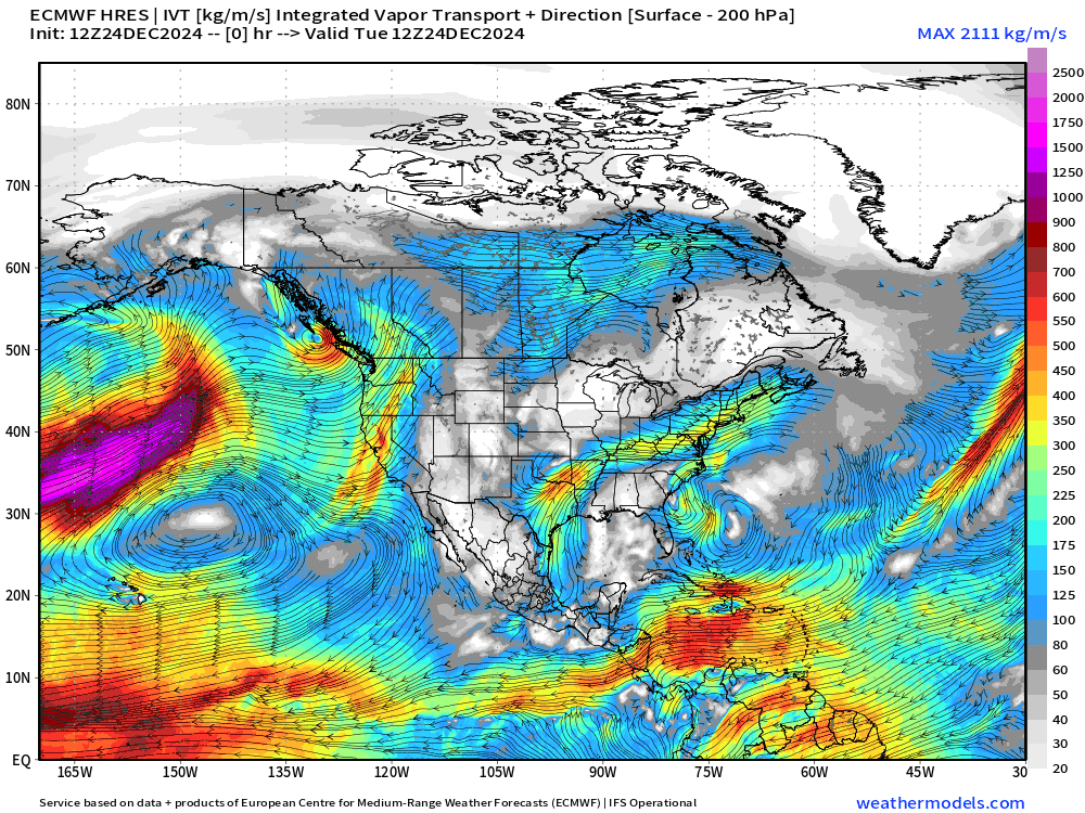
I count at least 5 atmospheric river events for the West Coast — but from northern California into the Pacific NW. Note from the precipitation anomaly map for the next 10-days that central and southern California are left with a significant dryness or deficit.
Moisture does make it through the mountains into the Lower 48 — not much, but there is often enough to contribute to Clipper systems or add to Gulf of Mexico moisture plumes.

Looking ahead into 2025 for the Pattern Flip
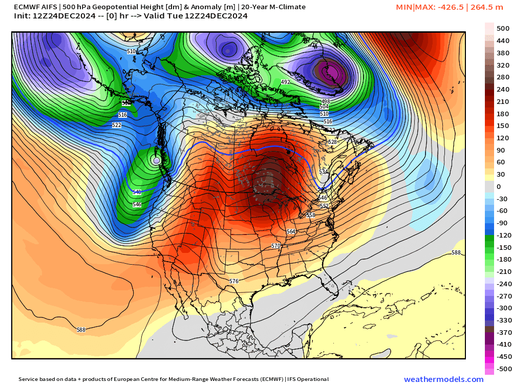
ECMWF AIFS (12z) next 15-days shows repeated trough development from shortwaves out of the Northeast Pacific but with very limited connection to the Arctic tropospheric polar vortex. This will limit the magnitude of the cold to mainly seasonable levels — depending upon your location. A 15°F cold anomaly in the Southeast is pretty rough but obviously not in the Midwest, Great Lakes or Northeast.
Any one of these shortwaves could phase with a surface low to blow up into a major winter storm — the pattern is quite favorable. However, it’s too early to “wishcast” Southeast snowstorms or Nor’easters.
Keep reading with a 7-day free trial
Subscribe to Weather Trader to keep reading this post and get 7 days of free access to the full post archives.