


December 22, 2024 Sunday Winter Weather
Another Clipper system in Great Lakes and Northeast into Tuesday

Special Holiday Offer to Subscribe or Upgrade to Annual plan for 20% off. Your support is important for research, development, and growth of this platform into 2025.
Good Sunday evening!
Yet another Alberta Clipper system will track through the Great Lakes into the Northeast with snowfall into Tuesday. Accumulations will be highest over Michigan but (sadly) tapering to only dusting or at most 1-inch around NYC and Boston.
Weather on Monday

Weather through Tuesday evening | HRRR simulated radar
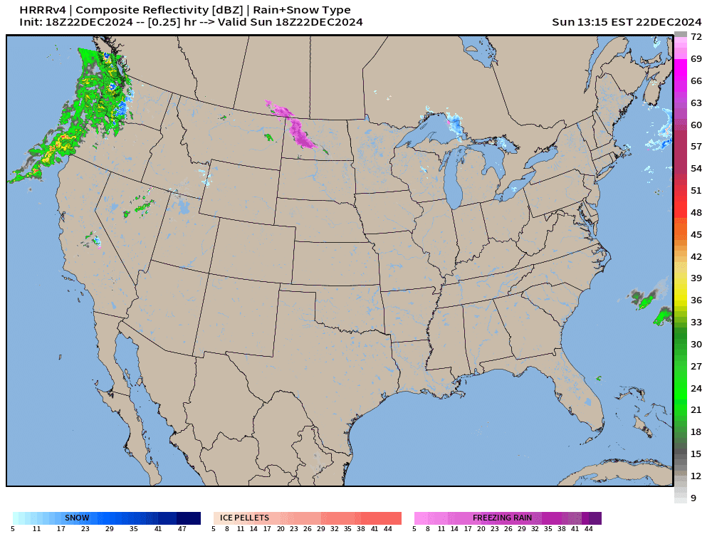
Looking at the simulated radar for hourly weather: Two storm systems in 48-hours across the Western U.S. with a front with heavy showers moving through the Bay Area before sputtering out before LA.
The Clipper System looks quite robust over the Great Lakes — forecast of 6-12” of snowfall across norther Lower Michigan and 6-inches+ across Ontario into Upstate New York.

However, by early Tuesday morning (6 AM) the model shows only light band of flurries into NYC, and heaviest precipitation in the Gulf of Maine. Of course, this could outperform only slightly this model guidance and we’d see 1-3” for Christmas Eve morning.

ECMWF Precipitation Type and MSLP Next 6-days
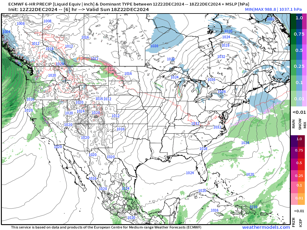
Tuesday —> The global model (ECMWF 12z) also has light accumulations (< 1-inch) from NYC to Boston near the coast. Then, much warmer temperatures and flow out of the south will replace the cold Canadian air with more mild Pacific origin air mass for the next 7-10 days.
By next Friday, warm moist flow out of the Gulf of Mexico provides a heavy rainmaker for Texas, Louisiana, and Arkansas (1-3”+).
Fantasy Weather | Blockbuster Blizzard
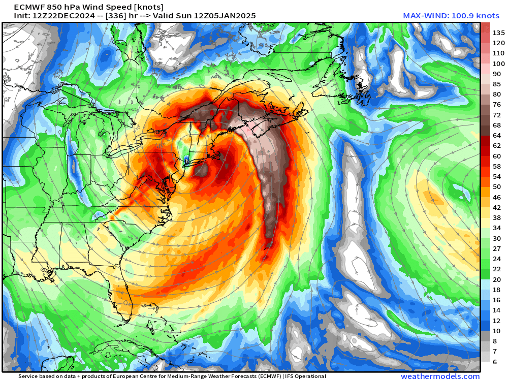
Excited to see this monster blizzard in the weather model (ECMWF) even if it is in the “fantasy range” of 14-days. The upper-level pattern is conducive to rapid intensification of a Nor’easter — bomb cyclone — right in the perfect spot for huge snowfall. 967 mb centered on NYC.
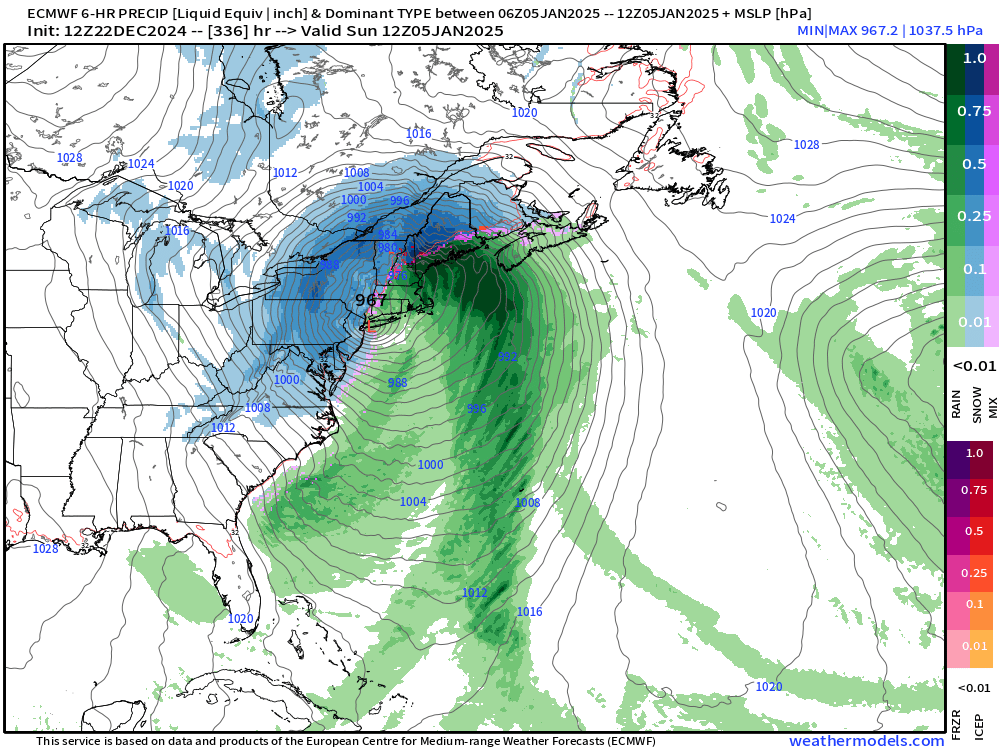
The 15-day snowfall map from ECMWF 12z (HRES) is incredible and would light up the historical scoreboard for major winter weather systems.

I’m posting the maps not to fearmonger or hype the “outlier” forecast, but remind everyone that winter has just started. However, we’ll need to wait again until 2025 for the next serious shot at colder Arctic air and Winter Storms — aside from these Clipper systems that seem to be dumping good snowfall on their own.
10-Day Integrated Vapor Transport | ECMWF 12z
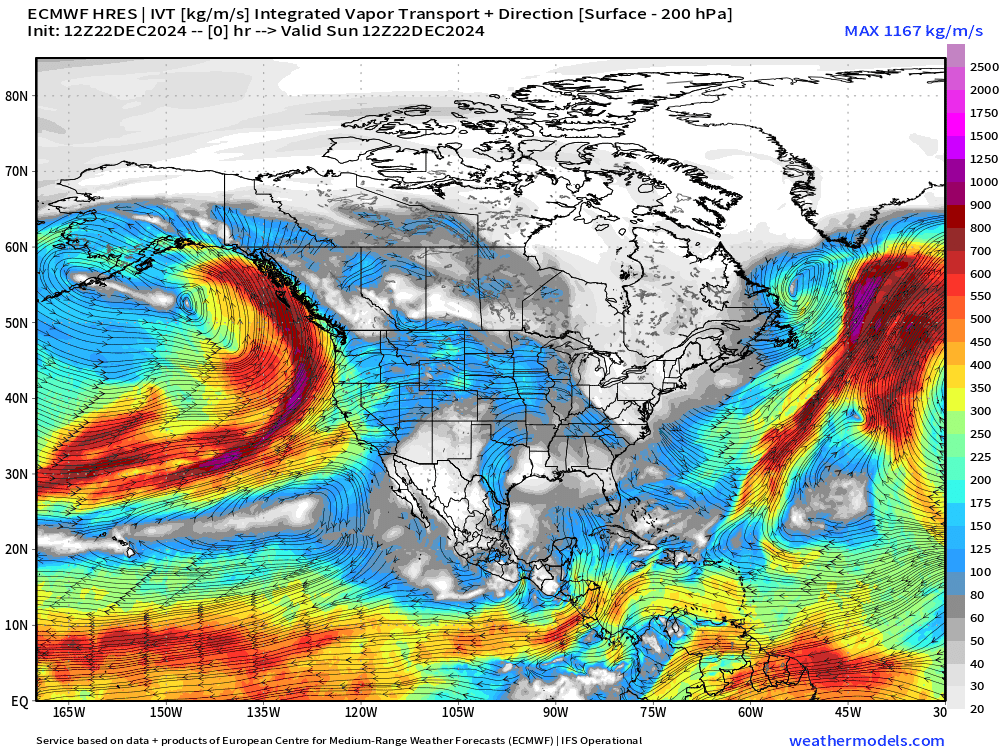
4 or 5 moderate to strong atmospheric rivers hammer the West Coast of the U.S.
The mountains capture most of the moisture but some does cross the Rockies and is entrained into storm systems forming in the central U.S. combined with Gulf of Mexico moist/warm flow.
Also, note the moisture influx into the Arctic over the North Pole from the storm systems parading through the North Pacific. This warmth/moisture advection helps maintain and build the ridging over Canada for the next 7-10 days.
Looking ahead into 2025 for a Pattern Flip
Our daily look at if/when the Canadian blocking/ridging will break down enough to allow colder Canadian / Arctic air to flood the Lower 48 from the northwest.
ECMWF HRES 12z does have a corridor set up after Day 8-9 for the tropospheric polar vortex to again affect the weather across the Lower 48. Much colder pattern in Day 10-15 range, as we’ll see in the ensembles.

GFS 18z in the Long Range (Day 13) also has a much colder signal with the PV anchored over the Hudson Bay.
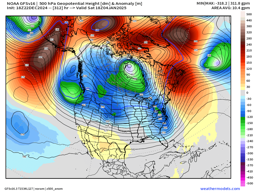

I would be despondent if the weather models didn’t show anything but above normal warmth for weeks on end, but that’s not the case. The upcoming warm spell will last a week or so, and then we’ll be back to typical, seasonably cold early January weather. Of course, it’s really cold right now, too!
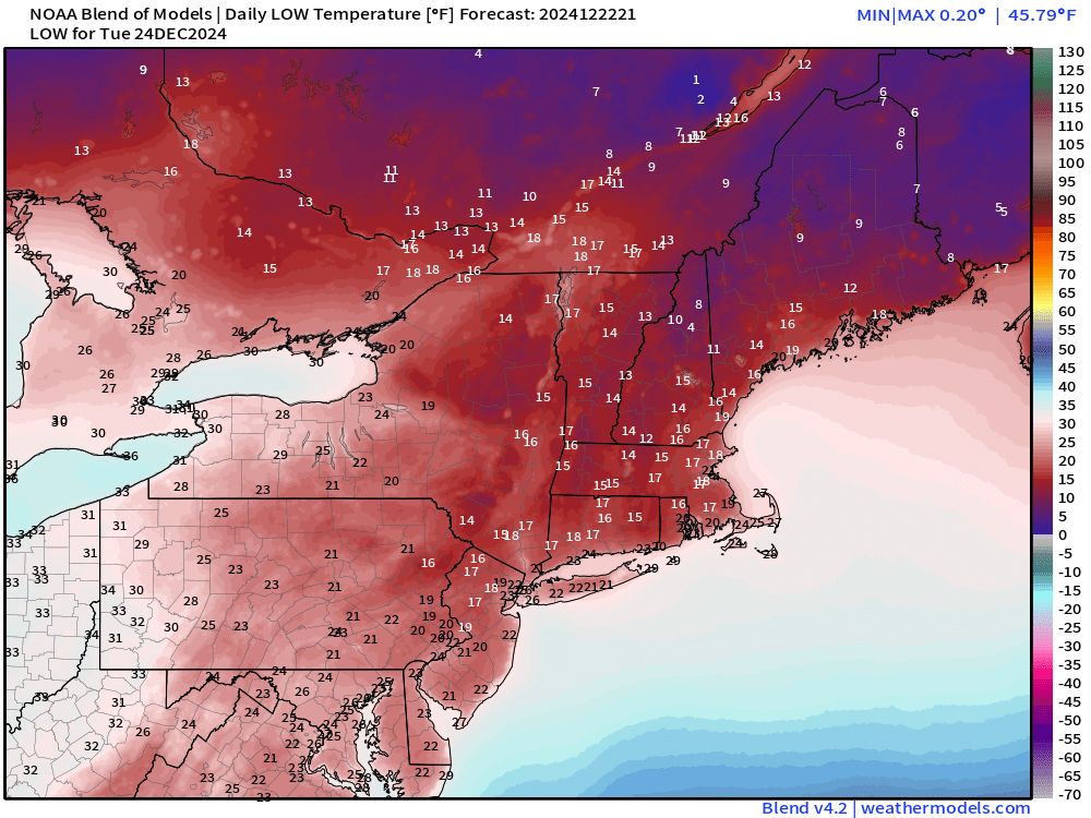
Monday Morning Low Temperatures


Cold across the Mid-Atlantic and Northeast Monday morning with some areas dipping below 0°F. Boston and NYC will be around 10°F depending upon the urban heat island.
Monday High Temperatures

Another day below freezing across the entire Northeast w/56 million failing to get above freezing.
Tuesday Morning Temperatures | Christmas Eve

And, into Christmas Eve, still only in the teens and 20s from north to south down I-95. Any precipitation would certainly be snow or frozen until daytime.
6:30 PM ET Temperatures across the Lower 48
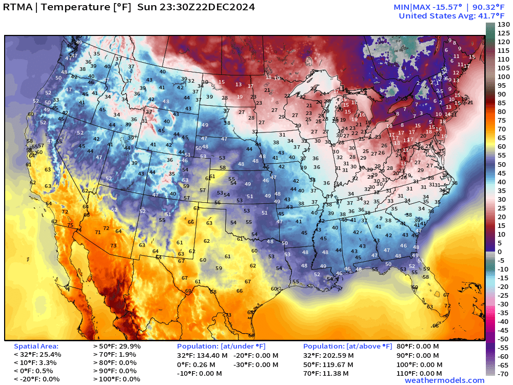
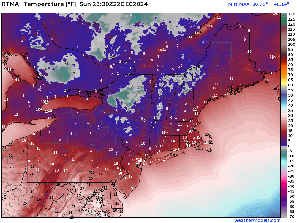
More than 134 million now below freezing this evening.
Temperature Anomaly | 6:30 PM ET
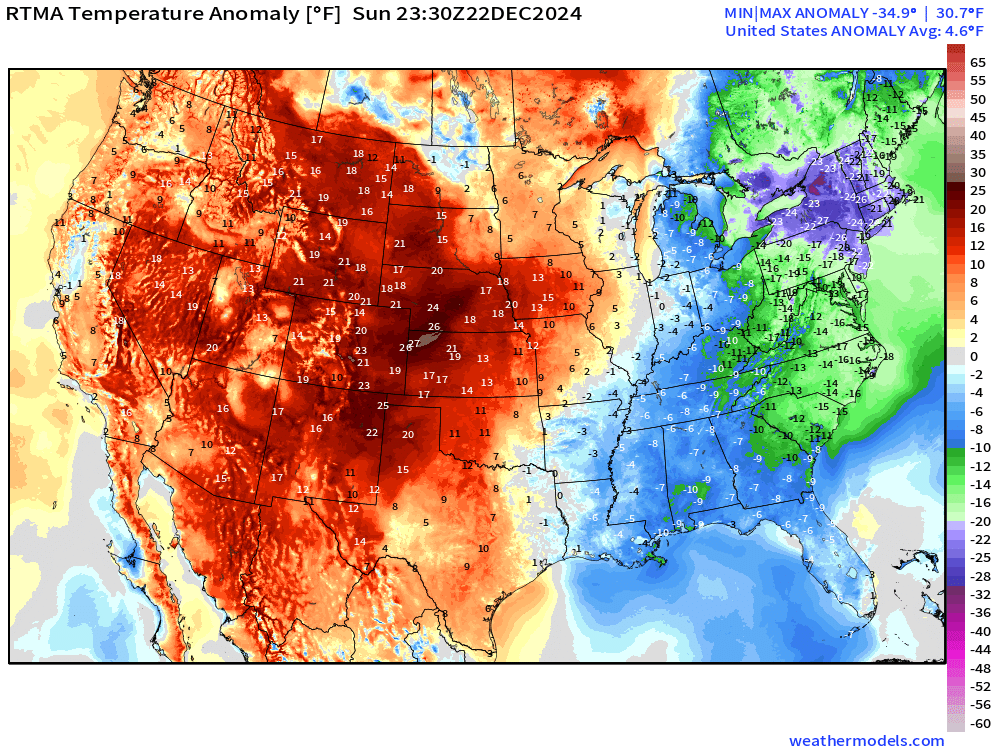
Overall the Lower 48 is still 4.6°F (above normal) with western warmth beating out the eastern cold by a LOT.
Total Precipitation next 7-Days | NOAA WPC

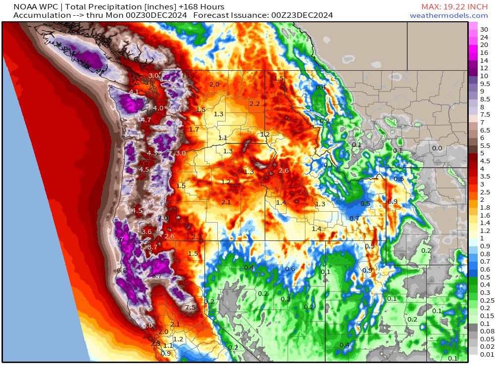
NWS WPC with large areas of 12-18” of rainfall along the NorCal coast up into Washington.
15-day Ensemble Median Snowfall
Probability of 1”+ Snowfall Next 15-days

ECMWF EPS 12z | 5-Day Chunk Temperature Anomaly
Days 1-5: December 22 - December 26

The 5-day average temperatures show a sliver of well below normal hanging on to the Eastern Seaboard …
Days 6-10: December 27 - December 31

Almost coast to coast well-above normal warmth with > 30°F anomaly over Canada.
Days 11-15: January 1 - January 5
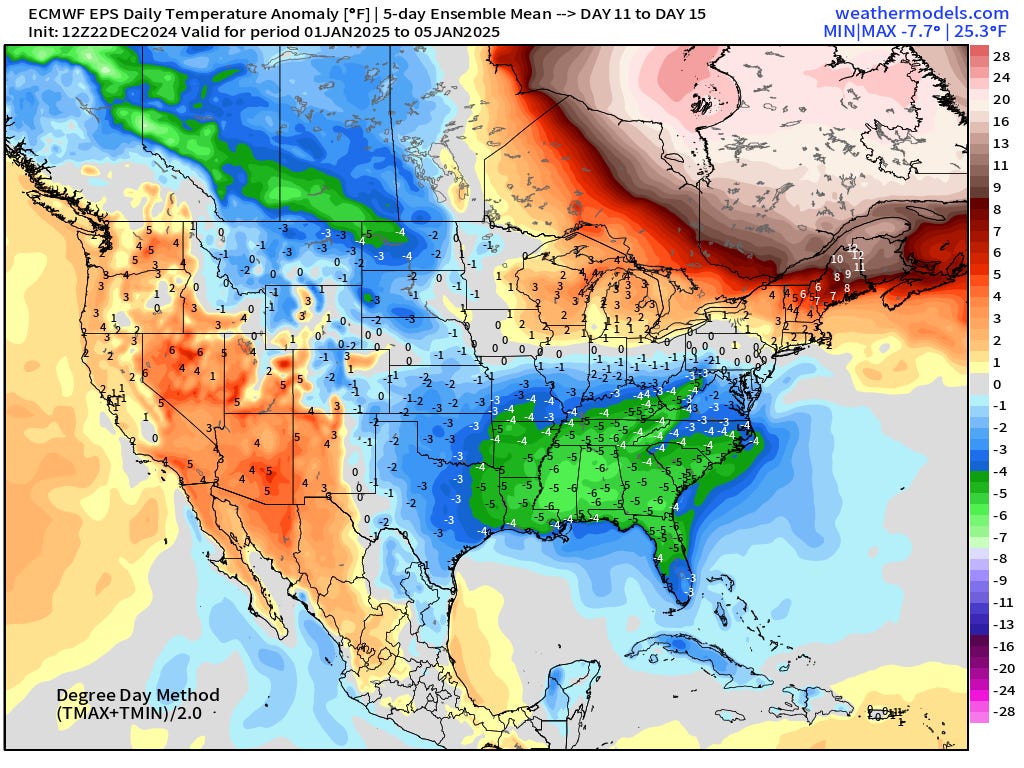
Much cooler in the final 5-day chunk to start January except for Quebec.
Snowfall Analysis | Season to Date October 1, 2024 — today

Snowfall Last 7-days


Maps sourced from weathermodels.com designed and innovated by yours truly! Please subscribe there for real-time access to the newest maps, charts from all of the weather models including ECMWF.