December 21, 2024 Saturday Winter Weather
Watching pattern flip and next major Arctic blast into early January
Special Holiday Offer to Subscribe or Upgrade to Annual plan for 20% off. Your support is important for research, development, and growth of this platform into 2025.
Good Saturday Evening and officially Winter 2024-2025!
Canadian Arctic High Pressure settles into the Northeast with very cold temperatures into Sunday morning. A storm system in the Midwest will eventually push warm air up and over that cold dome leading to light freezing rain in North Dakota and Minnesota as temperatures warm up significantly.
The West Coast will be bombarded by a series of storms and atmospheric rivers every day or two for the next 10-days.
Weather on Sunday
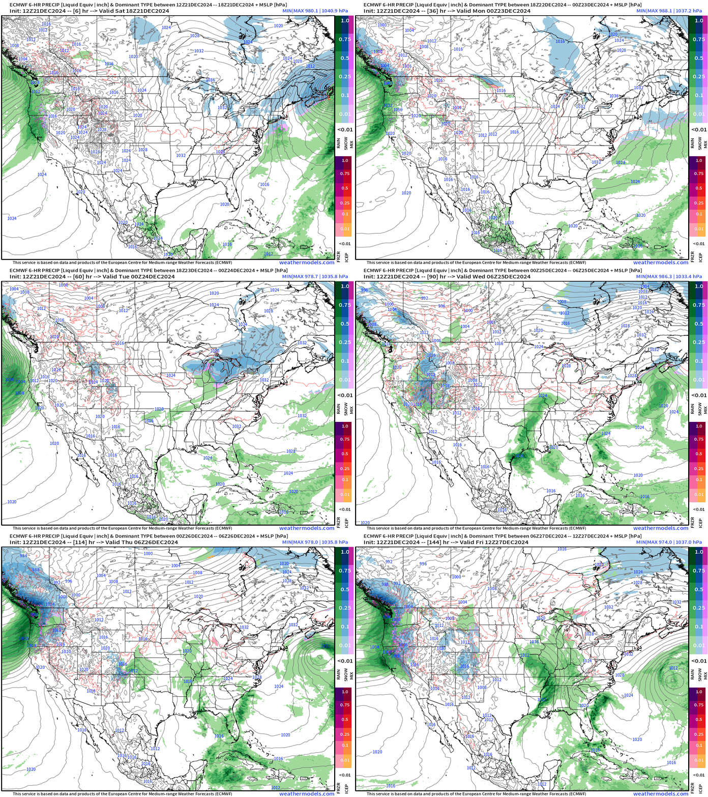
Precipitation Type and MSLP Next 6-days
Another Clipper system for Tuesday and Wednesday will drop a few inches of snow across the Great Lakes and maybe across the Northeast, but this storm looks less robust than the snowmaker that blanketed New Jersey, NYC, into Boston this morning.
After Christmas, a storm system (all heavy rain) in the ECMWF HRES 12z model in the central Mississippi River valley.
Snow Depth for Christmas Morning
Monitoring the snow cover for Santa Claus on Tuesday and Wednesday. Temperatures won’t be warming much above freezing in the Great Lakes and Northeast until Tuesday afternoon, so any snow that is on the ground might stick around on grassy surfaces or in the shade.
Pattern Flip — Eventually — Into January 2025
Keep reading with a 7-day free trial
Subscribe to Weather Trader to keep reading this post and get 7 days of free access to the full post archives.


