


December 20, 2024 Friday Winter Weather
Glancing blow from Nor'easter will dust New England with 1-3" of snowfall

Special Holiday Offer to Subscribe or Upgrade to Annual plan for 20% off. Your support is important for research, development, and growth of this platform into 2025.
Friday Headlines
Less exhaustive update this morning, and more details this afternoon after the 12z models complete [for paid subscribers].
Alberta Clipper —> offshore Gulf of Maine low pressure
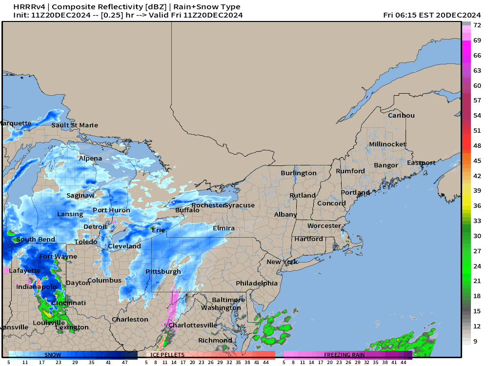
HRRR 11z showed an interesting solution with just enough precipitation on the back side of the developing Nor’easter (heading into Canada) to provide a quick 1-3” of snowfall in Boston late this evening. The potential is there for more … we’ll watch the model trends this morning into the afternoon.

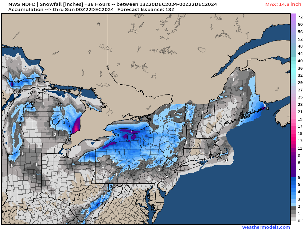
Current NWS Forecast for Snowfall Next 36-hours: 1”-3” for Boston.


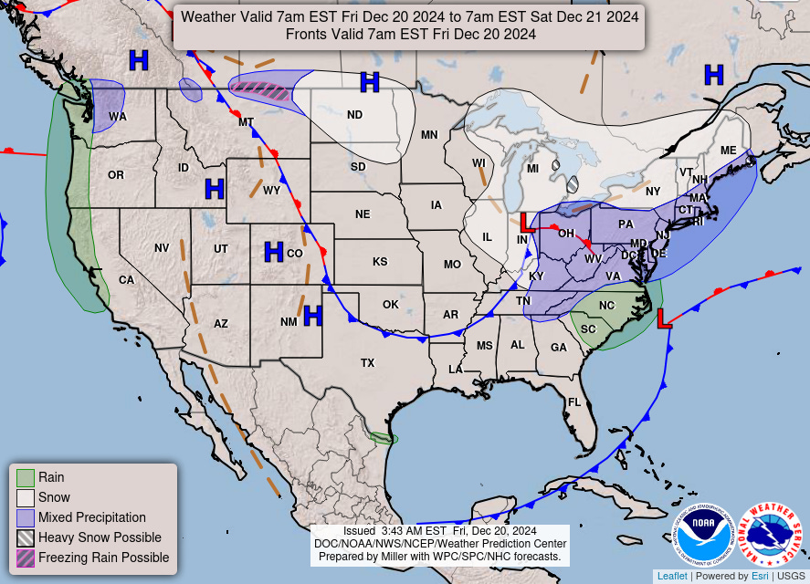
Trough across Eastern U.S. = brief winter cold


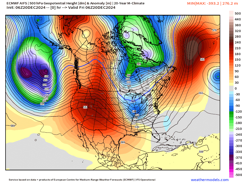
500 mb Trough | Winds and Temperature The storm system that forms off the east coast later tonight tracks across Newfoundland and deepens to 974 mb. Unfortunately for snow lovers across the Northeast, it misses the trough to “bomb out” in the Gulf of Maine by a few hundred miles. Instead, it will assist with cold air advection out of Quebec, so not completely wasted. The Canadian high pressure centered over the Great Lakes will slowly move eastward killing the winds = cold Sunday and Monday morning.


Sunday Morning Low Temperatures

Monday Morning Low Temperatures

8:00 AM ET Temperatures across the Lower 48

Almost 100 million at/below freezing at 8 AM ET. Coldest air by far in the Dakotas and now into Nebraska and Kansas.
Temperature Anomaly | 8:00 AM ET

Overall the Lower 48 is still 0.6°F (above normal) with western warmth beating out the central U.S. cold.
High Temperatures on Friday

High temperatures this afternoon only in the 30s into Kansas City, St. Louis, and the Ohio River Valley. Sunshine will keep the southeast in the 50s and up to 80°F in South Florida. The Southwest including Phoenix also in the 80s.
High Temperature Anomaly on Friday

The Western U.S. is very warm (relative to climatology) with temperatures 20°F above normal including Denver. The coldest air is only 10° to 15°F below normal, so far.
Total Precipitation next 7-Days | NOAA WPC

Trillions of gallons of Pacific atmospheric river rainfall (and mountain snow) to pile up across northern California, Oregon, and Washington.
ECMWF AIFS 06z | Height Anomaly Next 15-days

The North Pacific storm track through downstream Rossby wave trough thinning spawns many shortwaves that cruise through Southwest U.S. and then eastward across the Lower 48. However, ridging to the north (also built up by the powerful North Pacific storm systems) keeps these cut-offs from connecting to the tropospheric polar vortex well in Canada. The result is a fixed/stuck pattern of mild weather across the Lower 48 into the first week of January.
6-day Ensemble Median Snowfall

Probability of 1”+ Snowfall Next 6-days
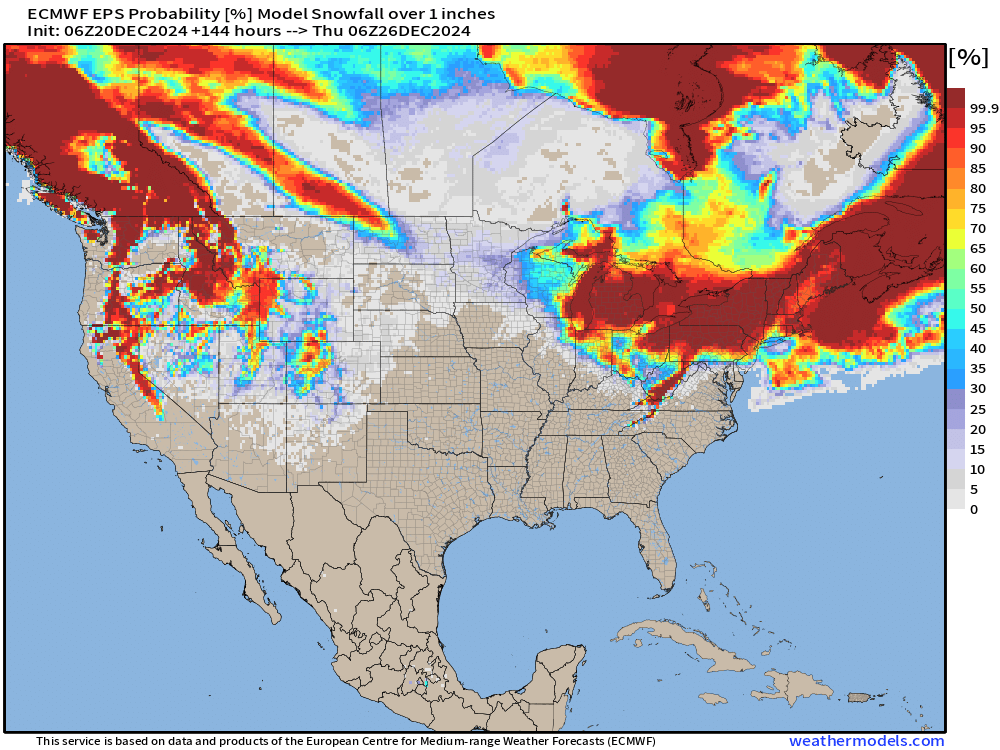
Could be light snowfall — stars align perfectly for a White Christmas morning across the Great Lakes into the Northeast. Outside chance (small) in D.C.
Next 15-days

Still no weak (or strong) signal for a strong winter storm across the Eastern U.S. into January 2025.
ECMWF EPS 00z | 5-Day Chunk Temperature Anomaly
Days 1-5: December 20 - December 24

Days 6-10: December 25 - December 29

Days 11-15: December 30 - January 3

Hard to see any cold signals in the Ensemble Mean from Days 7 to 15 into January 3, 2025.
Maps sourced from weathermodels.com designed and innovated by yours truly! Please subscribe there for real-time access to the newest maps, charts from all of the weather models including ECMWF.