


December 20, 2023 Wednesday Update
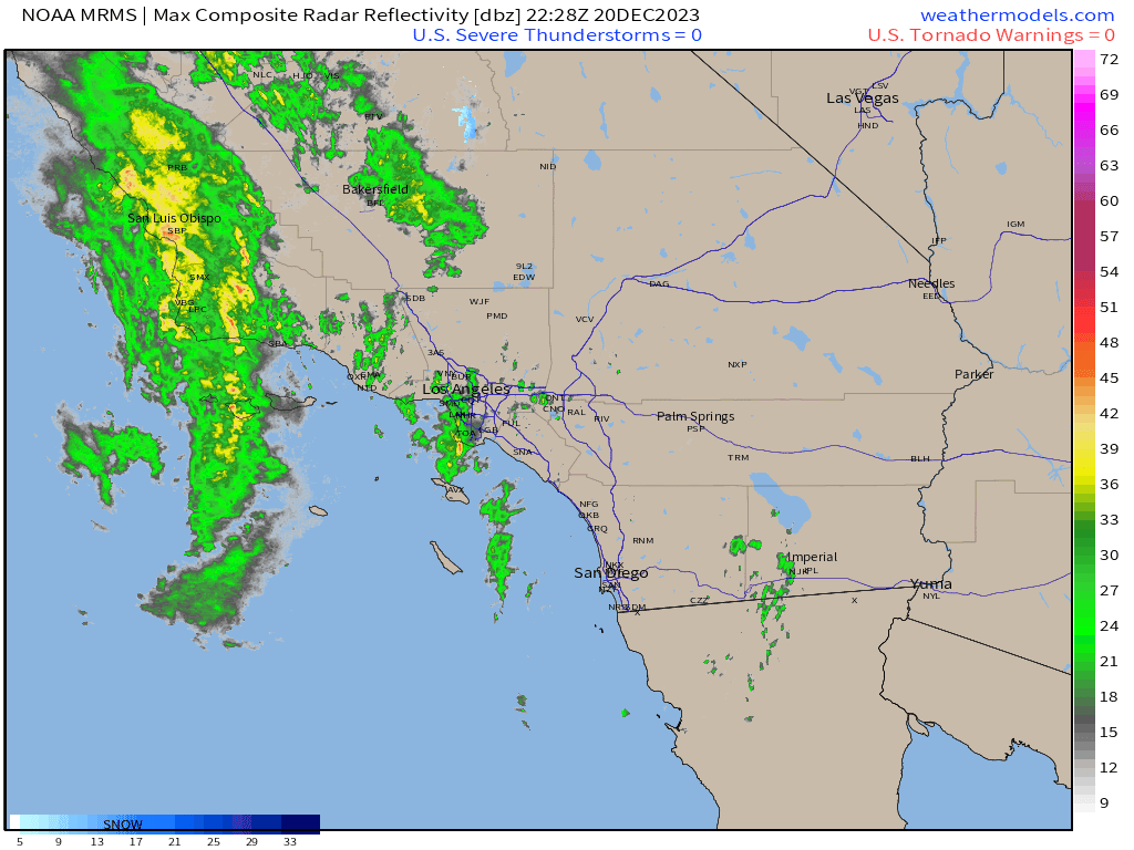
California storm with flash flooding
A slow moving upper-level low off the California coast is drifting southward bringing moisture onshore. The heaviest rain and potential for flooding is along the Transverse Range where 4-7” total may fall. Los Angeles will see 1-2” over the next 48-hours — welcome precipitation.
The low will move into the Southwest this weekend and then combine with another upper-level shortwave in the Rockies to yield our next storm system for Christmas Eve that could bring significant snowfall to Denver.


The storm system matures over Iowa early next week and seems to flatten and weaken without any upper-level support. There is a huge ridge well to the north in Canada and well above normal temperatures. Not a recipe for a dynamic or blockbuster storm system.
The next chance for an Eastern U.S. winter storm or another gusty rain storm would be a week from Friday heading into New Year’s weekend.
Meanwhile, the western U.S. storm track dials up the volume with potential for huge atmospheric river firehose rain/snow totals in the 7-10 day+ range.

Thursday Morning Low Temperatures
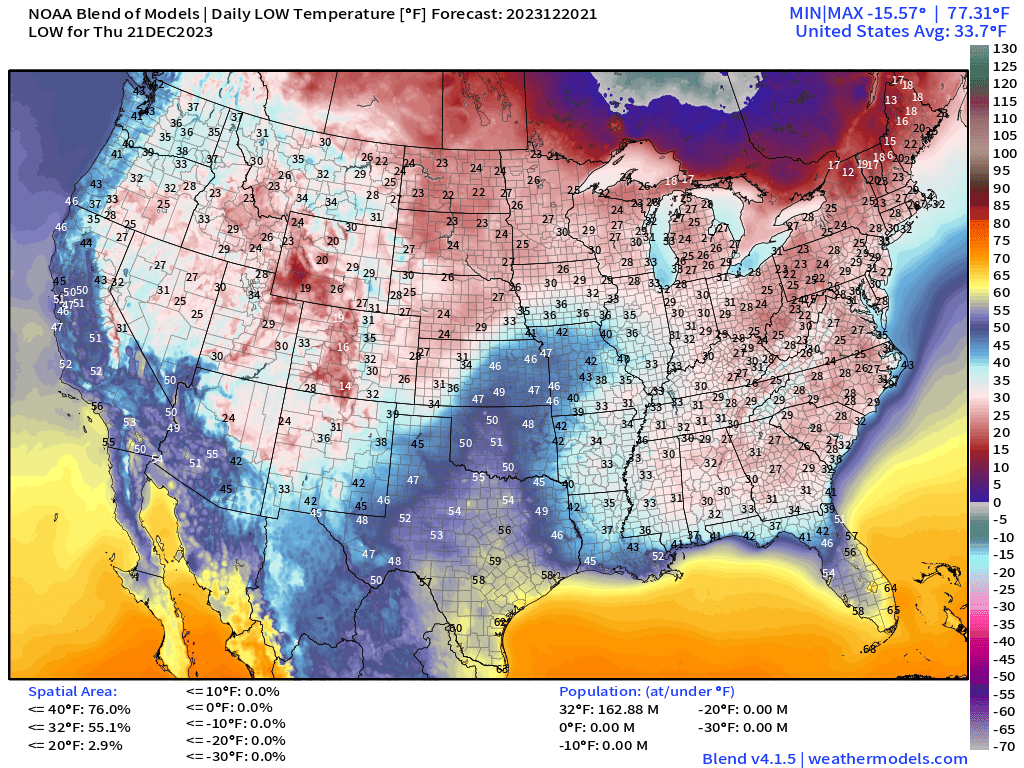
163 Million at/below freezing including Atlanta.
Thursday High Temperatures

It remains chilly in New England. 20s to the north in Maine, and 30s to lower 40s from Boston to NYC.
The Lower 48 overall average high temperature is over 50°F (!)
Temperature Outlook Next 2 Weeks

Snapshot of the temperature anomaly from the EPS 12z ensemble mean Christmas Even morning: 30-40°F above normal centered over James Bay. Extremely cold air remains bottled up over the Greenland ice sheet with 36°F below normal —> actual temperatures as cold as -80°F with wind chills colder than -120°F.
Keep reading with a 7-day free trial
Subscribe to Weather Trader to keep reading this post and get 7 days of free access to the full post archives.