


December 18, 2024 Wednesday Winter Weather
Alberta Clipper system will drop respectable snowfall across Midwest and Great Lakes

Main Weather Driver
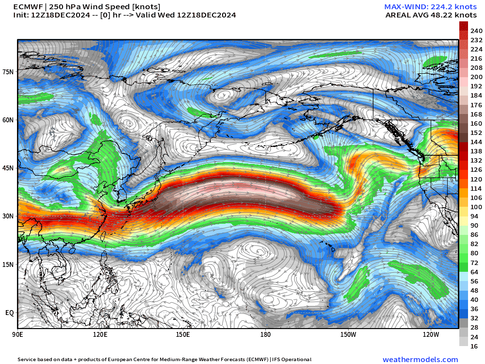
The North Pacific jet stream continues to scream along zonally from Japan to California with only some wave breaking evident as major extratropical cyclones rapidly intensifying on the poleward side.
Warmth and moisture from the subtropics is pushed eastward into western North America fueling the persistence of a blocking ridge. Until this pattern breaks down, we will continue to see abnormal early winter warmth and much-above normal temperatures across the Lower 48. Not seeing the pattern flip for the next 10 to 14 days at least, but that doesn’t mean the models can’t throw a curve ball into 2025.
Temperature Anomaly for Week 2 (December 26 - January 2) is unanimous among the ensembles and A.I. trained models with the most abnormal warmth centered over Hudson Bay.


Weather into Thursday Morning
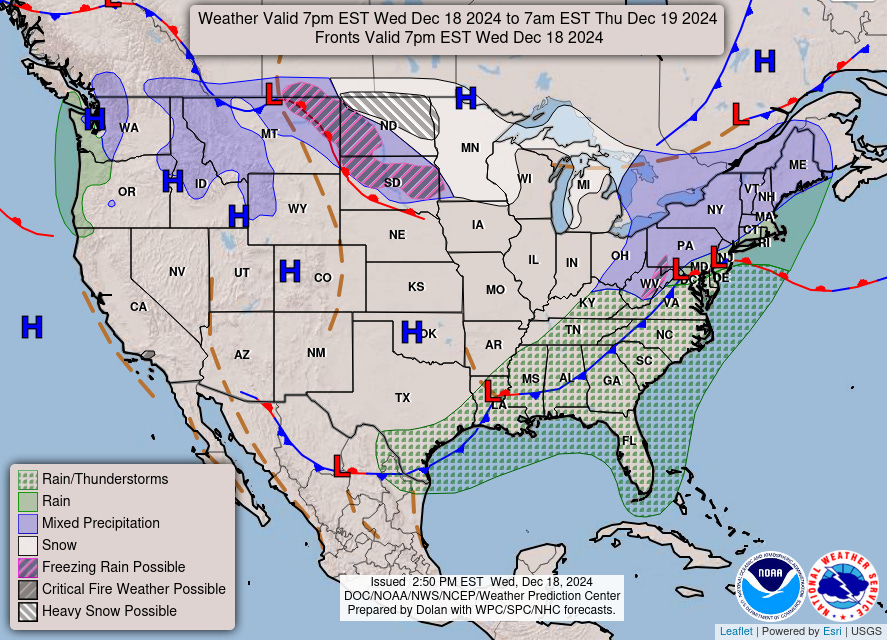
A vigorous Alberta Clipper is tracking into the upper-Midwest and then into the Great Lakes on Thursday with much colder air behind it. The cold front moving through the Southeast this evening will bring flow out of the Northwest and cut temperatures by 10° to 15°F on Thursday.
Weather on Thursday

Heavy snow is possible from North Dakota into Minneapolis and Milwaukee.
Next 48-hours Simulated Radar

HRRR snowfall next 48-hours

Snowfall amounts of 6” to 9” might be the maximum observed from the Clipper. 6” to 8” around Minneapolis is enough for a Winter Storm Warning.

NWS Snowfall Forecasts Next 48-Hours


Upper-Level Pattern Next 10-days | ECMWF 12z AIFS
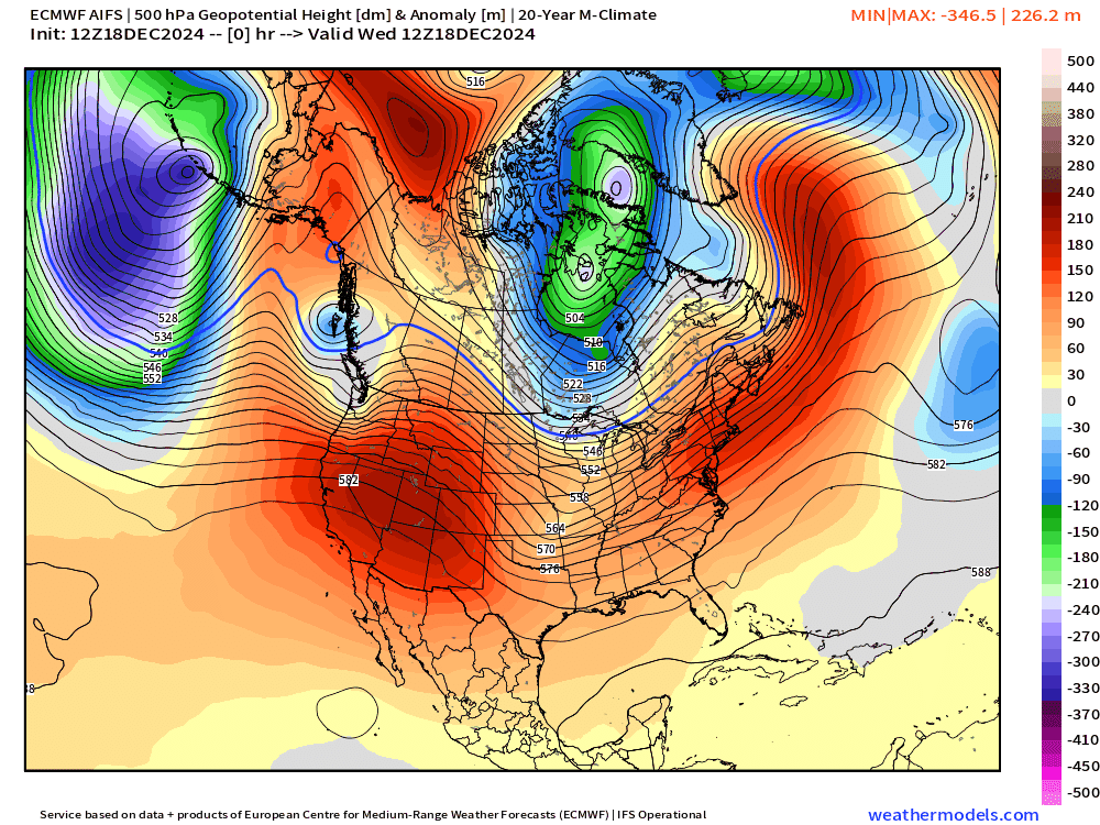
A dip in the polar jet stream will allow a trough to dig into the Mid-Atlantic this weekend ushering in much colder Canadian Arctic air across the Eastern Lower 48 for 48-72 hours before the next Pacific fueled blocking ridge progresses east.
You can see the trough thinning from downstream Rossby wave dynamics across the NE Pacific as intense extratropical cyclones stack up (mature) and vorticity can break off and head ESE beneath the blocking ridge. For winter weather lovers, this pattern does not yet look wintry but instead abnormally warm.
4:15 PM ET Temperatures across the Lower 48

Temperatures well into the 70s across the Southeast and Southwest this afternoon with more than 70 million at/above 70°F.
Temperature Anomaly | 4:15 PM ET

Overall the Lower 48 is 6.5°F (above normal) with the center of the Lower 48 closer to normal. Cold air behind the Alberta Clipper front is still waiting to crash stateside.
Next 9 Days Daily Temperature Anomaly
This animation is a good way to contextualize the mini Arctic blast this weekend, lingering into Monday across the eastern Lower 48. Exceptional warmth covers the Lower 48 again by next Wed/Thurs for Christmas.

Keep reading with a 7-day free trial
Subscribe to Weather Trader to keep reading this post and get 7 days of free access to the full post archives.