


December 17, 2024 Tuesday Winter Weather
Clipper Systems drop light snowfall until polar front arrives this weekend

Tuesday’s Weather

A Clipper system moving through the Midwest on Tuesday picks up steam into Wednesday intensifying into a decent winter storm for the Northeast — away from the coast, of course. A quick 3-6” of snowfall is possible through early Thursday before yet another Alberta Clipper system arrives into the Great Lakes.
The scant moisture in the Midwest is coming from the Pacific atmospheric rivers going up and over the blocking ridge. Then, the Gulf of Mexico can be tapped for more robust precipitation totals.
Next 48-hours Simulated Radar
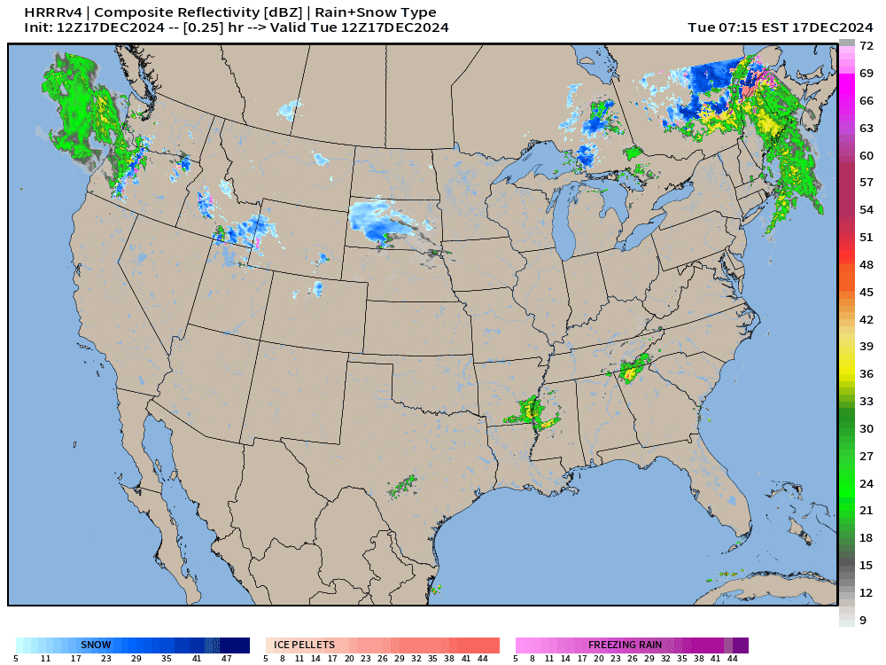
HRRR snowfall next 48-hours:
Respectable 6-inches+ in the upper Midwest. Maybe 3-6” across New England. Much more in the mountains of Washington.

HRRR total precipitation next 48-hours:

Eastern U.S. heaviest rainfall 1-2 inches along a line from Little Rock through Nashville into West Virginia. 0.5” to 1” from NYC to Boston.
Huge rainfall totals over Washington.
Upper-Level Pattern Next 10-days | ECMWF 06z AIFS
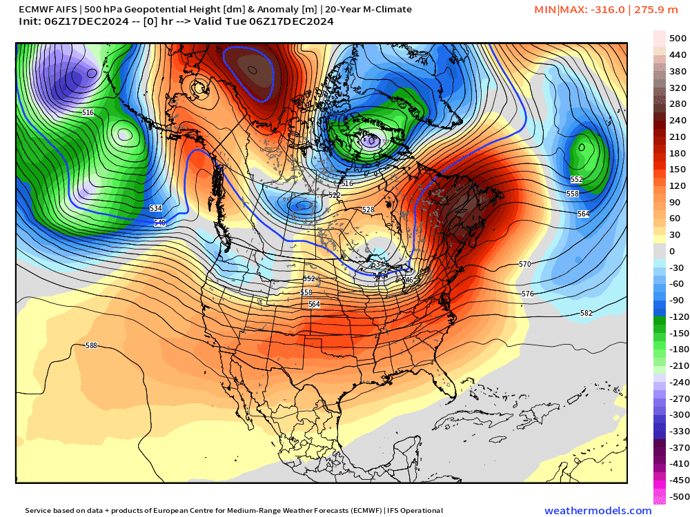
The long advertised upper-level trough finally develops off the Mid-Atlantic coast this weekend. It’s not as intense or far south as models hinted at days ago, but will bring seasonably chilly Canadian air even into the Southeast.
The North Pacific storm track continues to go bonkers with a series or family of extratropical cyclones and atmospheric rivers. The lows eventually track into the collection area of the Aleutian Low in the Gulf of Alaska — for the next 10-14 days — at least.
This means strong blocking/ridging downstream over North America including the Lower 48.
Moisture Transport Next 10-days

The ridge is apparent across the Western U.S. so the atmospheric rivers angle to NE meaning the moisture origin is from the warm Pacific subtropics. That also limits the chances of Southern California from seeing rainfall.
Christmas Morning Weather and Low Temperatures

Next Wednesday will be seasonably cool but near freezing or just above for your drive to Grandma’s across the Great Lakes and Mid-Atlantic. The cold wedge could hold on in Atlanta and the Carolinas.
While we see the “red” anomaly maps on X, it’s important to know that even if it is 10-15°F above normal, it’s not a heat wave by any means — just in the 30s and 40s instead of the 20s and 30s for high temperatures. That makes a huge difference being above freezing in late December. However, there could still be a mixture of light frozen precipitation or snowfall.

10:15 AM ET Temperatures across the Lower 48

The Northeast is much warmer this morning in the 40s and 50s to Maine. 60s creeping into Washington D.C.
Temperature Anomaly | 10:15 AM ET

Overall the Lower 48 is 6.6°F (above normal) with the exceptional warmth > 20°F above normal in New England and Quebec. Also, 15-20°F above normal in Texas and Louisiana, as well as mountains of Colorado.
Next 9 Days Daily Temperature Anomaly
Keep reading with a 7-day free trial
Subscribe to Weather Trader to keep reading this post and get 7 days of free access to the full post archives.