December 16, 2024 Week Ahead Weather
Very warm week ahead, brief cold shot for the weekend across Eastern Lower 48
Monday’s Weather
A frontal boundary is moving through the Ohio Valley and Southeast but quickly losing steam. The storm system is well into Canada, and will drag the warmer air into the Northeast. Another storm system is moving into the Western U.S. with some welcome snowfall in the mountains of the Pacific Northwest. Moisture will move into the Dakotas and Midwest on Tuesday.
Could be several feet of snow in the Cascades and mountains of Idaho and around Yellowstone. NWS snowfall next 48-hours:
Up to an inch or so of rain centered across Kentucky. Rain in south Florida. But the heaviest precipitation by far in Oregon and Washington upwards of 4-7”
NWS total precipitation next 48-hours:
12:30 PM ET Temperatures across the Lower 48
We have widespread 70s from Texas to the Carolinas. The wedge of easterly winds down the Appalachians keeping Atlanta and upstate SC/NC much cooler, but comfortable. 40s and 50s in the Great Lakes, and finally warming up in the Northeast.
Temperature Anomaly | 12:30 PM ET
Overall the Lower 48 is 7.9°F (above normal) with exceptional warmth across the center of the nation. Large area of 15°+ above normal including Houston and Minneapolis, Chicago and Detroit.
Next 9 Days Daily Temperature Anomaly
I think this animation is the best way to summarize the weather pattern across the Lower 48. Warm through the weekend followed by a brief 1-3 day Arctic blast, and then return to exceptional warmth by Christmas Day.
Next 5-days Average Temperature Anomaly
If we take Tuesday-Saturday and average the temperature anomaly each day for the highs and lows, then we get a solidly red picture for the Lower 48 except for the Dakotas.
High Temperatures and Anomaly on Monday
Warmest compared to normal from St. Louis to Toledo pushing into the upper-50s to lower 60s.
Total Precipitation next 7-Days | NOAA WPC
Total Precipitation | Next 15-days ECMWF Ensemble Median
Focusing on the next 15-days until December 31 — no doubt about the extreme West Coast precipitation on the way. 12-20” of rainfall for the immediate coast, and I’d suppose 10-20 feet of snow in the higher elevations. Going to be a crazy 2-weeks across Northern California to Oregon and Washington as the North Pacific storm track becomes very active.
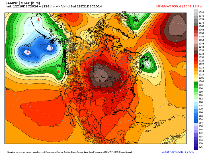
ECMWF MSLP | Next 7-days
A series of Clipper Systems seem to be the only significant snowfall for the next 7-days on the approach of the much colder Canadian Arctic air on Saturday.
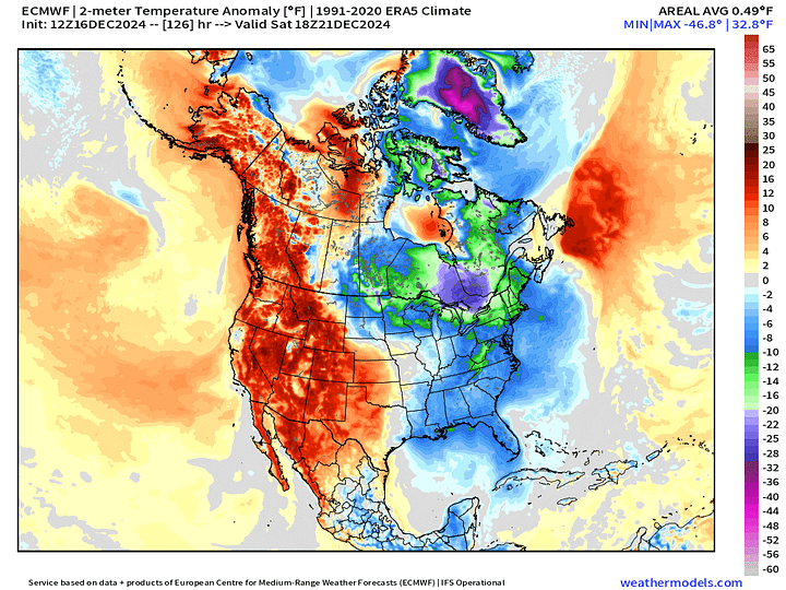
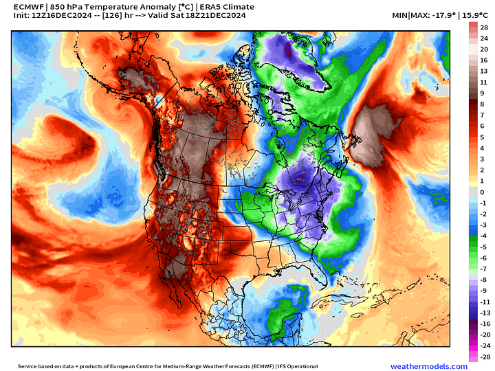
Zooming in on Saturday afternoon, ECMWF 12z has significantly pulled back on the intensity of the cold air — but will wait for the ensembles to confirm. The trough does not dig as strongly into the Mid-Atlantic and Southeast meaning much warmer relative to previous forecasts especially in Florida.


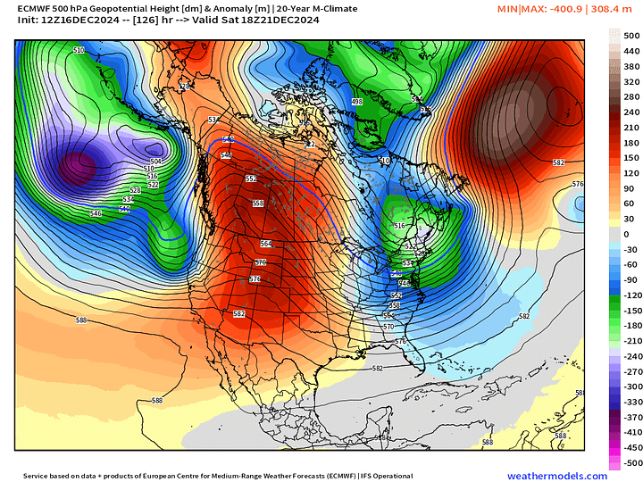
Weather Pattern Next 8-days | ECMWF 12z
The weak trough this weekend is the only serious interruption of very strong ridging or blocking from Western Canada into the Lower 48 over the next 7-10 days.
Snowfall Forecasts
15-day Ensemble Median Snowfall
Huge snowfall in the Western US, but the upper-level pattern does not favor organized winter storm activity at all across the rest of the U.S. during the next 1-2 weeks.
Probability of 3”+ Snowfall Next 15-days
ECMWF EPS 00z | 5-Day Chunk Temperature Anomaly
Days 1-5: December 16 - December 20
Canadian cold is lurking …
Days 6-10: December 21 - December 25
The -10°F to -15°F cold for the 6-10 Day period isn’t too shabby, but short-lived.
Days 11-15: December 26 - December 30
Major warmth across Midwest, Norther Rockies, west of the Mississippi and into Canada to end December.
Snowfall Analysis Season to Date | October 1, 2024 — today.
Maps sourced from weathermodels.com designed and innovated by yours truly! Please subscribe there for real-time access to the newest maps, charts from all of the weather models including ECMWF.


